Liste der Einträge im National Register of Historic Places im Berkshire County
Die Liste der Einträge im National Register of Historic Places im Berkshire County in Massachusetts führt alle Bauwerke, National Historic Landmarks und historischen Stätten im Berkshire County auf, die in das National Register of Historic Places aufgenommen wurden.[1]
Legende
| NRHP | Historic Place |
|---|---|
| NHL | Historic Landmark |
| NHLD | Historic Landmark District |
| HD | Historic District |
Aktuelle Einträge
| [2] | Name[3] | Bild | Eintragsdatum | Lage | Ort | Beschreibung |
|---|---|---|---|---|---|---|
| 1 | Allen Hotel |  | 1. Sep. 1983 ID-Nr. 83000566 | Wendell Ave. 42° 26′ 55″ N, 73° 15′ 9″ W42.448611-73.2525 | Pittsfield | |
| 2 | William Russell Allen House |  | 7. Mai 1980 ID-Nr. 80000427 | 359 East St. 42° 26′ 52″ N, 73° 14′ 49″ W42.447778-73.246944 | Pittsfield | |
| 3 | Anthony House |  | 3. Jan. 1985 ID-Nr. 85000021 | 67 East Rd. 42° 36′ 55″ N, 73° 6′ 10″ W42.615278-73.102778 | Adams | Geburtshaus von Susan B. Anthony und heutiges Museum. |
| 4 | Armory Block |  | 1. Apr. 1982 ID-Nr. 82004944 | 39-45 Park St. 42° 37′ 20″ N, 73° 7′ 14″ W42.622222-73.120556 | Adams | |
| 5 | Armstrong House |  | 25. Okt. 1985 ID-Nr. 85003394 | 60 Brooklyn St. 42° 42′ 26″ N, 73° 6′ 47″ W42.707222-73.113056 | North Adams | |
| 6 | Arnold Print Works |  weitere Bilder | 25. Okt. 1985 ID-Nr. 85003379 | 87 Marshall St. 42° 42′ 5″ N, 73° 6′ 59″ W42.701389-73.116389 | North Adams | Heute Standort des Massachusetts Museum of Contemporary Art |
| 7 | Colonel John Ashley House |  | 10. Feb. 1975 ID-Nr. 75001915 | Cooper Hill Rd. 42° 3′ 34″ N, 73° 21′ 23″ W42.059444-73.356389 | Sheffield | Museum der Organisation The Trustees of Reservations. |
| 8 | P. J. Barrett Block |  | 1. Apr. 1982 ID-Nr. 82004945 | 70-76 Park St. 42° 37′ 24″ N, 73° 7′ 15″ W42.623333-73.120833 | Adams | |
| 9 | Beaver Mill |  | 11. Mai 1973 ID-Nr. 73000292 | Beaver St. 42° 42′ 12″ N, 73° 5′ 55″ W42.703333-73.098611 | North Adams | |
| 10 | Becket Center Historic District |  | 11. Aug. 1982 ID-Nr. 82004952 | 42° 17′ 3″ N, 73° 4′ 8″ W42.284167-73.068889 | Becket | |
| 11 | Berkshire Mill No. 1 |  | 1. Apr. 1982 ID-Nr. 82004946 | Hoosac St. 42° 37′ 31,4″ N, 73° 7′ 6,3″ W42.625386-73.118404 | Adams | |
| 12 | Berkshire Life Insurance Company Building |  | 27. Feb. 1986 ID-Nr. 86000276 | 5-7 North St. 42° 26′ 56″ N, 73° 15′ 18″ W42.448889-73.255 | Pittsfield | |
| 13 | Rev. Adonijah Bidwell House |  | 26. Aug. 1982 ID-Nr. 82004954 | Royal Hemlocks und Art School Rds. 42° 12′ 27″ N, 73° 13′ 9″ W42.2075-73.219167 | Monterey | |
| 14 | Blackinton Historic District |  | 25. Okt. 1985 ID-Nr. 85003384 | 42° 41′ 26″ N, 73° 6′ 8″ W42.690556-73.102222 | North Adams | |
| 15 | The Boardman |  weitere Bilder | 25. Okt. 1985 ID-Nr. 85003403 | 39-53 Montana St. 42° 41′ 33″ N, 73° 6′ 23″ W42.6925-73.106389 | North Adams | |
| 16 | Boston Finishing Works |  | 4. Okt. 2016 ID-Nr. 16000690 | 160 Water St. 42° 42′ 22″ N, 73° 12′ 9,9″ W42.706108-73.2027627 | Williamstown | |
| 17 | Capt. John Brewer House |  | 29. März 1984 ID-Nr. 84002083 | Main Rd. 42° 10′ 40″ N, 73° 12′ 29″ W42.177778-73.208056 | Monterey | |
| 18 | Charles Browne House |  | 25. Okt. 1985 ID-Nr. 85003413 | 932 S. Church St. 42° 40′ 43″ N, 73° 5′ 52″ W42.678611-73.097778 | North Adams | |
| 19 | Cheshire Town Hall Complex |  | 7. März 2017 ID-Nr. 100000719 | 80-84 Church & 23 Depot Sts. 42° 33′ 39,8″ N, 73° 9′ 49″ W42.5610648-73.1636187 | Cheshire | |
| 20 | Chesterwood |  weitere Bilder | 15. Okt. 1966 ID-Nr. 66000652 | 2 mi (3,2 km) westlich von Stockbridge 42° 17′ 8″ N, 73° 21′ 18″ W42.285556-73.355 | Stockbridge | Wohnhaus von Daniel Chester French |
| 21 | Church on the Hill |  | 30. Sep. 1982 ID-Nr. 82001894 | Main St. 42° 21′ 49″ N, 73° 17′ 1″ W42.363611-73.283611 | Lenox | |
| 22 | Church Street-Cady Hill Historic District |  | 10. März 1983 ID-Nr. 83000567 | 42° 41′ 48″ N, 73° 6′ 26″ W42.696667-73.107222 | North Adams | Wurde im NRHP als "Church Street Historic District" eingetragen, jedoch am 25. Oktober 1985 umfangreich erweitert. |
| 23 | Citizens Hall |  | 19. Juni 1972 ID-Nr. 72000126 | U.S. 90 42° 18′ 58″ N, 73° 19′ 52″ W42.316111-73.331111 | Interlaken | |
| 24 | H. W. Clark Biscuit Company |  | 22. Apr. 2009 ID-Nr. 09000235 | 179-191 Ashland St. 42° 41′ 37,7″ N, 73° 6′ 31,9″ W42.693811-73.108856 | North Adams | |
| 25 | Clark-Eames House |  | 12. Sep. 1986 ID-Nr. 86002139 | 230 Middlefield Rd. 42° 20′ 36″ N, 73° 4′ 31″ W42.343333-73.075278 | Washington | |
| 26 | Clinton African Methodist Episcopal Zion Church |  | 29. Mai 2008 ID-Nr. 08000464 | 9 Elm Ct. 42° 11′ 48,1″ N, 73° 21′ 46,4″ W42.196686-73.362883 | Great Barrington | |
| 27 | Coleman Bridge |  weitere Bilder | 18. Feb. 2000 ID-Nr. 00000112 | Windsor Bush Rd. 42° 31′ 56″ N, 72° 59′ 36″ W42.532222-72.993333 | Windsor | |
| 28 | Congregational Church of West Stockbridge |  | 30. Juli 1996 ID-Nr. 96000899 | 45 Main St. 42° 19′ 57″ N, 73° 22′ 1″ W42.3325-73.366944 | West Stockbridge | |
| 29 | Crane and Company |  | 1. Juli 1983 ID-Nr. 83004376 | Main St. 42° 28′ 10″ N, 73° 10′ 42″ W42.469444-73.178333 | Dalton | Standort des Crane Company Museum. |
| 30 | Cranesville Historic District |  weitere Bilder | 9. Nov. 2005 ID-Nr. 05001208 | 42° 28′ 21″ N, 73° 10′ 38″ W42.4725-73.177222 | Dalton | |
| 31 | Crowley House |  | 25. Okt. 1985 ID-Nr. 85003414 | 365 W. Main St. 42° 41′ 59″ N, 73° 7′ 40″ W42.699722-73.127778 | North Adams | |
| 32 | Dalton Grange Hall No. 23 |  | 10. Nov. 1983 ID-Nr. 83003924 | South St. and Grange Hall Rd. 42° 27′ 38″ N, 73° 10′ 58″ W42.460556-73.182778 | Dalton | Nicht mehr existent. |
| 33 | W.E.B. Dubois Boyhood Homesite |  | 11. Mai 1976 ID-Nr. 76000947 | MA 23 42° 10′ 42″ N, 73° 23′ 30″ W42.178333-73.391667 | Great Barrington | Jugendhaus von W. E. B. Du Bois. |
| 34 | Dwight-Henderson House |  | 26. März 1976 ID-Nr. 76000237 | Main St. 42° 11′ 29″ N, 73° 21′ 56″ W42.191389-73.365556 | Great Barrington | Wohnhaus von Joseph Dwight. |
| 35 | Philip Eames House |  | 12. Sep. 1986 ID-Nr. 86002140 | 88 Stone House Rd. 42° 22′ 18″ N, 73° 7′ 9″ W42.371667-73.119167 | Washington | |
| 36 | East Lawn Cemetery and Sherman Burbank Memorial Chapel |  | 14. Sep. 2000 ID-Nr. 00001086 | 605 Main St. 42° 42′ 27″ N, 73° 11′ 47″ W42.7075-73.196389 | Williamstown | |
| 37 | East Main Street Cemetery |  | 2. Juni 2000 ID-Nr. 00000567 | E. Main St. 42° 28′ 24″ N, 73° 9′ 5″ W42.473333-73.151389 | Dalton | |
| 38 | East Otis Schoolhouse |  | 27. Mai 2021 ID-Nr. 100006595 | 2 Old Blandford Rd. 42° 18′ 28,4″ N, 73° 14′ 53,5″ W42.3079-73.2482 | Otis | |
| 39 | Eaton, Crane & Pike Company Factory |  | 3. Aug. 1990 ID-Nr. 90001166 | 75 S. Church St. 42° 26′ 47″ N, 73° 15′ 38″ W42.446389-73.260556 | Pittsfield | |
| 40 | Elm Court |  | 30. Dez. 1985 ID-Nr. 85003184 | Stockbridge St. 42° 20′ 19″ N, 73° 17′ 31″ W42.338611-73.291944 | Lenox und Stockbridge | |
| 41 | Elm-Maple-South Streets Historic District |  | 8. Sep. 2004 ID-Nr. 04000932 | 42° 16′ 46″ N, 73° 18′ 47″ W42.279444-73.313056 | Stockbridge | |
| 42 | Fairview Cemetery |  | 11. Mai 2000 ID-Nr. 00000483 | Curtis Ave. 42° 28′ 37″ N, 73° 10′ 21″ W42.476944-73.1725 | Dalton | |
| 43 | Farnams Village Historic District |  | 27. Apr. 2000 ID-Nr. 99000866 | 42° 32′ 44″ N, 73° 11′ 31″ W42.545556-73.191944 | Cheshire | |
| 44 | General John and Mary Fellows Farmstead | 28. Aug. 2018 ID-Nr. 100002828 | 1601 Barnum St. 42° 3′ 35″ N, 73° 23′ 56,5″ W42.059729-73.3990227 | Sheffield | ||
| 45 | Fitch-Hoose House |  | 24. Juni 2010 ID-Nr. 10000390 | 6 Gulf Rd. 42° 28′ 52″ N, 73° 10′ 32″ W42.481111-73.175556 | Dalton | |
| 46 | Five Corners Historic District |  | 7. Jan. 1993 ID-Nr. 92001717 | 42° 39′ 35″ N, 73° 14′ 33″ W42.659722-73.2425 | Williamstown | |
| 47 | Freeman’s Grove Historic District |  | 25. Okt. 1985 ID-Nr. 85003388 | 42° 41′ 41″ N, 73° 6′ 40″ W42.694722-73.111111 | North Adams | |
| 48 | Frelinghuysen Morris House and Studio |  | 31. Mai 2016 ID-Nr. 16000304 | 92 Hawthorne St., 159 West St. 42° 20′ 56″ N, 73° 17′ 59,3″ W42.348878-73.299802 | Stockbridge | |
| 49 | Freight Yard Historic District |  | 13. Juni 1972 ID-Nr. 72000131 | 42° 41′ 18″ N, 73° 6′ 54″ W42.688333-73.115 | North Adams | Teil des Western Gateway Heritage State Park |
| 50 | Glendale Power House |  | 24. Juni 1982 ID-Nr. 82004957 | MA 183 42° 16′ 50″ N, 73° 21′ 11″ W42.280556-73.353056 | Stockbridge | |
| 51 | Golden Hill Bridge |  | 9. Feb. 1994 ID-Nr. 93001592 | Golden Hill Rd. 42° 19′ 18″ N, 73° 14′ 33″ W42.321667-73.2425 | Lee | |
| 52 | Goodwood |  | 15. Apr. 1982 ID-Nr. 82004955 | 311 Summit Rd. 42° 23′ 49″ N, 73° 21′ 22″ W42.396944-73.356111 | Richmond | |
| 53 | Hall’s Tavern |  | 10. März 1983 ID-Nr. 83000568 | 31 North St. 42° 33′ 46″ N, 73° 9′ 58″ W42.562778-73.166111 | Cheshire | |
| 54 | Hancock Shaker Village |  weitere Bilder | 24. Nov. 1968 ID-Nr. 68000037 | 5 mi (8 km) südlich von Pittsfield am U.S. Highway 20 42° 26′ 3″ N, 73° 22′ 27″ W42.434167-73.374167 | Hancock und Pittsfield | |
| 55 | Hancock Town Hall |  | 26. Sep. 1975 ID-Nr. 73001956 | MA 43 42° 32′ 53″ N, 73° 18′ 39″ W42.548056-73.310833 | Hancock | |
| 56 | Samuel Harrison House |  | 22. März 2006 ID-Nr. 06000147 | 80 Third St. 42° 27′ 2,3″ N, 73° 14′ 46″ W42.450636-73.2461 | Pittsfield | |
| 57 | Hathaway Tenement |  | 25. Okt. 1985 ID-Nr. 85003415 | 311-321 River St. 42° 42′ 13″ N, 73° 7′ 12″ W42.703611-73.12 | North Adams | |
| 58 | Hillside Cemetery |  weitere Bilder | 19. Juli 2001 ID-Nr. 01000722 | West Main St. 42° 42′ 0,2″ N, 73° 7′ 23,5″ W42.700042-73.1232 | North Adams | |
| 59 | Hoosac Street School |  | 10. Feb. 1988 ID-Nr. 87002547 | 20 Hoosac St. 42° 37′ 31″ N, 73° 6′ 53″ W42.625278-73.114722 | Adams | |
| 60 | Hoosac Tunnel | 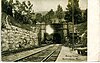 weitere Bilder | 2. Nov. 1973 ID-Nr. 73000294 | 42° 40′ 30″ N, 73° 2′ 43″ W42.675-73.045278 | North Adams | |
| 61 | Housatonic Congregational Church |  | 18. Apr. 2002 ID-Nr. 02000377 | 1089 Main St. 42° 15′ 29″ N, 73° 21′ 56″ W42.258056-73.365556 | Great Barrington | |
| 62 | Frank Howard Building |  | 14. Aug. 2012 ID-Nr. 12000499 | 124-132 Fenn St., 67-71 Federal St. 42° 26′ 59,1″ N, 73° 15′ 7″ W42.449737-73.251956 | Pittsfield | |
| 63 | Hyde House |  | 21. Nov. 1976 ID-Nr. 76000239 | 144 W. Park St. 42° 18′ 13″ N, 73° 15′ 12″ W42.303611-73.253333 | Lee | |
| 64 | Hyde School |  | 4. Juni 2004 ID-Nr. 04000566 | 100 High St. 42° 18′ 23,8″ N, 73° 14′ 52,7″ W42.3066-73.247975 | Lee | |
| 65 | Jacob’s Pillow Dance Festival |  | 5. Feb. 2001 ID-Nr. 00001458 | George Carter Rd. 42° 15′ 52″ N, 73° 7′ 5″ W42.264444-73.118056 | Becket | |
| 66 | Johnson Manufacturing Company |  | 25. Okt. 1985 ID-Nr. 85003418 | 65 Brown St. 42° 42′ 8″ N, 73° 7′ 18″ W42.702222-73.121667 | North Adams | |
| 67 | Johnson School |  weitere Bilder | 25. Okt. 1985 ID-Nr. 85003416 | School St. 42° 42′ 18″ N, 73° 7′ 8″ W42.705-73.118889 | North Adams | |
| 68 | Jones Block |  | 1. Apr. 1982 ID-Nr. 82004947 | 49-53 Park St. 42° 37′ 20,5″ N, 73° 7′ 11,9″ W42.622353-73.119982 | Adams | |
| 69 | Kenmore |  | 28. März 1996 ID-Nr. 96000326 | 42° 23′ 37″ N, 73° 21′ 54″ W42.393611-73.365 | Richmond | |
| 70 | Lee Lower Main Street Historic District |  | 26. März 1976 ID-Nr. 09000090 | 42° 18′ 17,1″ N, 73° 14′ 55,7″ W42.304753-73.248814 | Lee | |
| 71 | Lee Station |  | 27. Dez. 2010 ID-Nr. 10001067 | 109 Railroad St. 42° 18′ 25″ N, 73° 15′ 6″ W42.306944-73.251667 | Lee | |
| 72 | Lenox Academy |  | 30. Sep. 1982 ID-Nr. 82001895 | 75 Main St. 42° 21′ 32″ N, 73° 17′ 5″ W42.358889-73.284722 | Lenox | |
| 73 | Lenox High School |  | 25. Aug. 2004 ID-Nr. 04000903 | 109 Housatonic St. 42° 21′ 23″ N, 73° 17′ 13″ W42.356389-73.286944 | Lenox | |
| 74 | Lenox Library |  | 3. Apr. 1973 ID-Nr. 73000291 | 18 Main St. 42° 21′ 27″ N, 73° 17′ 6″ W42.3575-73.285 | Lenox | |
| 75 | Lenox Railroad Station |  | 16. Juni 1989 ID-Nr. 89000225 | Housatonic St. und Willow Creek Rd. 42° 21′ 1″ N, 73° 14′ 44″ W42.350278-73.245556 | Lenox | |
| 76 | Lenox Village Historic District | 27. Juni 2022 ID-Nr. 100006987 | 42° 21′ 28″ N, 73° 16′ 58″ W42.357778-73.282778 | Lenox | ||
| 77 | Lower Historic District |  weitere Bilder | 12. Sep. 1986 ID-Nr. 86002141 | Washington Mountain Rd. 42° 20′ 24″ N, 73° 7′ 4″ W42.34-73.117778 | Washington | |
| 78 | Mahaiwe Block |  | 12. Sep. 2008 ID-Nr. 08000898 | 6-14 Castle St. und 314-322 Main St. 42° 11′ 37,8″ N, 73° 21′ 46,3″ W42.193823-73.362864 | Great Barrington | |
| 79 | Main Street Cemetery |  | 18. Mai 2000 ID-Nr. 00000502 | Main St. 42° 28′ 27″ N, 73° 10′ 31″ W42.474167-73.175278 | Dalton | |
| 80 | Main Street Historic District |  | 17. Jan. 2002 ID-Nr. 01001466 | 42° 16′ 55″ N, 73° 19′ 22″ W42.281944-73.322778 | Stockbridge | |
| 81 | Maple Street Cemetery |  | 2. Juni 2004 ID-Nr. 04000536 | Maple St. 42° 37′ 35″ N, 73° 7′ 29″ W42.626389-73.124722 | Adams | |
| 82 | Mausert Block |  | 1. Apr. 1982 ID-Nr. 82004948 | 19-27 Park St. 42° 37′ 17″ N, 73° 7′ 14″ W42.621389-73.120556 | Adams | |
| 83 | Herman Melville House |  weitere Bilder | 15. Okt. 1966 ID-Nr. 66000126 | Holmes Rd. 42° 24′ 56″ N, 73° 15′ 4″ W42.415556-73.251111 | Pittsfield | |
| 84 | Merrell Tavern |  | 23. Feb. 1972 ID-Nr. 72000136 | MA 102 42° 16′ 36″ N, 73° 16′ 59″ W42.276667-73.283056 | South Lee | |
| 85 | Methodist Episcopal Society of Tyringham |  | 30. Aug. 2000 ID-Nr. 00000986 | 128-130 Main Rd. 42° 14′ 38″ N, 73° 12′ 10″ W42.243889-73.202778 | Tyringham | |
| 86 | Middlefield-Becket Stone Arch Railroad Bridge District |  weitere Bilder | 11. Apr. 1980 ID-Nr. 80000502 | 42° 18′ 43,9″ N, 73° 1′ 9,8″ W42.3122-73.0194 | Becket | |
| 87 | Mill River Historic District |  | 17. Mai 1994 ID-Nr. 94000423 | 42° 6′ 49″ N, 73° 16′ 6″ W42.113611-73.268333 | New Marlborough | |
| 88 | Mill Village Historic District |  | 6. Okt. 1983 ID-Nr. 83003926 | Cole Ave., Mill, Arnold, and Elm Sts. 42° 43′ 0″ N, 73° 11′ 25″ W42.716667-73.190278 | Williamstown | |
| 89 | Mission House |  weitere Bilder | 24. Nov. 1968 ID-Nr. 68000038 | Main St. 42° 16′ 59,4″ N, 73° 18′ 56,5″ W42.283156-73.315681 | Stockbridge | |
| 90 | Mohawk Trail |  | 3. Apr. 1973 ID-Nr. 73000283 | Entlang des Cold River 42° 38′ 15″ N, 72° 57′ 13″ W42.6375-72.953611 | Florida und Savoy | |
| 91 | Montville Baptist Church |  | 12. Okt. 2006 ID-Nr. 06000936 | 5 Hammertown Rd. 42° 7′ 7″ N, 73° 6′ 48″ W42.118611-73.113333 | Sandisfield | |
| 92 | Monument Mills |  | 29. Nov. 1983 ID-Nr. 83003927 | Park und Front Sts. 42° 15′ 19″ N, 73° 21′ 52″ W42.255278-73.364444 | Great Barrington | |
| 93 | Monument Square-Eagle Street Historic District |  | 19. Juni 1972 ID-Nr. 72000132 | 42° 41′ 57″ N, 73° 6′ 37″ W42.699167-73.110278 | North Adams | |
| 94 | Morewood School |  | 31. Mai 1984 ID-Nr. 84002084 | 30 S. Mountain Rd. 42° 25′ 48″ N, 73° 15′ 40″ W42.43-73.261111 | Pittsfield | |
| 95 | Mount Greylock Summit Historic District |  | 20. Apr. 1998 ID-Nr. 98000349 | 42° 38′ 16″ N, 73° 10′ 6″ W42.637778-73.168333 | Adams | |
| 96 | The Mount |  weitere Bilder | 11. Nov. 1971 ID-Nr. 71000900 | U.S. Highway 7 42° 19′ 53″ N, 73° 16′ 54″ W42.331389-73.281667 | Lenox | |
| 97 | Naumkeag |  weitere Bilder | 3. Nov. 1975 ID-Nr. 75000264 | 5 Prospect Hill Rd. 42° 17′ 17″ N, 73° 19′ 5″ W42.288056-73.318056 | Stockbridge | |
| 98 | New Boston Inn |  | 1. Sep. 1988 ID-Nr. 88001459 | Junction of MA 8 and MA 57 42° 5′ 38″ N, 73° 4′ 40″ W42.093889-73.077778 | Sandisfield | |
| 99 | New Boston Village Historic District | 8. Apr. 2022 ID-Nr. 100007554 | 42° 5′ 37,5″ N, 73° 4′ 32,4″ W42.093756634068-73.075669044922 | Sandisfield | ||
| 100 | New Marlborough Village |  | 30. Sep. 1982 ID-Nr. 82001896 | 42° 7′ 30″ N, 73° 13′ 38″ W42.125-73.227222 | New Marlborough | |
| 101 | Nichols-Sterner House |  | 17. Sep. 1987 ID-Nr. 87001997 | 428 Swamp Rd. 42° 24′ 27″ N, 73° 19′ 11″ W42.4075-73.319722 | Richmond | |
| 102 | Norad Mill |  | 25. Okt. 1985 ID-Nr. 85003417 | 60 Roberts Dr. 42° 41′ 55″ N, 73° 8′ 20″ W42.698611-73.138889 | North Adams | |
| 103 | Normal School Historic District |  weitere Bilder | 25. Okt. 1985 ID-Nr. 85003391 | 42° 41′ 27″ N, 73° 6′ 10″ W42.690833-73.102778 | North Adams | |
| 104 | North Becket Village Historic District |  | 26. Juli 1988 ID-Nr. 88000229 | 42° 19′ 57″ N, 73° 4′ 58″ W42.3325-73.082778 | Becket | |
| 105 | North Egremont Historic District |  | 20. Jan. 1989 ID-Nr. 88003126 | 42° 11′ 55″ N, 73° 26′ 25″ W42.198611-73.440278 | Egremont | |
| 106 | Northeast School |  | 30. Aug. 2002 ID-Nr. 02000902 | 981 Summit Rd. 42° 24′ 0″ N, 73° 19′ 54″ W42.4-73.331667 | Richmond | |
| 107 | Old Central Fire Station | 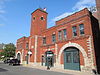 | 2. Nov. 1977 ID-Nr. 77000177 | 66 Allen St. 42° 26′ 58″ N, 73° 15′ 9″ W42.449444-73.2525 | Pittsfield | |
| 108 | Old Central High School | 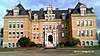 | 6. Aug. 1980 ID-Nr. 80000428 | 42° 27′ 3″ N, 73° 14′ 56″ W42.450833-73.248889 | Pittsfield | |
| 109 | Old Churchyard Cemetery |  weitere Bilder | 16. Apr. 2012 ID-Nr. 12000206 | Angrenzend an 918 Jenks Rd. 42° 34′ 50,9″ N, 73° 7′ 26,8″ W42.580815-73.124107 | Cheshire | |
| 110 | Old Covered Bridge | 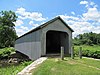 weitere Bilder | 24. Nov. 1978 ID-Nr. 78000445 | Covered Bridge Lane 42° 7′ 26″ N, 73° 21′ 17″ W42.123889-73.354722 | Sheffield | |
| 111 | Old Curtisville Historic District |  | 29. Okt. 1976 ID-Nr. 76000250 | MA 183 42° 18′ 57″ N, 73° 19′ 57″ W42.315833-73.3325 | Stockbridge | |
| 112 | Old Town Hall | 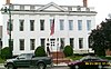 | 26. Apr. 1972 ID-Nr. 72001299 | 42° 26′ 54″ N, 73° 15′ 11″ W42.448333-73.253056 | Pittsfield | |
| 113 | Benjamin Osborn House |  | 1. Okt. 1987 ID-Nr. 87001758 | West St., east on a private road 42° 7′ 2″ N, 73° 28′ 12″ W42.117222-73.47 | Mount Washington | |
| 114 | Otis Center Historic District | 7. Apr. 2022 ID-Nr. 100007553 | 42° 11′ 34,9″ N, 73° 5′ 31,2″ W42.193029471598-73.092012927179 | Otis | ||
| 115 | Park Square Historic District |  | 24. Juli 1975 ID-Nr. 75001911 | 42° 26′ 54″ N, 73° 15′ 12″ W42.448333-73.253333 | Pittsfield | |
| 116 | Park Street Firehouse |  | 28. Jan. 1982 ID-Nr. 82004949 | 47 Park St. 42° 37′ 20″ N, 73° 7′ 11,8″ W42.622222-73.119936 | Adams | |
| 117 | Pettibone Farm |  | 4. Jan. 1991 ID-Nr. 90001944 | Old Cheshire Rd. 42° 32′ 1″ N, 73° 12′ 1″ W42.533611-73.200278 | Lanesborough | |
| 118 | Phillips Woolen Mill |  | 30. Sep. 1982 ID-Nr. 82001897 | 71 Grove St. 42° 36′ 23″ N, 73° 8′ 5″ W42.606389-73.134722 | Adams | |
| 119 | Pilgrim Memorial Church and Parish House |  | 25. Nov. 2005 ID-Nr. 05001323 | 249 Wahconah St. 42° 27′ 56″ N, 73° 15′ 14″ W42.465556-73.253889 | Pittsfield | |
| 120 | Pittsfield & North Adams Passenger Station and Baggage & Express House |  | 1. Apr. 1982 ID-Nr. 82004950 | 10 Pleasant St. 42° 37′ 18,5″ N, 73° 7′ 8,6″ W42.621798-73.119068 | Adams | |
| 121 | Pittsfield Cemetery |  | 13. März 2007 ID-Nr. 07000145 | 203 Wahconah St. 42° 28′ 1″ N, 73° 15′ 28″ W42.466936-73.257783 | Pittsfield | |
| 122 | Charles Whittlesey Power House |  | 8. Aug. 1997 ID-Nr. 97000820 | 575 South St. 42° 25′ 44″ N, 73° 15′ 21″ W42.428889-73.255833 | Pittsfield | |
| 123 | Providence Court |  | 20. Nov. 1987 ID-Nr. 87001107 | 379 East St. 42° 26′ 51″ N, 73° 14′ 47″ W42.4475-73.246389 | Pittsfield | |
| 124 | Quaker Meetinghouse |  | 17. Aug. 1976 ID-Nr. 76000236 | Maple Street Cemetery 42° 37′ 38″ N, 73° 7′ 34″ W42.627222-73.126111 | Adams | |
| 125 | Ramsdell Public Library |  | 25. Juli 2014 ID-Nr. 14000440 | 1087 Main St. 42° 15′ 29,2″ N, 73° 21′ 55,1″ W42.2581-73.3653 | Great Barrington | |
| 126 | Renfrew Mill No. 2 |  | 14. Okt. 1982 ID-Nr. 82000474 | 217 Columbia St. 42° 38′ 15″ N, 73° 6′ 26″ W42.6375-73.107222 | Adams | |
| 127 | A.H. Rice Silk Mill |  | 2. März 2015 ID-Nr. 15000047 | 55 Spring St. 42° 27′ 24,5″ N, 73° 14′ 30,1″ W42.4568-73.2417 | Pittsfield | |
| 128 | Richmond Furnace Historical and Archeological District |  weitere Bilder | 31. Aug. 1999 ID-Nr. 99001044 | 42° 21′ 21″ N, 73° 22′ 32″ W42.355833-73.375556 | Richmond | |
| 129 | Rising Paper Mill |  | 11. Aug. 1975 ID-Nr. 75000253 | 42° 14′ 28″ N, 73° 21′ 28″ W42.241111-73.357778 | Great Barrington | |
| 130 | Rock Ridge |  | 16. Sep. 1983 ID-Nr. 83000569 | Tyringham Rd. 42° 11′ 8″ N, 73° 13′ 19″ W42.185556-73.221944 | Monterey | |
| 131 | Philemon Sage House |  | 31. Aug. 1982 ID-Nr. 82001898 | MA 183 42° 3′ 17″ N, 73° 9′ 3″ W42.054722-73.150833 | Sandisfield | |
| 132 | Saint Andrew’s Chapel |  | 12. Sep. 1986 ID-Nr. 86002142 | Washington Mountain Rd. 42° 21′ 27″ N, 73° 7′ 58″ W42.3575-73.132778 | Washington | |
| 133 | St. Joseph’s School |  weitere Bilder | 22. Dez. 1983 ID-Nr. 83003928 | Eagle St. 42° 42′ 4″ N, 73° 6′ 33″ W42.701111-73.109167 | North Adams | |
| 134 | St. Luke’s Episcopal Church |  | 23. Feb. 1972 ID-Nr. 72000127 | U.S. Highway 7 42° 32′ 6,4″ N, 73° 13′ 47,6″ W42.5351-73.2299 | Lanesborough | |
| 135 | Searles Castle |  | 15. Apr. 1982 ID-Nr. 82004953 | Main St. 42° 11′ 23″ N, 73° 21′ 42″ W42.189722-73.361667 | Great Barrington | |
| 136 | Shadow Brook Farm Historic District |  | 10. März 1988 ID-Nr. 88000202 | 42° 20′ 41″ N, 73° 19′ 38″ W42.344722-73.327222 | Stockbridge | |
| 137 | Shaker Farm |  | 6. Nov. 1995 ID-Nr. 95001198 | 42° 22′ 53″ N, 73° 21′ 13″ W42.381389-73.353611 | Richmond | |
| 138 | Sheffield Center Historic District |  | 1. Dez. 1989 ID-Nr. 89002060 | 42° 6′ 22″ N, 73° 21′ 9″ W42.106111-73.3525 | Sheffield | |
| 139 | Sheffield Plain Historic District |  | 23. Juni 1988 ID-Nr. 88000881 | 42° 7′ 22″ N, 73° 21′ 20″ W42.122778-73.355556 | Sheffield | |
| 140 | Thomas Shepard House |  | 31. Mai 1984 ID-Nr. 84002085 | 764 East Hill Rd. 42° 5′ 21,4″ N, 73° 12′ 2,5″ W42.08929-73.200682 | New Marlborough | |
| 141 | Eber Sherman Farm |  | 6. Okt. 1983 ID-Nr. 83003929 | 1010 State Rd. 42° 42′ 3″ N, 73° 10′ 9,8″ W42.70082-73.16938 | North Adams | |
| 142 | William B. Sherman Farm |  | 25. Okt. 1985 ID-Nr. 85003419 | 1072 State Rd. 42° 42′ 3″ N, 73° 10′ 24″ W42.700833-73.173333 | North Adams | |
| 143 | Sibley-Corcoran House |  | 12. Sep. 1986 ID-Nr. 86002143 | 387 Valley Rd. 42° 22′ 32,6″ N, 73° 6′ 45,5″ W42.375722-73.112639 | Washington | |
| 144 | Simmons Block |  | 1. Apr. 1982 ID-Nr. 82004951 | 86-90 Park St. 42° 37′ 25″ N, 73° 7′ 14″ W42.623611-73.120556 | Adams | |
| 145 | Col. Benjamin Simond House |  | 1. Sep. 1983 ID-Nr. 83000570 | 643 Simonds Rd. 42° 43′ 47″ N, 73° 12′ 20″ W42.729722-73.205556 | Williamstown | |
| 146 | Society of the Congregational Church of Great Barrington |  | 20. Aug. 1992 ID-Nr. 92000999 | 241 und 251 Main St. 42° 11′ 43″ N, 73° 21′ 41″ W42.195278-73.361389 | Great Barrington | |
| 147 | South Center School House |  | 12. Sep. 1986 ID-Nr. 86002144 | Washington Mountain Rd. 42° 21′ 0″ N, 73° 7′ 33″ W42.35-73.125833 | Washington | |
| 148 | South Egremont Village Historic District |  | 31. Mai 1984 ID-Nr. 84002086 | 42° 9′ 28″ N, 73° 24′ 38″ W42.157778-73.410556 | South Egremont | |
| 149 | South Lee Historic District |  | 18. Feb. 1999 ID-Nr. 99000237 | 42° 16′ 41,8″ N, 73° 16′ 33,3″ W42.278267-73.275908 | Lee | |
| 150 | South Mountain Concert Hall |  | 14. Aug. 1973 ID-Nr. 73001943 | New South Mountain Rd. 42° 25′ 5″ N, 73° 17′ 21″ W42.418056-73.289167 | Pittsfield | |
| 151 | Springside Park |  weitere Bilder | 27. Juni 2008 ID-Nr. 08000553 | 874 North St. 42° 28′ 17,3″ N, 73° 14′ 40,2″ W42.471478-73.244494 | Pittsfield | |
| 152 | Stafford Hill Memorial | 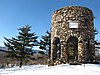 | 14. Feb. 1986 ID-Nr. 86000260 | Stafford Hill Rd. 42° 34′ 28″ N, 73° 6′ 59″ W42.574444-73.116389 | Cheshire | |
| 153 | Stockbridge Casino |  | 27. Aug. 1976 ID-Nr. 76000249 | 42° 16′ 56″ N, 73° 18′ 6″ W42.282222-73.301667 | Stockbridge | |
| 154 | Summer Street Historic District |  | 5. Sep. 1985 ID-Nr. 85002009 | 42° 37′ 7″ N, 73° 7′ 1″ W42.618611-73.116944 | Adams | |
| 155 | Sykes House |  | 25. Okt. 1985 ID-Nr. 85003420 | 521 W. Main St. 42° 41′ 56″ N, 73° 7′ 59″ W42.698889-73.133056 | North Adams | |
| 156 | Taconic and West Avenues Historic District |  | 11. Juni 1998 ID-Nr. 98000680 | 42° 11′ 27″ N, 73° 22′ 5″ W42.190833-73.368056 | Great Barrington | |
| 157 | Trinity Episcopal Church |  | 4. Apr. 1996 ID-Nr. 96000363 | 102 Walker St. 42° 21′ 16″ N, 73° 16′ 56″ W42.354444-73.282222 | Lenox | |
| 158 | Tyringham Cemetery |  | 16. Sep. 2009 ID-Nr. 09000716 | Church Rd. 42° 14′ 33,7″ N, 73° 12′ 5,2″ W42.242703-73.201444 | Tyringham | |
| 159 | Tyringham Library |  | 11. Jan. 2018 ID-Nr. 100001960 | 118 Main Rd. 42° 14′ 45,2″ N, 73° 12′ 23,5″ W42.2458975-73.2065307 | Tyringham | |
| 160 | Tyringham Shaker Settlement Historic District |  weitere Bilder | 15. Okt. 1987 ID-Nr. 87001785 | Jerusalem Rd. 42° 14′ 46″ N, 73° 13′ 30″ W42.246111-73.225 | Tyringham | |
| 161 | Upper Historic District |  | 2. Sep. 1987 ID-Nr. 86002145 | 42° 21′ 48″ N, 73° 8′ 37″ W42.363333-73.143611 | Washington | |
| 162 | Upper North Street Commercial District |  | 27. Dez. 2002 ID-Nr. 02001615 | 42° 27′ 14″ N, 73° 15′ 9″ W42.453889-73.2525 | Pittsfield | |
| 163 | US Post Office-Great Barrington Main |  | 10. Jan. 1986 ID-Nr. 86000163 | 222 Main St. 42° 12′ 0″ N, 73° 21′ 36″ W42.2-73.36 | Great Barrington | |
| 164 | US Post Office-Williamstown Main |  | 17. Juli 1986 ID-Nr. 86002243 | 56 Spring St. 42° 42′ 38″ N, 73° 12′ 14″ W42.710556-73.203889 | Williamstown | |
| 165 | Ventfort Hall |  | 5. März 1993 ID-Nr. 93000055 | 42° 21′ 11″ N, 73° 16′ 48″ W42.353056-73.28 | Lenox | |
| 166 | Villa Virginia |  | 29. Nov. 1983 ID-Nr. 83003930 | Ice Glen Rd. 42° 16′ 27″ N, 73° 18′ 41″ W42.274167-73.311389 | Stockbridge | |
| 167 | Wahconah Park |  | 12. Aug. 2005 ID-Nr. 05000878 | 143 Wahconah St. 42° 27′ 45,3″ N, 73° 15′ 5,5″ W42.462592-73.251514 | Pittsfield | |
| 168 | Wells House |  | 25. Okt. 1985 ID-Nr. 85003393 | 568 W. Main St. 42° 41′ 54″ N, 73° 8′ 5″ W42.698333-73.134722 | North Adams | |
| 169 | West Stockbridge Grange No. 246 |  | 5. Feb. 1999 ID-Nr. 99000134 | 5 Swamp Rd. 42° 20′ 9″ N, 73° 22′ 7″ W42.335833-73.368611 | West Stockbridge | |
| 170 | West Stockbridge Town Hall |  | 1. Juli 2009 ID-Nr. 09000469 | 9 Main St. 42° 20′ 3″ N, 73° 22′ 1,5″ W42.334167-73.367083 | West Stockbridge | |
| 171 | Westover-Bacon-Potts Farm |  | 27. Juli 1990 ID-Nr. 90000157 | 42° 8′ 53″ N, 73° 25′ 1″ W42.148056-73.416944 | Egremont | |
| 172 | Wheatleigh |  | 6. Apr. 1982 ID-Nr. 82004956 | W. Hawthorne Rd. 42° 20′ 27″ N, 73° 18′ 14″ W42.340833-73.303889 | Stockbridge | |
| 173 | Wheeler Family Farmstead |  | 6. Sep. 2011 ID-Nr. 11000614 | 817 S. Main St. 42° 10′ 43″ N, 73° 21′ 46″ W42.178611-73.362778 | Great Barrington | |
| 174 | Williamstown Rail Yard and Station Historic District |  | 3. Juni 1994 ID-Nr. 94000544 | 42° 43′ 11″ N, 73° 11′ 25″ W42.719722-73.190278 | Williamstown | |
| 175 | Windsor Print Works |  weitere Bilder | 17. Mai 1973 ID-Nr. 73000296 | 121 Union St. 42° 42′ 2″ N, 73° 6′ 18″ W42.700556-73.105 | North Adams | |
| 176 | Wollison-Shipton Building |  | 30. Sep. 1982 ID-Nr. 82001899 | 142-156 North St. 42° 27′ 2″ N, 73° 15′ 12″ W42.450556-73.253333 | Pittsfield |
Siehe auch
- Liste der National Historic Landmarks in Massachusetts
- National Register of Historic Places in Massachusetts
Weblinks
Commons: National Register of Historic Places in Berkshire County, Massachusetts – Sammlung von Bildern, Videos und Audiodateien
Einzelnachweise
- ↑ Auszug aus dem National Register of Historic Places - Berkshire County Abgerufen am 19. November 2015
- ↑ Die Nummerierung in dieser Listenspalte ist an der vom National Park Service vorgelegten Reihenfolge der Einträge orientiert; die Farben unterscheiden verschiedene Schutzgebietstypen des Nationalparksystems mit landesweiter Bedeutung (z. B. National Historic Landmarks) von den sonstigen Einträgen im National Register of Historic Places.
- ↑ National Register Information System. In: National Register of Historic Places. National Park Service, abgerufen am 13. März 2009 (englisch).
- Karte mit allen Koordinaten:
- OSM
- WikiMap
| Countys | Barnstable • Berkshire • Bristol • Dukes • Essex • Franklin • Hampden • Hampshire • Middlesex • Nantucket • Norfolk • Plymouth • Suffolk • Worcester (Nord | Süd) | ||||||||||||||||
| Städte |
|


