Šmaver, Nova Gorica
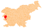
Place in Slovenian Littoral, Slovenia
46°0′13.27″N 13°37′21.75″E / 46.0036861°N 13.6227083°E / 46.0036861; 13.6227083 (2002)
Šmaver (pronounced [ˈʃmaːʋər]; Italian: San Mauro) is a settlement on the right bank of the Soča River north of Solkan in the Municipality of Nova Gorica in western Slovenia.[2]
Name
Locally, Šmaver is known as Štamaver or Šentmaver.[3]
History
The actual settlement of San Mauro remained in Italy, whereas the area of Šmaver with the eastern slopes of Mount Sabotin, now without any permanent residents, was annexed to the Socialist Federal Republic of Yugoslavia in 1947.
References
External links
- Šmaver on Geopedia
- v
- t
- e
Administrative seat: Nova Gorica
| Current |
|
|---|---|
| Former |
|
- Nevin Birsa
- Valter Birsa
- Matej Bor
- Jure Franko
- Ivo Hvalica
- Klement Jug
- Boris Kalin
- Zdenko Kalin
- Vasja Klavora
- Danilo Kovačič
- Janko Kralj
- Branko Marušič
- Tomaž Marušič
- Iztok Mlakar
- Dušan Pirjevec Ahac
- Marko Anton Plenčič
- Vojteh Ravnikar
- Gianni Rijavec
- Leon Rupnik
- Igor Simčič
- Mojca Širok
- Stanislav Škrabec
- Josip Srebrnič
- Jože Srebrnič
- Boštjan Vuga
- Danilo Zavrtanik
- Vasilij Žbogar
 | This article about the Municipality of Nova Gorica in Slovenia is a stub. You can help Wikipedia by expanding it. |
- v
- t
- e


