Adventurers' Land
Geological Site of Special Scientific Interest north of March in Cambridgeshire
| Site of Special Scientific Interest | |
 | |
| Location | Cambridgeshire |
|---|---|
| Grid reference | TF 361 019[1] |
| Interest | Geological |
| Area | 10.1 hectares[1] |
| Notification | 1989[1] |
| Location map | Magic Map |
Adventurers' Land is a 10.1-hectare (25-acre) geological Site of Special Scientific Interest (SSSI) north of March in Cambridgeshire.[1][2] It is a Geological Conservation Review site.[3]
The site is described by Natural England as important for the study of changes in Holocene sea levels. There are five peat levels dating to between 6,400 and 1,850 years BP, and the earliest represents the oldest directly dated transgression of the sea into the Fens. Part of the site is also in the Nene Washes biological SSSI.[4]
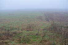
A public footpath along the north bank of the River Nene from Guyhirn goes through the site, which has been filled in and no geology is visible.
References
- ^ a b c d "Designated Sites View: Adventurers' Land". Sites of Special Scientific Interest. Natural England. Retrieved 25 November 2016.
- ^ "Map of Adventurers' Land". Sites of Special Scientific Interest. Natural England. Retrieved 25 November 2016.
- ^ "Adventurers' Land (Quaternary of East Anglia)". Joint Nature Conservation Committee. Retrieved 4 December 2016.
- ^ "Adventurers' Land citation" (PDF). Sites of Special Scientific Interest. Natural England. Archived from the original (PDF) on 4 March 2016. Retrieved 25 November 2016.
Wikimedia Commons has media related to Adventurers' Land.
52°35′53″N 0°00′29″E / 52.598°N 0.008°E / 52.598; 0.008
- v
- t
- e
- Alder Carr
- Aversley Wood
- Balsham Wood
- Barnack Hills & Holes
- Bassenhally Pit
- Bedford Purlieus
- Berry Fen
- Bonemills Hollow
- Brackland Rough
- Brampton Meadow
- Brampton Racecourse
- Brampton Wood
- Buff Wood
- Caldecote Meadows
- Cam Washes
- Carlton Wood
- Castor Flood Meadows
- Castor Hanglands
- Cherry Hinton Pit
- Chettisham Meadow
- Chippenham Fen and Snailwell Poor's Fen
- Delph Bridge Drain
- Dernford Fen
- Devil's Dyke
- Dogsthorpe Star Pit
- Elsworth Wood
- Ely Pits and Meadows
- Eversden and Wimpole Woods
- Fleam Dyke
- Fowlmere Watercress Beds
- Fulbourn Fen
- Furze Hill
- Gamlingay Wood
- Godmanchester Eastside Common
- Gog Magog Golf Course
- Grafham Water
- Great Stukeley Railway Cutting
- Great Wilbraham Common
- Hardwick Wood
- Hayley Wood
- Hemingford Grey Meadow
- Hildersham Wood
- Holland Hall (Melbourn) Railway Cutting
- Holme Fen
- Houghton Meadows
- Kingston Wood and Outliers
- L-Moor, Shepreth
- Langley Wood
- Little Catworth Meadow
- Little Paxton Pits
- Little Paxton Wood
- Madingley Wood
- Monks Wood and The Odd Quarter
- Nene Washes
- Orton Pit
- Orwell Clunch Pit
- Ouse Washes
- Out and Plunder Woods
- Overhall Grove
- Papworth Wood
- Park Wood
- Perry Woods
- Portholme
- Roman Road
- Sawston Hall Meadows
- Snailwell Meadows
- Soham Wet Horse Fen
- Southorpe Meadow
- Southorpe Paddock
- Southorpe Roughs
- St Neots Common
- Stow-Cum-Quy Fen
- Sutton Heath and Bog
- Ten Wood
- Thriplow Meadows
- Thriplow Peat Holes
- Upware North Pit
- Upwood Meadows
- Wansford Pasture
- Warboys and Wistow Woods
- Waresley Wood
- Weaveley and Sand Woods
- West, Abbot's and Lound Woods
- Whitewater Valley
- Whittlesford - Thriplow Hummocky Fields
- Wicken Fen
- Wilbraham Fens
- Woodwalton Fen
- Woodwalton Marsh


