Astarachay
38°26′31″N 48°52′55″E / 38.442°N 48.882°E / 38.442; 48.882
River in Iran, Iran and Azerbaijan
| Astarachay Astaraçay, آستاراچای | |
|---|---|
| Location | |
| Countries | Iran and Azerbaijan |
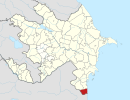
| Province | Gilan, Iran |
| District | Astara, Azerbaijan |
| Cities | Astara, Iran Astara Azerbaijan |
| Physical characteristics | |
| Mouth | Caspian Sea |
| Length | 38 km (24 mi) |
| Basin size | 242 km2 (93 sq mi) |
The Astarachay (Talysh: Ostororü, Persian: آستاراچای, Azerbaijani: Astaraçay), is a small river that defines the eastern border between Iran and Azerbaijan in Western Asia.[1]
The river discharges into the Caspian Sea. After flowing in a canyon through the Alborz mountain range, it reaches its river mouth on the southwestern Caspian coast.
The Astarachay is partially in Gilan Province of far northwestern Iran.
See also
- Tributaries of the Caspian Sea
- Alborz mountain range topics
- Landforms of Gilan Province
External links
- Aerial Map: Astarachay
- Astarachay Archived 2013-07-22 at the Wayback Machine
References
- ^ Reka Astara-chay
- v
- t
- e

- Aras
- Sefid-Rud
- Ghezel Ozan
- Shahrood (River)
- Zarjoob
- Chalus River
- Haraz River
- Atrek River
- Kojoor River
- Do Hezar River
- Atrek River
- Qarasu River
- Gorganrud River
- Astarachay
- Qom (River)
- Abhar River
- Jajrud
- Karaj River
| ||
|---|---|---|
| Capital |  | |
| Counties and cities | ||
| Sights |
| |
| Populated places | ||
 | This Astara Rayon location article is a stub. You can help Wikipedia by expanding it. |
- v
- t
- e
This article related to a river in Azerbaijan is a stub. You can help Wikipedia by expanding it. |
- v
- t
- e
 | This Astara County location article is a stub. You can help Wikipedia by expanding it. |
- v
- t
- e
This article related to a river in Iran is a stub. You can help Wikipedia by expanding it. |
- v
- t
- e


