Bridger Pass
| Bridger Pass[1] | |
|---|---|
| Bridger's Pass[2] Name origin: Jim Bridger | |
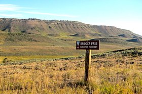 Hiking along Bridger Pass Road in the Divide Basin | |
| Elevation | 7,532 ft (2,296 m)[3] |
| Traversed by | Stansbury Expedition Cherokee Trail |
| Range | Sierra Madre (Wyoming) |
| Coordinates | 41°33′02″N 107°26′05″W / 41.5505°N 107.4347°W / 41.5505; -107.4347 |
Bridger's Pass | |
   | |
| Nearest city | Rawlins, Wyoming |
| Coordinates | 41°33′3″N 107°26′4″W / 41.55083°N 107.43444°W / 41.55083; -107.43444 |
| Area | less than one acre |
| Built | 1850 |
| NRHP reference No. | 70000669[4] |
| Added to NRHP | April 28, 1970 |
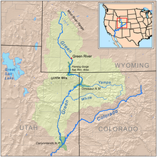
Bridger Pass is a mountain pass in Carbon County, Wyoming on the Continental Divide of the Americas near the south Great Divide Basin bifurcation point, i.e., the point at which the divide appears to split and envelop the basin.
The first documented crossing of Bridger Pass was by the Stansbury Expedition, returning east from an expedition to Utah and guided by Jim Bridger.[2] A decade later the pass was in regular use by travelers on the Overland Trail and the associated stage line, these having been established along the route described by Stansbury and known since that time as the Cherokee Trail. To support the stage line, the Bridger Stage Station was established near the pass. The Overland Trail was used steadily between 1860 and 1869 until the First transcontinental railroad made the stage line obsolete.
In modern times, the official route of the Continental Divide Trail uses Bridger Pass Road to navigate the Great Divide Basin between Battle Pass on Wyoming Highway 70 and Rawlins, Wyoming. A challenge to hikers is the lack of potable water along this section due to the brackish nature (salinity) of water in the basin.[5]
References
- ^ U.S. Geological Survey Geographic Names Information System: Bridger Pass
- ^ a b Barnhart, Bill (Dec 19, 1969). "Bridger's Pass: Nomination Form" (pdf). NPS Focus. Wyoming Recreation Commission. Retrieved 2010-04-27.
- ^ "Bridger Pass, Wyoming, USGS 7.5 minute topographic map via TopoQuest". USGS. Retrieved 2013-05-26.
- ^ "National Register Information System". National Register of Historic Places. National Park Service. March 13, 2009.
- ^ Wyoming's Continental Divide Trail by Lora Davis - 2000
External links
- Bridger's Pass at the Wyoming State Historic Preservation Office
- "Bridger's Pass" . New International Encyclopedia. 1905.
- v
- t
- e

- Arlington
- Brush Creek Work Center
- Como Bluff
- Downtown Rawlins Historic District
- Headquarters Park Historic District
- Medicine Bow Airport
- Muddy Creek Archeological Complex
- Parco Historic District
- Powder Wash Archeological District
- Rawlins Residential Historic District
- Ryan Ranch
- Wyoming State Penitentiary
- Garrett Allen Prehistoric Site
- Jim Baker Cabin
- Boston Wyoming Smelter Site
- Bridger Pass
- Carbon Cemetery
- DFU Elk Mountain Bridge
- Divide Sheep Camp
- DMJ Pick Bridge
- DML Butler Bridge
- Duck Lake Station Site
- Elk Mountain Hotel
- George Ferris Mansion
- Ferris-Haggarty Mine Site
- First State Bank of Baggs
- Fort Halleck
- Fort Fred Steele
- Fossil Cabin
- France Memorial United Presbyterian Church
- Hanna Community Hall
- Hotel Wolf
- Hugus Hardware
- Jack Creek Guard Station
- J. O. Ranch Rural Historic Landscape
- Medicine Bow Union Pacific Depot
- Midway Station Site
- Pine Grove Station Site
- Platte River Crossing
- Sage Creek Station Site
- Saratoga Masonic Hall
- Stockgrowers Bank
- Stone Wall Ranch
- Union Pacific Railroad Depot, Rawlins
- Virginian Hotel
- Washakie Station Site
| Authority control databases |
|
|---|


