Bruin, Kentucky
Unincorporated community in Kentucky, United States
Unincorporated community in Kentucky, United States
38°10′30″N 83°1′32″W / 38.17500°N 83.02556°W / 38.17500; -83.0255641125
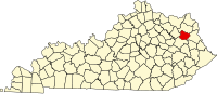
Bruin is an unincorporated community in Elliott County, Kentucky, United States. It lies along Kentucky routes 7 and 409 just south of Grayson Lake State Park. Bruin is northeast of the county seat, Sandy Hook.[1] Its elevation is 689 feet (210 m).[2]
The post office was established on 28 December 1869 by Samuel Mobley[1] The community was named after Bruin Creek[1] which flows parallel to Route 7 on the east side.[3]
References
- ^ a b c Rennick, Robert M. (1987) Kentucky Place Names University Press of Kentucky, Lexington, Kentucky, p. 39, ISBN 0-8131-0179-4
- ^ U.S. Geological Survey Geographic Names Information System: Bruin, Kentucky, Geographic Names Information System, 1979-09-20. Accessed 2008-01-03.
- ^ Bruin Quadrangle, Kentucky, (1971) Topographic Map 1:24,000, United States Geological Survey
External links
- Bruin, KY: Community Profile
- v
- t
- e
Municipalities and communities of Elliott County, Kentucky, United States
County seat: Sandy Hook
communities
- Kentucky portal
- United States portal
 | This Elliott County, Kentucky state location article is a stub. You can help Wikipedia by expanding it. |
- v
- t
- e


