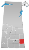
Fleming, Saskatchewan
Fleming is a town in Saskatchewan, Canada. Per the 2021 census, with a population of 70 inhabitants, Fleming was the smallest official town in Saskatchewan by population.[5] It is bordered primarily by the Rural Municipality of Moosomin No. 121, but also by the Rural Municipality of Maryfield No. 91.
Demographics
In the 2021 Census of Population conducted by Statistics Canada, Fleming had a population of 70 living in 31 of its 34 total private dwellings, a change of -16.7% from its 2016 population of 84. With a land area of 1.89 km2 (0.73 sq mi), it had a population density of 37.0/km2 (95.9/sq mi) in 2021.[6]
See also
References
- ^ "2011 Community Profiles". Statistics Canada. Government of Canada. Archived from the original on 2018-12-26. Retrieved 2014-04-09.
- ^ National Archives, Archivia Net. "Post Offices and Postmasters". Archived from the original on 2006-10-06. Retrieved 2014-07-15.
- ^ Government of Saskatchewan, MRD Home. "Municipal Directory System". Archived from the original on 2016-01-15. Retrieved 2014-07-15.
- ^ Commissioner of Canada Elections, Chief Electoral Officer of Canada (2005). "Elections Canada On-line". Archived from the original on 2007-04-21. Retrieved 2014-07-15.
- ^ "Profile Table - Fleming, Town". Statistics Canada. Retrieved 5 November 2022.
- ^ "Population and dwelling counts: Canada, provinces and territories, census divisions and census subdivisions (municipalities), Saskatchewan". Statistics Canada. February 9, 2022. Retrieved April 1, 2022.
- v
- t
- e
- Aberdeen
- Abernethy
- Alameda
- Allan
- Arborfield
- Arcola
- Asquith
- Assiniboia
- Balcarres
- Balgonie
- Battleford
- Bengough
- Bienfait
- Big River
- Biggar
- Birch Hills
- Blaine Lake
- Bredenbury
- Broadview
- Bruno
- Burstall
- Cabri
- Canora
- Carlyle
- Carnduff
- Carrot River
- Central Butte
- Choiceland
- Churchbridge
- Colonsay
- Coronach
- Craik
- Creighton
- Cudworth
- Cupar
- Cut Knife
- Dalmeny
- Davidson
- Delisle
- Duck Lake
- Dundurn
- Eastend
- Eatonia
- Elrose
- Esterhazy
- Eston
- Fleming
- Foam Lake
- Fort Qu'Appelle
- Francis
- Govan
- Gravelbourg
- Grenfell
- Gull Lake
- Hafford
- Hague
- Hanley
- Herbert
- Hudson Bay
- Imperial
- Indian Head
- Ituna
- Kamsack
- Kelvington
- Kerrobert
- Kindersley
- Kinistino
- Kipling
- Kyle
- La Ronge
- Lafleche
- Lampman
- Langenburg
- Langham
- Lanigan
- Lashburn
- Leader
- Lemberg
- Leroy
- Lumsden
- Luseland
- Macklin
- Maidstone
- Maple Creek
- Marshall
- Midale
- Milestone
- Moosomin
- Morse
- Mossbank
- Naicam
- Nipawin
- Nokomis
- Norquay
- Ogema
- Osler
- Outlook
- Oxbow
- Pilot Butte
- Ponteix
- Porcupine Plain
- Preeceville
- Qu'Appelle
- Radisson
- Radville
- Raymore
- Redvers
- Regina Beach
- Rocanville
- Rockglen
- Rose Valley
- Rosetown
- Rosthern
- Rouleau
- St. Brieux
- St. Walburg
- Saltcoats
- Scott
- Shaunavon
- Shellbrook
- Sintaluta
- Southey
- Spiritwood
- Springside
- Star City
- Storthoaks
- Stoughton
- Strasbourg
- Sturgis
- Tisdale
- Turtleford
- Unity
- Vonda
- Wadena
- Wakaw
- Waldheim
- Wapella
- Watrous
- Watson
- Wawota
- White City
- Whitewood
- Wilkie
- Willow Bunch
- Wolseley
- Wynyard
- Yellow Grass
- Zealandia
- Culture
- Economy
- First Nations
- Geography
- Government
- History
- Regions
- Tourist attractions
 Category
 Canada portal
 WikiProject
50°04′15″N 101°29′56″W / 50.07083°N 101.49889°W / 50.07083; -101.49889
 | This article about a location in the Census Division No. 5 of Saskatchewan is a stub. You can help Wikipedia by expanding it. |
- v
- t
- e


