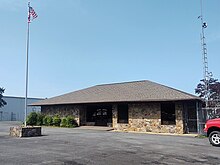
Heber Springs Municipal Airport
Airport


HBZ
Location of airport in Arkansas
Show map of Arkansas
HBZ
HBZ (the United States)
Show map of the United States| Direction | Length | Surface | |
|---|---|---|---|
| ft | m | ||
| 5/23 | 4,002 | 1,220 | Asphalt |
| Aircraft operations | 19,500 |
|---|---|
| Based aircraft | 29 |
Source: Federal Aviation Administration[1]
Heber Springs Municipal Airport (ICAO: KHBZ, FAA LID: HBZ) is a public-use airport located 2 nautical miles (3.7 km) northeast of the central business district of Heber Springs, in Cleburne County, Arkansas, United States. It is owned by the City of Heber Springs.[1]
This airport is included in the FAA's National Plan of Integrated Airport Systems for 2011–2015, which categorized it as a general aviation airport.[2]
Although most U.S. airports use the same three-letter location identifier for the FAA and IATA, this airport is assigned HBZ by the FAA[1] but has no designation from the IATA.[3]
Facilities and aircraft
Heber Springs Municipal Airport covers an area of 55 acres (22 ha) at an elevation of 632 feet (193 m) above mean sea level. It has one runway designated 5/23 with an asphalt surface measuring 4,002 by 75 feet (1,220 m × 23 m).[1]
For the 12-month period ending November 30, 2010, the airport had 19,500 aircraft operations, an average of 53 per day: 97% general aviation and 3% military. At that time there were 29 aircraft based at this airport: 83% single-engine and 17% multi-engine.[1]
See also
References
- ^ a b c d e FAA Airport Form 5010 for HBZ PDF. Federal Aviation Administration. effective 25 August 2011.
- ^ "2011–2015 NPIAS Report, Appendix A (PDF, 2.03 MB)" (PDF). 2011–2015 National Plan of Integrated Airport Systems. Federal Aviation Administration. 4 October 2010. Archived from the original (PDF) on 27 September 2012.
- ^ "Heber Springs, Arkansas (FAA: HBZ, ICAO: KHBZ)". Great Circle Mapper. Retrieved 19 October 2011.
External links
- Heber Springs Municipal Airport (HBZ) at Arkansas Department of Aeronautics
- Aerial image as of 28 February 2001 from USGS The National Map
- FAA Terminal Procedures for HBZ, effective June 13, 2024
- Resources for this airport:
- FAA airport information for HBZ
- AirNav airport information for HBZ
- FlightAware airport information and live flight tracker
- SkyVector aeronautical chart for HBZ
- v
- t
- e
 Arkansas portal

- El Dorado
- Harrison
- Hot Springs
- Jonesboro
- Almyra
- Arkadelphia
- Ash Flat
- Augusta
- Batesville
- Benton
- Bentonville
- Berryville
- Blytheville (Arkansas International, Municipal)
- Brinkley
- Calico Rock
- Camden
- Carlisle
- Clarendon
- Clarksville
- Clinton
- Colt
- Conway
- Corning
- Crossett
- Danville
- De Queen
- De Witt
- Dumas
- Fayetteville
- Flippin
- Fordyce
- Heber Springs
- Helena-West Helena
- Hope
- Horseshoe Bend
- Lake Village
- Magnolia
- Malvern
- Manila
- Marianna
- Marked Tree
- Marshall
- McGehee
- Melbourne
- Mena
- Monticello
- Morrilton (Municipal, Petit Jean)
- Mount Ida
- Mountain Home
- Nashville
- Newport
- Osceola
- Ozark
- Paragould
- Paris/Subiaco
- Piggott
- Pine Bluff
- Pocahontas
- Rogers
- Russellville
- Searcy
- Sheridan
- Siloam Springs
- Springdale
- Stuttgart
- Waldron
- Walnut Ridge
- Warren
 Arkansas portal
- List of airports in Arkansas


