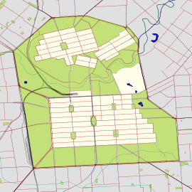
Jeffcott Street


- 34°54′11″S 138°35′24″E / 34.902970°S 138.589976°E / -34.902970; 138.589976 (North end)
- 34°54′46″S 138°35′36″E / 34.912661°S 138.593456°E / -34.912661; 138.593456 (South end)
North Adelaide
North Adelaide
Jeffcott Street is a north–south street through the largest section of North Adelaide, South Australia.
Route
It goes around the sides of Wellington Square. The southern end continues south as Montefiore Road over a bridge over the River Torrens and Adelaide Metro railyards to connect with the northern end of Morphett Street.
History
Jeffcott Street was named in 1837 at a meeting to set street names after John Jeffcott, the first judge of the Supreme Court of South Australia and one of the members of the committee.[2]
The Montefiore Road bridge below Jeffcott street is the latest of many on the site.[3]
In 2019, Jeffcott street's powerlines were put underground with funding from the Power Line Environment Committee.[4]
References
- ^ Google (1 June 2022). "Jeffcott Street" (Map). Google Maps. Google. Retrieved 1 June 2022.
- ^ "Advertising". South Australian Gazette And Colonial Register. Vol. I, no. 2. South Australia. 3 June 1837. p. 1. Retrieved 24 May 2021 – via National Library of Australia.
- ^ "Adelaide – Bridges". The Manning Index of South Australian History. State Library of South Australia. Retrieved 24 May 2021.
- ^ Hamilton, Kevin. "PLEC Annual Report 2017-18" (PDF). Power Line Environment Committee. Retrieved 10 March 2023.
- v
- t
- e
 Road infrastructure in Adelaide
- Anzac Highway
- Adelaide–Mannum Road (North East Road)
- Gawler Bypass
- Glen Osmond Road
- Grand Junction Road
- Main North Road
- Main South Road
- Mount Barker Road
- Port Road
- Port Wakefield Road
- Portrush/Lower Portrush/Ascot/Taunton/Hampstead Roads
- Salisbury Highway
- Sir Donald Bradman Drive
- South Road
- Victor Harbor Road
- Churchill Road
- City Ring Route
- Cross Road
- Daws Road
- Elder Smith Road
- Flagstaff Road
- Fullarton Road
- Goodwood Road
- Grange Road
- Greenhill Road
- Henley Beach Road
- Kensington Road
- McIntyre/King Roads
- Magill Road
- Marion Road
- Melbourne Street
- Montacute Road
- Montague Road
- O'Connell Street
- Panalatinga Road
- Payneham/Lower North East Roads
- Philip Highway
- Prospect Road
- Regency/Muller Roads
- Tapleys Hill/Brighton/Ocean/Lonsdale/Dyson/Murray Roads
- The Parade
- Torrens Road
- Unley Road
- Victoria Road
- Angas Street
- East Terrace
- Carrington Street
- Currie Street
- Flinders Street
- Franklin Street
- Gawler Place
- Gilbert Street
- Gilles Street
- Gouger Street
- Grenfell Street
- Grote Street
- Halifax Street
- Hindley Street
- Jeffcott Street
- King William Street
- Morphett Street
- North Terrace
- Pirie Street
- Pulteney Street
- Rundle Mall
- Rundle Street
- South Terrace
- Sturt Street
- Wakefield Street
- Waymouth Street
- West Terrace
- Wright Street


