List of Pennsylvania state historical markers in Cameron County

This is a list of the Pennsylvania state historical markers in Cameron County.
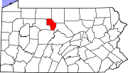
This is intended to be a complete list of the official state historical markers placed in Cameron County, Pennsylvania by the Pennsylvania Historical and Museum Commission (PHMC). The locations of the historical markers, as well as the latitude and longitude coordinates as provided by the PHMC's database, are included below when available. There are 7 historical markers located in Cameron County.[1]
Map all coordinates using OpenStreetMap
Download coordinates as:
- KML
- GPX (all coordinates)
- GPX (primary coordinates)
- GPX (secondary coordinates)
Historical markers
| Marker title | Image | Date dedicated | Location | Marker type | Topics |
|---|---|---|---|---|---|
| Allegheny Portage | August 25, 1949 | Junction East Allegheny Avenue (PA 120) & PA 155, Emporium 41°30′29″N 78°13′13″W / 41.50802°N 78.22032°W / 41.50802; -78.22032 (Allegheny Portage) | Roadside | Native American, Transportation | |
| Bucktails, The | February 8, 1950 | Junction 3rd Street (PA 120) & Bridge Street (PA 555), Driftwood 41°20′22″N 78°08′03″W / 41.339485°N 78.134104°W / 41.339485; -78.134104 (Bucktails, The) | Roadside | Civil War, Military | |
| Cameron County | September 14, 1982 | County Courthouse, East 5th Street between North Cherry & Chestnut Streets, Emporium 41°30′46″N 78°14′11″W / 41.5128°N 78.23642°W / 41.5128; -78.23642 (Cameron County) | City | Government & Politics, Government & Politics 19th Century | |
| Portage Path | October 10, 1950 | PA 155, 5.5 miles north of Emporium (MISSING) | Roadside | Native American, Navigation, Paths & Trails, Transportation | |
| Sinnemahoning Path | February 9, 1950 | CCC Memorial Highway (PA 120), 3.8 miles south of Emporium 41°27′49″N 78°11′53″W / 41.46368°N 78.19812°W / 41.46368; -78.19812 (Sinnemahoning Path) | Roadside | Native American, Paths & Trails, Transportation | |
| Sinnemahoning Path | February 9, 1950 | PA 120, 1.5 miles north of Driftwood (MISSING) | Roadside | Native American, Paths & Trails, Transportation | |
| Tom Mix |  | May 28, 1955 | Across creek from birthplace, Low Grade Road (PA 555), west of Driftwood 41°20′25″N 78°11′19″W / 41.340250°N 78.188733°W / 41.340250; -78.188733 (Tom Mix) | Roadside | Motion Pictures & Television |
See also
 Pennsylvania portal

References
- ^ "PHMC Historical Markers Search" (Searchable database). Pennsylvania Historical and Museum Commission. Commonwealth of Pennsylvania. Retrieved 2010-07-19.
External links
- Pennsylvania Historical Marker Program
- Pennsylvania Historical & Museum Commission
- v
- t
- e
Municipalities and communities of Cameron County, Pennsylvania, United States
County seat: Emporium
- Driftwood
- Emporium
- Prospect Park
- Sinnamahoning
communities
- Pennsylvania portal
- United States portal


