List of historic places in the Capital Regional District
Map all coordinates using OpenStreetMap
Download coordinates as:
- KML
- GPX (all coordinates)
- GPX (primary coordinates)
- GPX (secondary coordinates)
This is a list of historic places in the Capital Regional District, British Columbia (excluding the City of Victoria) entered on the Canadian Register of Historic Places, whether they are designated federally, provincially or municipally. For a list of historic places in the City of Victoria refer to the List of historic places in Victoria, British Columbia.
| Name | Address | Coordinates | Government recognition (CRHP №) | Image | |
|---|---|---|---|---|---|
| Light Tower | Carmanah Point Clo-oose BC | 48°36′42″N 124°45′05″W / 48.611694°N 124.751306°W / 48.611694; -124.751306 (Light Tower (Carmanah Point)) | Federal (10650) |  More images | |
| Belmont Road Main Gatehouse, Royal Roads University formerly Royal Roads Military College | 13 College Dr Victoria, BC V9C, Canada Hatley Park National Historic Site Colwood BC | 48°26′13″N 123°27′40″W / 48.4369°N 123.4612°W / 48.4369; -123.4612 (Belmont Road Main Gatehouse) | Federal (2840) |  More images | |
| Cole Island | Cole Island Colwood BC | 48°27′13″N 123°27′04″W / 48.4535°N 123.451°W / 48.4535; -123.451 (Cole Island) | British Columbia (12074) |  Upload Photo | |
| Cow Barn and Dairy RR6 | Hatley Park National Historic Site Colwood BC | 48°25′49″N 123°28′30″W / 48.4304°N 123.475°W / 48.4304; -123.475 (Cow Barn and Dairy RR6) | Federal (2841) |  More images | |
| Defence Electric Light Number 1 | Fort Rodd Hill Road Colwood BC | 48°25′55″N 123°27′00″W / 48.4319°N 123.45°W / 48.4319; -123.45 (Defence Electric Light Number 1) | Federal (4295) |  More images | |
| Fisgard Lighthouse and Dwelling | 603 Fort Rodd Hill Road Colwood BC | 48°25′49″N 123°26′51″W / 48.4304°N 123.4476°W / 48.4304; -123.4476 (Fisgard Lighthouse National Historic Site) | Federal (1146, (1253), British Columbia (20335) |  More images | |
| Fort Rodd Hill National Historic Site of Canada | 603 Fort Rodd Hill Road Colwood BC | 48°25′57″N 123°27′00″W / 48.4324°N 123.45°W / 48.4324; -123.45 (Fort Rodd Hill National Historic Site of Canada) | Federal (13469) |  | |
| Fort Rodd Hill National Historic Site, Lower Battery, Casemate Barracks (6 Buildings) | Colwood BC | 48°25′55″N 123°27′00″W / 48.4319°N 123.45°W / 48.4319; -123.45 (Fort Rodd Hill National Historic Site, Lower Battery, Casemate Barracks (6 Buildings)) | Federal (4296) |  More images | |
| Fort Rodd Hill, Battery Commander’s Post | Fort Rodd Hill Road Colwood BC | 48°25′55″N 123°27′00″W / 48.4319°N 123.45°W / 48.4319; -123.45 (Fort Rodd Hill, Battery Commander’s Post) | Federal (4348) |  More images | |
| Fort Rodd Hill, Canteen | Fort Rodd Hill Road Colwood BC | 48°25′55″N 123°27′00″W / 48.4319°N 123.45°W / 48.4319; -123.45 (Fort Rodd Hill, Canteen) | Federal (4346) |  More images | |
| Fortress Plotting Room | Fort Rodd Hill Road Colwood BC | 48°25′55″N 123°27′00″W / 48.4319°N 123.45°W / 48.4319; -123.45 (Fortress Plotting Room) | Federal (4292) |  More images | |
| Gatehouse Lodge | Hatley Park National Historic Site Colwood BC | 48°26′20″N 123°28′48″W / 48.439°N 123.48°W / 48.439; -123.48 (Gatehouse Lodge) | Federal (11288) | Upload Photo | |
| Grant Block, Building 24, Royal Roads University formerly Royal Roads Military College | Hatley Park National Historic Site Colwood BC | 48°26′00″N 123°28′59″W / 48.4333°N 123.483°W / 48.4333; -123.483 (Grant Block, Building 24, Royal Roads University formerly Royal Roads Military College) | Federal (3664) |  More images | |
| Guardhouse, Lower Battery | Fort Rodd Hill Road Colwood BC | 48°25′55″N 123°27′00″W / 48.4319°N 123.45°W / 48.4319; -123.45 (Guardhouse, Lower Battery) | Federal (4286) |  More images | |
| Guardhouse, Upper Battery | Fort Rodd Hill Road Colwood BC | 48°25′55″N 123°27′00″W / 48.4319°N 123.45°W / 48.4319; -123.45 (Guardhouse, Upper Battery) | Federal (4283) |  More images | |
| Gun Emplacement and Magazine, Lower Battery | Fort Rodd Hill Road Colwood BC | 48°26′N 123°29′W / 48.43°N 123.48°W / 48.43; -123.48 (Gun Emplacement and Magazine, Lower Battery) | Federal (4290) |  More images | |
| Gun Emplacement and Magazine, Upper Battery | Fort Rodd Hill Road Colwood BC | 48°26′N 123°29′W / 48.43°N 123.48°W / 48.43; -123.48 (Gun Emplacement and Magazine, Upper Battery) | Federal (4289) |  More images | |
| Gun Emplacement, Magazine and Directors Tower, Belmont Battery Classified Federal Heritage Building | Fort Rodd Hill Road Colwood BC | Federal (3145) |  More images | ||
| Gymnasium RR22, Royal Roads University formerly Royal Roads Military College | Hatley Park National Historic Site Colwood BC | 48°25′49″N 123°28′30″W / 48.4304°N 123.475°W / 48.4304; -123.475 (Gymnasium RR22) | Federal (2844) |  More images | |
| Hatley Park National Historic Site / Former Royal Roads Military College/Royal Roads University | 2005 Sooke Road Colwood BC | 48°26′06″N 123°28′23″W / 48.4351°N 123.473°W / 48.4351; -123.473 (Hatley Park / Former Royal Roads Military College National Historic Site of Canada) | Federal (15749, (7944) | Upload Photo | |
| Journey's End (House) | Ocean Boulevard Colwood BC | 48°26′07″N 123°27′04″W / 48.4354°N 123.4510°W / 48.4354; -123.4510 (House (Journey's End)) | Federal (4375) | Upload Photo | |
| Nixon Block RR24A, Royal Roads University formerly Royal Roads Military College | Hatley Park National Historic Site Colwood BC | 48°25′49″N 123°28′30″W / 48.4304°N 123.475°W / 48.4304; -123.475 (Nixon Block RR24A) | Federal (2843) |  More images | |
| Searchlight Engine Room | 603, Fort Rodd Hill Road Colwood BC | 48°25′55″N 123°27′00″W / 48.4319°N 123.45°W / 48.4319; -123.45 (Searchlight Engine Room) | Federal (4279) |  More images | |
| Searchlight N° 7 | Fort Rodd Hill Road Colwood BC | 48°25′55″N 123°27′00″W / 48.4319°N 123.45°W / 48.4319; -123.45 (Searchlight N° 7) | Federal (4281) |  More images | |
| Stable / Garage RR4 Royal Roads University formerly Royal Roads Military College | Hatley Park National Historic Site Colwood BC | 48°25′49″N 123°28′30″W / 48.4304°N 123.475°W / 48.4304; -123.475 (Stable / Garage RR4) | Federal (2842) |  More images | |
| Swimming Pool RR22A Royal Roads University formerly Royal Roads Military College | Hatley Park National Historic Site Colwood BC | 48°25′49″N 123°28′30″W / 48.4304°N 123.475°W / 48.4304; -123.475 (Swimming Pool RR22A) | Federal (2845) | Upload Photo | |
| Warrant Officer's Quarters | Fort Rodd Hill Road Colwood BC | 48°25′55″N 123°27′00″W / 48.4319°N 123.45°W / 48.4319; -123.45 (Warrant Officer's Quarters) | Federal (4277) |  More images | |
| Building 34 Nelles Block | Esquimalt BC | 48°26′11″N 123°25′05″W / 48.4364°N 123.418°W / 48.4364; -123.418 (Building 34) | Federal (10070) | Upload Photo | |
| Building D1 Base Commander’s Residence | Esquimalt BC | 48°25′48″N 123°26′06″W / 48.43°N 123.435°W / 48.43; -123.435 (Building D1) | Federal (3983) | Upload Photo | |
| Building D101 Admiral’s Residence | Hospital Rd Dockyard Esquimalt BC | 48°25′51″N 123°26′15″W / 48.4307°N 123.4374°W / 48.4307; -123.4374 (Building D101) | Federal (3147) | Upload Photo | |
| Building D109 Former Sail Loft and Oil Stores | Esquimalt BC | 48°25′48″N 123°26′06″W / 48.43°N 123.435°W / 48.43; -123.435 (Building D109) | Federal (4064) | Upload Photo | |
| Building D175 Drydock Pumphouse | Esquimalt BC | 48°25′48″N 123°26′06″W / 48.43°N 123.435°W / 48.43; -123.435 (Building D175) | Federal (2792) | Upload Photo | |
| Building D211 Clothing and Receiving Stores | Esquimalt BC | 48°25′48″N 123°26′06″W / 48.43°N 123.435°W / 48.43; -123.435 (Building D211) | Federal (3980) |  More images | |
| Building D214 Dockyard Guardhouse | Esquimalt BC | 48°25′48″N 123°26′06″W / 48.43°N 123.435°W / 48.43; -123.435 (Building D214) | Federal (2793) |  More images | |
| Building D26 Former Royal Navy Prison | Esquimalt BC | 48°25′48″N 123°26′06″W / 48.43°N 123.435°W / 48.43; -123.435 (Building D26) | Federal (3984) |  More images | |
| Building D38 Stone Frigate | Esquimalt BC | 48°25′48″N 123°26′06″W / 48.43°N 123.435°W / 48.43; -123.435 (Building D38) | Federal (4341) |  More images | |
| Building D51 Factory | Esquimalt BC | 48°25′48″N 123°26′06″W / 48.43°N 123.435°W / 48.43; -123.435 (Building D51) | Federal (3982) | Upload Photo | |
| Building D70 Dockyard Main Office | Esquimalt BC | 48°25′48″N 123°26′06″W / 48.43°N 123.435°W / 48.43; -123.435 (Building D70) | Federal (2785) |  More images | |
| Building D75-D76 Rum and Salt Meats Stores | Esquimalt BC | 48°25′48″N 123°26′06″W / 48.43°N 123.435°W / 48.43; -123.435 (Building D75-D76) | Federal (3978) |  More images | |
| Building D77 Creery Building Former Ordnance Stores | Esquimalt BC | 48°26′18″N 123°25′48″W / 48.4384°N 123.43°W / 48.4384; -123.43 (Building D77) | Federal (3979) |  More images | |
| Building D80, former Cordage / Furniture Stores Recognized Federal Heritage Building | Esquimalt BC | 48°25′48″N 123°26′06″W / 48.43°N 123.435°W / 48.43; -123.435 (Building D80, former Cordage / Furniture Stores Recognized Federal Heritage Building) | Federal (3981) |  More images | |
| CFB Esquimalt, Bickford Tower, Building D118 | Esquimalt BC | 48°25′48″N 123°26′06″W / 48.43°N 123.435°W / 48.43; -123.435 (CFB Esquimalt, Bickford Tower, Building D118) | Federal (3900) | Upload Photo | |
| CFB Esquimalt, Dockyard, Electrical Shop Building, D141 | Esquimalt BC | 48°25′48″N 123°26′06″W / 48.43°N 123.435°W / 48.43; -123.435 (CFB Esquimalt, Dockyard, Electrical Shop Building, D141) | Federal (3895) | Upload Photo | |
| CFB Esquimalt, Dockyards, Aldergrove Building, D199 | Esquimalt BC | Federal (3893) |  More images | ||
| Communications School, Building 67 | Esquimalt BC | 48°25′48″N 123°26′06″W / 48.43°N 123.435°W / 48.43; -123.435 (Communications School, Building 67) | Federal (3988) |  More images | |
| Esquimalt Naval Sites National Historic Site of Canada | Esquimalt BC | 48°26′02″N 123°26′02″W / 48.434°N 123.434°W / 48.434; -123.434 (Esquimalt Naval Sites National Historic Site of Canada) | Federal (12301) | 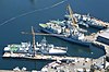 More images | |
| Former Armament Artificer's and Sergeant's Quarters, Building 522 | Esquimalt BC | 48°26′00″N 123°25′59″W / 48.4333°N 123.433°W / 48.4333; -123.433 (Former Armament Artificer's and Sergeant's Quarters, Building 522) | Federal (3986) |  More images | |
| Former Married Privates' Quarters, Building 523 | Esquimalt BC | 48°26′00″N 123°25′59″W / 48.4333°N 123.433°W / 48.4333; -123.433 (Former Married Privates' Quarters, Building 523) | Federal (3985) |  More images | |
| Former Offices of the Officer-in-Charge | CFB Esquimalt Esquimalt BC | 48°25′48″N 123°26′06″W / 48.43°N 123.435°W / 48.43; -123.435 (Former Offices of the Officer-in-Charge) | Federal (3991) |  More images | |
| Guard House Building 38 | Esquimalt BC | 48°26′N 123°29′W / 48.43°N 123.48°W / 48.43; -123.48 (Guard House Building 38) | Federal (2652) | Upload Photo | |
| Gun Emplacement, Building 578 | Signal Hill Esquimalt BC | Federal (4754) | Upload Photo | ||
| Gunnery School, former Building 50 | Esquimalt BC | 48°25′48″N 123°26′06″W / 48.43°N 123.435°W / 48.43; -123.435 (Gunnery School, former Building 50) | Federal (3990) |  More images | |
| Naden Museum Square, Building 20 | Esquimalt BC | 48°26′11″N 123°25′16″W / 48.4364°N 123.421°W / 48.4364; -123.421 (Naden Museum Square, Building 20) | Federal (10131) |  More images | |
| Naden Museum Square, Building 37 | Esquimalt BC | 48°26′09″N 123°25′19″W / 48.4359°N 123.422°W / 48.4359; -123.422 (Naden Museum Square, Building 37) | Federal (10143) |  More images | |
| Naden, Building Nos. 33, 33A, 33B Former Drill Hall | Esquimalt BC | 48°25′48″N 123°26′06″W / 48.43°N 123.435°W / 48.43; -123.435 (Naden, Building Nos. 33, 33A, 33B) | Federal (3989) |  More images | |
| Naden, Museum Square, Building No. 35 | Esquimalt BC | 48°25′48″N 123°26′06″W / 48.43°N 123.435°W / 48.43; -123.435 (Naden, Museum Square, Building No. 35) | Federal (3913) |  More images | |
| Protestant Chapel Building 39 | Esquimalt BC | 48°25′48″N 123°26′06″W / 48.43°N 123.435°W / 48.43; -123.435 (Protestant Chapel Building 39) | Federal (3914) |  More images | |
| Pump House | 825 Admirals Road Esquimalt BC | 48°26′14″N 123°25′29″W / 48.437225°N 123.424824°W / 48.437225; -123.424824 (Pump House) | Federal (10158) | Upload Photo | |
| Radar Training Building | Esquimalt BC | 48°26′23″N 123°24′58″W / 48.4398°N 123.416°W / 48.4398; -123.416 (Radar Training Building) | Federal (13215) | Upload Photo | |
| Royal Garrison Artillery Barracks’ Blocks, Building 1075 | Esquimalt BC | 48°25′48″N 123°26′06″W / 48.43°N 123.435°W / 48.43; -123.435 (Royal Garrison Artillery Barracks’ Blocks, Building 1075) | Federal (2829) | Upload Photo | |
| Shipwrights' Shed / Spar Shed, Building D113 | Esquimalt BC | 48°25′48″N 123°26′06″W / 48.43°N 123.435°W / 48.43; -123.435 (Shipwrights' Shed / Spar Shed, Building D113) | Federal (4477) |  More images | |
| Signal Hill No. 508 | Esquimalt BC | Federal (3987) |  More images | ||
| Stores / Museum Warehouse, Building 29 | Esquimalt BC | 48°25′48″N 123°26′06″W / 48.43°N 123.435°W / 48.43; -123.435 (Stores / Museum Warehouse, Building 29) | Federal (3915) |  More images | |
| Torpedo School, former Building 2 | Esquimalt BC | Federal (6194) |  More images | ||
| Trades Training Building | Esquimalt BC | 48°26′23″N 123°24′58″W / 48.4398°N 123.416°W / 48.4398; -123.416 (Trades Training Building) | Federal (13176) | Upload Photo | |
| Transformer House | 825 Admirals Road Esquimalt BC | 48°26′14″N 123°25′27″W / 48.437265°N 123.424222°W / 48.437265; -123.424222 (Transformer House) | Federal (10224) | Upload Photo | |
| Veterans' Cemetery Chapel | Esquimalt BC | 48°26′28″N 123°24′47″W / 48.441°N 123.413°W / 48.441; -123.413 (Veterans' Cemetery Chapel) | Federal (4366) | Upload Photo | |
| Warehouse Building D85 | Esquimalt BC | 48°25′48″N 123°26′06″W / 48.43°N 123.435°W / 48.43; -123.435 (Warehouse Building D85) | Federal (4274) |  More images | |
| Work Point Barracks No. 1004 | Esquimalt BC | 48°25′48″N 123°26′06″W / 48.43°N 123.435°W / 48.43; -123.435 (Work Point Barracks No. 1004) | Federal (2796) |  More images | |
| Work Point Barracks No. 1020 | Esquimalt BC | 48°25′48″N 123°26′06″W / 48.43°N 123.435°W / 48.43; -123.435 (Work Point Barracks No. 1020) | Federal (2797) |  More images | |
| Work Point Guard House | Esquimalt BC | 48°25′34″N 123°23′51″W / 48.426°N 123.3974°W / 48.426; -123.3974 (Work Point Guard House) | Federal (21058) |  More images | |
| Building D83 Oil Stores | Esquimalt BC | 48°25′48″N 123°26′06″W / 48.43°N 123.435°W / 48.43; -123.435 (Building D83) | Federal (2794) |  More images | |
| Lighttower | off southern tip of Vancouver Island Metchosin BC | 48°17′53″N 123°31′53″W / 48.298028°N 123.531417°W / 48.298028; -123.531417 (Lighttower (Race Rocks)) | Federal (4744) |  | |
| Denham Till Park and Residence | 744 Birch Road North Saanich BC | 48°40′48″N 123°28′05″W / 48.68°N 123.468°W / 48.68; -123.468 (Denham Till Park and Residence) | North Saanich municipality (11383) |  More images | |
| Glamorgan Farm | 1805 Glamorgan Road North Saanich BC | 48°39′30″N 123°25′37″W / 48.6583°N 123.427°W / 48.6583; -123.427 (Glamorgan Farm) | North Saanich municipality (11359) | Upload Photo | |
| Holy Trinity Church | 1319 Mills Road North Saanich BC | 48°39′19″N 123°26′45″W / 48.6552°N 123.4457°W / 48.6552; -123.4457 (Holy Trinity Church) | North Saanich municipality (11356) |  More images | |
| Holy Trinity Cemetery | 1319 Mills Road North Saanich BC | 48°39′17″N 123°26′42″W / 48.6548°N 123.445°W / 48.6548; -123.445 (Holy Trinity Cemetery) | North Saanich municipality (11357) |  More images | |
| Horth Residence | 498 Downey Road North Saanich BC | 48°40′26″N 123°28′44″W / 48.6739°N 123.479°W / 48.6739; -123.479 (Horth Residence) | North Saanich municipality (11361) |  More images | |
| Lillian Hoffar Park | 10563 McDonald Park Road North Saanich BC | 48°40′10″N 123°24′54″W / 48.6695°N 123.415°W / 48.6695; -123.415 (Lillian Hoffar Park) | North Saanich municipality (11384) |  More images | |
| Lillian Hoffar Western Red Cedar | 10563 McDonald Park Road North Saanich BC | 48°40′12″N 123°24′58″W / 48.67°N 123.416°W / 48.67; -123.416 (Lillian Hoffar Western Red Cedar) | North Saanich municipality (11385) | Upload Photo | |
| Mary Spencer Residence | 8916 Marshall Road North Saanich BC | 48°37′26″N 123°25′01″W / 48.624°N 123.417°W / 48.624; -123.417 (Mary Spencer Residence) | North Saanich municipality (11358) | Upload Photo | |
| Nymph Point Park | 1900 block Marina Way North Saanich BC | 48°40′29″N 123°25′01″W / 48.6748°N 123.417°W / 48.6748; -123.417 (Nymph Point Park) | North Saanich municipality (11362) |  More images | |
| R.O. Bull Memorial Park | 400-block Wain Road North Saanich BC | 48°40′36″N 123°28′48″W / 48.6767°N 123.48°W / 48.6767; -123.48 (R.O. Bull Memorial Park) | North Saanich municipality (11387) |  More images | |
| The White House | 9774 West Saanich Road North Saanich BC | 48°38′55″N 123°27′14″W / 48.6487°N 123.454°W / 48.6487; -123.454 (The White House) | North Saanich municipality (11360) |  More images | |
| Wain Park | 800-block Wain Road North Saanich BC | 48°40′41″N 123°27′43″W / 48.678°N 123.462°W / 48.678; -123.462 (Wain Park) | North Saanich municipality (11386) |  More images | |
| 1150 Monterey Avenue | 1150 Monterey Avenue Oak Bay BC | 48°25′21″N 123°18′54″W / 48.4226°N 123.315°W / 48.4226; -123.315 (1150 Monterey Avenue) | Oak Bay municipality (6769) |  More images | |
| 1241 Monterey Avenue | 1241 Monterey Avenue Oak Bay BC | 48°25′25″N 123°18′50″W / 48.4236°N 123.314°W / 48.4236; -123.314 (1241 Monterey Avenue) | Oak Bay municipality (6443) |  More images | |
| 151 Sunny Lane | 151 Sunny Lane Oak Bay BC | 48°24′45″N 123°19′12″W / 48.4124°N 123.32°W / 48.4124; -123.32 (151 Sunny Lane) | Oak Bay municipality (18739) | Upload Photo | |
| 1512 Beach Drive | 1512 Beach Drive Oak Bay BC | 48°25′36″N 123°18′28″W / 48.4267°N 123.3079°W / 48.4267; -123.3079 (1512 Beach Drive) | Oak Bay municipality (20005) | Upload Photo | |
| 1590 York Place | 1590 York Place Oak Bay BC | 48°25′40″N 123°18′39″W / 48.427704°N 123.310964°W / 48.427704; -123.310964 (1590 York Place) | Oak Bay municipality (6535) | Upload Photo | |
| 1931 Bowker Place | 1931 Bowker Place Oak Bay BC | 48°25′51″N 123°18′22″W / 48.4307°N 123.306°W / 48.4307; -123.306 (1931 Bowker Place) | Oak Bay municipality (18738) |  More images | |
| 210 Denison Road | 210 Denison Road Oak Bay BC | 48°24′43″N 123°19′23″W / 48.412°N 123.323°W / 48.412; -123.323 (210 Denison Road) | Oak Bay municipality (18582) | Upload Photo | |
| 2264 Windsor Road | 2264 Windsor Road Oak Bay BC | 48°25′20″N 123°18′50″W / 48.4223°N 123.314°W / 48.4223; -123.314 (2264 Windsor Road) | Oak Bay municipality (17842) | Upload Photo | |
| 235 Denison Road | 235 Denison Road Oak Bay BC | 48°24′46″N 123°19′23″W / 48.4129°N 123.323°W / 48.4129; -123.323 (235 Denison Road) | Oak Bay municipality (16189) | Upload Photo | |
| 2450 Windsor Road | 2450 Windsor Road Oak Bay BC | 48°25′22″N 123°18′32″W / 48.4227°N 123.309°W / 48.4227; -123.309 (2450 Windsor Road) | Oak Bay municipality (17843) | Upload Photo | |
| 2753 Somass Drive | 2753 Somass Drive Oak Bay BC | 48°25′46″N 123°18′22″W / 48.4295°N 123.306°W / 48.4295; -123.306 (2753 Somass Drive) | Oak Bay municipality (17841) |  More images | |
| 318 Newport Avenue | 318 Newport Avenue Oak Bay BC | 48°24′41″N 123°18′11″W / 48.4115°N 123.303°W / 48.4115; -123.303 (318 Newport Avenue) | Oak Bay municipality (18282) | Upload Photo | |
| 3225 Beach Drive | 3225 Beach Drive Oak Bay BC | 48°26′48″N 123°17′38″W / 48.4466°N 123.294°W / 48.4466; -123.294 (3225 Beach Drive) | Oak Bay municipality (16188) | Upload Photo | |
| 33 Sylvan Lane | 33 Sylvan Lane Oak Bay BC | 48°24′49″N 123°19′19″W / 48.4135°N 123.322°W / 48.4135; -123.322 (33 Sylvan Lane) | Oak Bay municipality (18396) | Upload Photo | |
| 825 Foul Bay Road | 825 Foul Bay Road Oak Bay BC | 48°25′09″N 123°19′23″W / 48.4193°N 123.323°W / 48.4193; -123.323 (825 Foul Bay Road) | Oak Bay municipality (6738) |  More images | |
| 929 Island Road | 929 Island Road Oak Bay BC | 48°25′09″N 123°18′25″W / 48.4193°N 123.307°W / 48.4193; -123.307 (929 Island Road) | Oak Bay municipality (6741) | Upload Photo | |
| 941 Victoria Avenue | 941 Victoria Avenue Oak Bay BC | 48°25′11″N 123°19′05″W / 48.4196°N 123.318°W / 48.4196; -123.318 (941 Victoria Avenue) | Oak Bay municipality (18405) |  More images | |
| Balgreggan | 3000 Rutland Road Oak Bay BC | 48°26′38″N 123°17′38″W / 48.4439°N 123.294°W / 48.4439; -123.294 (Balgreggan) | Oak Bay municipality (6447) | Upload Photo | |
| Bide-A-Wee House | 1538 Beach Drive Oak Bay BC | 48°26′N 123°19′W / 48.43°N 123.31°W / 48.43; -123.31 (Bide-A-Wee House) | Oak Bay municipality (2347) | Upload Photo | |
| Bleakney House | 516 Newport Avenue Oak Bay BC | 48°24′50″N 123°18′14″W / 48.414°N 123.304°W / 48.414; -123.304 (Bleakney House) | Oak Bay municipality (6446) | Upload Photo | |
| Bowden House | 2809 Burdick Avenue Oak Bay BC | 48°26′32″N 123°18′36″W / 48.4423°N 123.31°W / 48.4423; -123.31 (Bowden House) | Oak Bay municipality (6448) | Upload Photo | |
| The Bowker Gates | 2200 block of Beach Drive Oak Bay BC | 48°26′03″N 123°18′19″W / 48.4342°N 123.3053°W / 48.4342; -123.3053 (The Bowker Gates) | Oak Bay municipality (20045) | Upload Photo | |
| Bryn-Y-Mor | 380 Newport Avenue Oak Bay BC | 48°24′44″N 123°18′14″W / 48.4123°N 123.304°W / 48.4123; -123.304 (Bryn-Y-Mor) | Oak Bay municipality (18283) | Upload Photo | |
| Castle Block | 2188 Oak Bay Avenue Oak Bay BC | 48°25′36″N 123°18′58″W / 48.4268°N 123.316°W / 48.4268; -123.316 (Castle Block) | Oak Bay municipality (6715) | Upload Photo | |
| Charlewood House | 2664 Orchard Avenue Oak Bay BC | 48°25′21″N 123°18′14″W / 48.4226°N 123.304°W / 48.4226; -123.304 (Charlewood House) | Oak Bay municipality (6618) | Upload Photo | |
| Chinese Cemetery at Harling Point National Historic Site of Canada | Crescent Road and Penzance Street Oak Bay BC | 48°24′24″N 123°19′23″W / 48.4066°N 123.323°W / 48.4066; -123.323 (Chinese Cemetery at Harling Point National Historic Site of Canada) | Federal (9167) |  More images | |
| Clark House | 1086 St. Louis Street Oak Bay BC | 48°25′16″N 123°18′22″W / 48.421°N 123.306°W / 48.421; -123.306 (Clark House) | Oak Bay municipality (6688) | Upload Photo | |
| Dainhurst | 508 Island Road Oak Bay BC | 48°24′49″N 123°18′18″W / 48.4137°N 123.3050°W / 48.4137; -123.3050 (Dainhurst) | Oak Bay municipality (18285) | Upload Photo | |
| Eastman House | 2087 Byron Street Oak Bay BC | 48°25′40″N 123°19′12″W / 48.4278°N 123.32°W / 48.4278; -123.32 (Eastman House) | Oak Bay municipality (6440) |  More images | |
| Elliot House | 1255 Victoria Avenue Oak Bay BC | 48°25′26″N 123°19′05″W / 48.424°N 123.318°W / 48.424; -123.318 (Elliot House) | Oak Bay municipality (6441) |  More images | |
| Fanny Shipwreck | Off Alpha Islet, north of Discovery Island Oak Bay BC | 48°26′00″N 123°13′55″W / 48.4332°N 123.232°W / 48.4332; -123.232 (Fanny Shipwreck) | British Columbia (19305) | Upload Photo | |
| Gilbert House | 2090 Byron Street Oak Bay BC | 48°25′42″N 123°19′12″W / 48.4283°N 123.32°W / 48.4283; -123.32 (Gilbert House) | Oak Bay municipality (6445) |  More images | |
| Glenlyon Norfolk School | 1701 Beach Drive Oak Bay BC | 48°26′N 123°19′W / 48.43°N 123.31°W / 48.43; -123.31 (Glenlyon Norfolk School) | Oak Bay municipality (2345) | Upload Photo | |
| Grayson House | 2483 Cranmore Road Oak Bay BC | 48°25′52″N 123°18′43″W / 48.4311°N 123.312°W / 48.4311; -123.312 (Grayson House) | Oak Bay municipality (6536) |  More images | |
| Hambley House | 2086 Byron Street Oak Bay BC | 48°25′42″N 123°19′12″W / 48.4283°N 123.32°W / 48.4283; -123.32 (Hambley House) | Oak Bay municipality (6714) | Upload Photo | |
| Hamilton-Smith House | 2753 Cavendish Avenue Oak Bay BC | 48°25′56″N 123°18′18″W / 48.4323°N 123.305°W / 48.4323; -123.305 (Hamilton-Smith House) | Oak Bay municipality (6442) |  More images | |
| Harman House | 1586 York Place Oak Bay BC | 48°26′N 123°19′W / 48.43°N 123.31°W / 48.43; -123.31 (Harman House) | Oak Bay municipality (2348) | Upload Photo | |
| Henry Burt-Smith House | 1193 Beach Drive Oak Bay BC | 48°25′13″N 123°18′00″W / 48.4204°N 123.3°W / 48.4204; -123.3 (Henry Burt-Smith House) | Oak Bay municipality (6449) | Upload Photo | |
| Hinton House | 1029 Beach Drive Oak Bay BC | 48°25′02″N 123°17′49″W / 48.4171°N 123.297°W / 48.4171; -123.297 (Hinton House) | Oak Bay municipality (6712) | Upload Photo | |
| Ince | 2021 McNeill Avenue Oak Bay BC | 48°25′12″N 123°19′23″W / 48.4201°N 123.323°W / 48.4201; -123.323 (Ince) | Oak Bay municipality (18281) |  More images | |
| James Tait House | 2435 Musgrave Street Oak Bay BC | 48°26′14″N 123°18′29″W / 48.4371°N 123.308°W / 48.4371; -123.308 (James Tait House) | Oak Bay municipality (6740) |  More images | |
| Jarvis House | 1050 St. Patrick Street Oak Bay BC | 48°25′16″N 123°18′43″W / 48.421°N 123.312°W / 48.421; -123.312 (Jarvis House) | Oak Bay municipality (6690) |  More images | |
| Johnston House | 1275 St. David Street Oak Bay BC | 48°25′26″N 123°18′36″W / 48.424°N 123.31°W / 48.424; -123.31 (Johnston House) | Oak Bay municipality (6687) | Upload Photo | |
| Jones House | 599 Island Road Oak Bay BC | 48°24′52″N 123°18′25″W / 48.4144°N 123.307°W / 48.4144; -123.307 (Jones House) | Oak Bay municipality (6767) | Upload Photo | |
| Kildonan | 931 Foul Bay Road Oak Bay BC | 48°25′18″N 123°19′19″W / 48.4216°N 123.322°W / 48.4216; -123.322 (Kildonan) | Oak Bay municipality (18676) | Upload Photo | |
| Kingsmount | 305 Denison Road Oak Bay BC | 48°24′52″N 123°19′19″W / 48.4144°N 123.322°W / 48.4144; -123.322 (Kingsmount) | Oak Bay municipality (6742) | Upload Photo | |
| Kirkland | 2519 Currie Road Oak Bay BC | 48°25′18″N 123°18′22″W / 48.4217°N 123.306°W / 48.4217; -123.306 (Kirkland) | Oak Bay municipality (6771) | Upload Photo | |
| Little-Oaks | 3165 Tarn Place Oak Bay BC | 48°26′30″N 123°17′31″W / 48.4417°N 123.292°W / 48.4417; -123.292 (Little-Oaks) | Oak Bay municipality (18408) | Upload Photo | |
| Logan Mayhew House | 3515 Beach Drive Oak Bay BC | 48°27′10″N 123°18′00″W / 48.4527°N 123.3°W / 48.4527; -123.3 (Logan Mayhew House) | Oak Bay municipality (15697) | Upload Photo | |
| Lovatt House | 2030 Milton Street Oak Bay BC | Oak Bay municipality (6444) | Upload Photo | ||
| Margaret Marsh House | 2493 Currie Road Oak Bay BC | 48°25′16″N 123°18′25″W / 48.4212°N 123.307°W / 48.4212; -123.307 (Margaret Marsh House) | Oak Bay municipality (6770) | Upload Photo | |
| Oak Bay United Church | 2095 Granite Street Oak Bay BC | 48°25′29″N 123°19′12″W / 48.4248°N 123.32°W / 48.4248; -123.32 (Oak Bay United Church) | Oak Bay municipality (18286) |  More images | |
| Oliver House | 953 St. Patrick Street Oak Bay BC | 48°25′11″N 123°18′40″W / 48.4197°N 123.311°W / 48.4197; -123.311 (Oliver House) | Oak Bay municipality (6689) |  More images | |
| Oxford Cottage | 947 Foul Bay Road Oak Bay BC | 48°25′24″N 123°19′16″W / 48.4233°N 123.321°W / 48.4233; -123.321 (Oxford Cottage) | Oak Bay municipality (6739) | Upload Photo | |
| Robin Oak | 1265 Roslyn Road Oak Bay BC | 48°25′26″N 123°19′01″W / 48.4238°N 123.317°W / 48.4238; -123.317 (Robin Oak) | Oak Bay municipality (6505) |  More images | |
| Rowland Powell House | 1684 Yale Street Oak Bay BC | 48°25′44″N 123°19′05″W / 48.4288°N 123.318°W / 48.4288; -123.318 (Rowland Powell House) | Oak Bay municipality (6713) |  More images | |
| Tapley House | 2138 Central Avenue Oak Bay BC | 48°25′01″N 123°19′08″W / 48.4169°N 123.319°W / 48.4169; -123.319 (Tapley House) | Oak Bay municipality (2346) | Upload Photo | |
| Tod House | 2564 Heron Street Oak Bay BC | 48°26′16″N 123°18′22″W / 48.4378°N 123.306°W / 48.4378; -123.306 (Tod House) | Oak Bay municipality (2350) |  More images | |
| Trial Islands Lighthouse | Trial Islands Oak Bay BC | 48°23′42″N 123°18′18″W / 48.3951°N 123.3050°W / 48.3951; -123.3050 (Trial Islands Lighthouse) | Federal (20834) |  | |
| Turner House | 3110 Weald Road Oak Bay BC | 48°26′43″N 123°18′18″W / 48.4454°N 123.305°W / 48.4454; -123.305 (Turner House) | Oak Bay municipality (6691) | Upload Photo | |
| Valrose | 3125 Uplands Road Oak Bay BC | 48°26′46″N 123°18′28″W / 48.446016°N 123.307749°W / 48.446016; -123.307749 (Valrose) | Oak Bay municipality (6504) | Upload Photo | |
| Victoria Golf Club | 1110 Beach Drive Oak Bay BC | 48°24′53″N 123°18′00″W / 48.4146°N 123.3°W / 48.4146; -123.3 (Victoria Golf Club) | Oak Bay municipality (18284) | Upload Photo | |
| William Henry Noble House | 2224 Hampshire Terrace Oak Bay BC | 48°25′31″N 123°18′54″W / 48.4252°N 123.315°W / 48.4252; -123.315 (William Henry Noble House) | Oak Bay municipality (6716) | Upload Photo | |
| Woodlands | 1668 Hampshire Road Oak Bay BC | 48°25′50″N 123°18′58″W / 48.4305°N 123.316°W / 48.4305; -123.316 (Woodlands) | Oak Bay municipality (6534) |  More images | |
| 998 Gorge Road West | 998 Gorge Road West Saanich BC | 48°27′13″N 123°25′12″W / 48.4536°N 123.42°W / 48.4536; -123.42 (998 Gorge Road West) | Saanich municipality (3694) | Upload Photo | |
| Army Huts, University of Victoria | 3800 Finnerty Road Saanich BC | 48°28′06″N 123°18′40″W / 48.4683°N 123.311°W / 48.4683; -123.311 (Army Huts, University of Victoria) | Saanich municipality (1933) | Upload Photo | |
| Brown Residence | 1210 Tattersall Drive Saanich BC | 48°27′29″N 123°21′22″W / 48.458°N 123.356°W / 48.458; -123.356 (Brown Residence) | Saanich municipality (1797) |  More images | |
| Butchart Gardens National Historic Site of Canada | 800 Benvenuto Drive Central Saanich BC | 48°33′49″N 123°28′08″W / 48.5636°N 123.469°W / 48.5636; -123.469 (Butchart Gardens National Historic Site of Canada) | Federal (7821) |  More images | |
| Captain Walker Residence | 3808 Heritage Lane Saanich BC | 48°27′54″N 123°24′47″W / 48.465°N 123.413°W / 48.465; -123.413 (Captain Walker Residence) | Saanich municipality (1795) | Upload Photo | |
| Cedar Hill School | 3861 Cedar Hill Cross Road Saanich BC | 48°27′50″N 123°20′28″W / 48.464°N 123.341°W / 48.464; -123.341 (Cedar Hill School) | Saanich municipality (1796) |  More images | |
| Cedar Hill School Manual Training Hall | 3851 Cedar Hill Cross Road Saanich BC | 48°27′50″N 123°20′24″W / 48.4639°N 123.34°W / 48.4639; -123.34 (Cedar Hill School Manual Training Hall) | Saanich municipality (1794) |  More images | |
| Claxton Residence | 3501 Cedar Hill Road Saanich BC | 48°27′27″N 123°20′20″W / 48.4576°N 123.339°W / 48.4576; -123.339 (Claxton Residence) | Saanich municipality (3692) |  More images | |
| Clovelly | 1196 Clovelly Terrace Saanich BC | 48°27′22″N 123°21′23″W / 48.456°N 123.3564°W / 48.456; -123.3564 (Clovelly) | Saanich municipality (3697) |  More images | |
| Craigflower Schoolhouse | 2755 Admirals Road Saanich BC | 48°27′09″N 123°25′19″W / 48.4524°N 123.422°W / 48.4524; -123.422 (Craigflower Schoolhouse) | British Columbia (1449) | 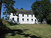 | |
| Dodd House | 4139 Lambrick Way Saanich BC | 48°28′41″N 123°19′34″W / 48.478°N 123.326°W / 48.478; -123.326 (Dodd House) | Saanich municipality (1790) | Upload Photo | |
| Dominion Astrophysical Observatory | 5071 West Saanich Road Saanich BC | 48°31′16″N 123°25′01″W / 48.521°N 123.417°W / 48.521; -123.417 (Dominion Astrophysical Observatory) | Federal (2966, (16392) |  More images | |
| Douglas Street Baptist Church | 3277 Douglas Street Saanich BC | 48°26′56″N 123°22′23″W / 48.449°N 123.373°W / 48.449; -123.373 (Douglas Street Baptist Church) | Saanich municipality (1832) |  More images | |
| Duke Residence | 1140 Tattersall Drive Saanich BC | 48°27′30″N 123°21′31″W / 48.4583°N 123.3587°W / 48.4583; -123.3587 (Duke Residence) | Saanich municipality (1803) |  More images | |
| Dunlop House | 3100 Foul Bay Road Saanich BC | 48°26′47″N 123°19′23″W / 48.4465°N 123.323°W / 48.4465; -123.323 (Dunlop House) | Saanich municipality (1770) |  More images | |
| French Residence | 3301 Camrose Court Saanich BC | 48°27′19″N 123°21′20″W / 48.45525°N 123.35543°W / 48.45525; -123.35543 (French Residence) | Saanich municipality (1761) |  More images | |
| Fullerton/McClung Residence | 1861 Ferndale Road Saanich BC | 48°29′24″N 123°18′50″W / 48.49°N 123.314°W / 48.49; -123.314 (Fullerton/McClung Residence) | Saanich municipality (1764) | Upload Photo | |
| Gordon Head Community Hall | 4146 Tyndall Avenue Saanich BC | 48°28′42″N 123°19′23″W / 48.4784°N 123.323°W / 48.4784; -123.323 (Gordon Head Community Hall) | Saanich municipality (1772) | Upload Photo | |
| Goward House | 2495 Arbutus Road Saanich BC | 48°28′00″N 123°17′49″W / 48.4668°N 123.297°W / 48.4668; -123.297 (Goward House) | Saanich municipality (1437) |  More images | |
| Graham Residence | 452 Boleskine Road Saanich BC | 48°27′09″N 123°22′48″W / 48.4525°N 123.38°W / 48.4525; -123.38 (Graham Residence) | Saanich municipality (3690) | Upload Photo | |
| Hamilton Residence | 355 Gorge Road West Saanich BC | 48°26′53″N 123°24′11″W / 48.448°N 123.403°W / 48.448; -123.403 (Hamilton Residence) | Saanich municipality (1822) | Upload Photo | |
| Hampton Hall | 274 Hampton Road Saanich BC | 48°27′17″N 123°23′31″W / 48.4547°N 123.392°W / 48.4547; -123.392 (Hampton Hall) | Saanich municipality (1838) | Upload Photo | |
| Hamsterley Farm Water Tower | 2485 Sinclair Road Saanich BC | 48°27′49″N 123°18′11″W / 48.4636°N 123.303°W / 48.4636; -123.303 (Hamsterley Farm Water Tower) | Saanich municipality (1932) |  More images | |
| High Oaks Farm | 4051 Granville Avenue Saanich BC | 48°28′39″N 123°25′34″W / 48.4774°N 123.426°W / 48.4774; -123.426 (High Oaks Farm) | Saanich municipality (1836) | Upload Photo | |
| Hill Farm | 4040 Wilkinson Road Saanich BC | 48°28′30″N 123°24′50″W / 48.475°N 123.414°W / 48.475; -123.414 (Hill Farm) | Saanich municipality (3693) | Upload Photo | |
| Holland Residence | 1170 Tattersall Drive Saanich BC | 48°27′29″N 123°21′29″W / 48.4581°N 123.358°W / 48.4581; -123.358 (Holland Residence) | Saanich municipality (1833) | Upload Photo | |
| Home Lumber Company Office | 470 Ardersier Road Saanich BC | 48°27′02″N 123°22′44″W / 48.4505°N 123.379°W / 48.4505; -123.379 (Home Lumber Company Office) | Saanich municipality (1827) | Upload Photo | |
| Horspool Residence | 321 Gorge Road Saanich BC | 48°26′51″N 123°24′07″W / 48.4476°N 123.402°W / 48.4476; -123.402 (Horspool Residence) | Saanich municipality (1837) | Upload Photo | |
| Hutchison Residence | 810 Rogers Avenue Saanich BC | 48°28′41″N 123°22′41″W / 48.478°N 123.378°W / 48.478; -123.378 (Hutchison Residence) | Saanich municipality (1821) | Upload Photo | |
| Jones Residence | 1911 Woodley Road Saanich BC | 48°27′07″N 123°19′30″W / 48.452°N 123.325°W / 48.452; -123.325 (Jones Residence) | Saanich municipality (1765) | Upload Photo | |
| Kitchin Residence | 3577 McInnis Rise Saanich BC | 48°27′25″N 123°21′22″W / 48.4569°N 123.356°W / 48.4569; -123.356 (Kitchin Residence) | Saanich municipality (1825) | Upload Photo | |
| Lake Hill Pumping Station | 3940 Quadra Street Saanich BC | 48°27′57″N 123°21′43″W / 48.4659°N 123.362°W / 48.4659; -123.362 (Lake Hill Pumping Station) | Saanich municipality (3695) |  More images | |
| Lambrick House | 4135 Lambrick Way Saanich BC | 48°28′43″N 123°19′41″W / 48.4786°N 123.328°W / 48.4786; -123.328 (Lambrick House) | Saanich municipality (1767) | Upload Photo | |
| Lee Residence | 5259 Patricia Bay Highway Saanich BC | 48°31′44″N 123°23′10″W / 48.5288°N 123.386°W / 48.5288; -123.386 (Lee Residence) | Saanich municipality (3696) | Upload Photo | |
| Maritime Naval Communication Centre | 2260 McCoy Road Saanich BC | 48°28′09″N 123°18′50″W / 48.4692°N 123.314°W / 48.4692; -123.314 (Maritime Naval Communication Centre) | Saanich municipality (1931) |  More images | |
| McRae Residence | 1445 Ocean View Road Saanich BC | 48°27′05″N 123°20′38″W / 48.4514°N 123.344°W / 48.4514; -123.344 (McRae Residence) | Saanich municipality (1826) | Upload Photo | |
| Mercer Residence | 4366 Blenkinsop Road Saanich BC | 48°29′19″N 123°21′25″W / 48.4886°N 123.357°W / 48.4886; -123.357 (Mercer Residence) | Saanich municipality (3691) | Upload Photo | |
| Mount View High School | 3818 Carey Road Saanich BC | 48°27′32″N 123°22′55″W / 48.4589°N 123.382°W / 48.4589; -123.382 (Mount View High School) | Saanich municipality (1762) | Upload Photo | |
| Norfolk Lodge | 5789 Brookhill Road Saanich BC | 48°32′22″N 123°25′16″W / 48.5394°N 123.421°W / 48.5394; -123.421 (Norfolk Lodge) | Saanich municipality (1759) | Upload Photo | |
| Old Municipal Hall | 4512 West Saanich Road Saanich BC | 48°29′42″N 123°23′20″W / 48.495°N 123.389°W / 48.495; -123.389 (Old Municipal Hall) | Saanich municipality (1823) |  More images | |
| Provincial Normal School | 3100 Foul Bay Road Saanich BC | 48°26′51″N 123°19′30″W / 48.4475°N 123.325°W / 48.4475; -123.325 (Provincial Normal School) | Saanich municipality (1763) |  More images | |
| Richmond Road Streetcar Shelter | 3100 Foul Bay Road Saanich BC | 48°26′51″N 123°19′34″W / 48.4474°N 123.326°W / 48.4474; -123.326 (Richmond Road Streetcar Shelter) | Saanich municipality (1930) |  More images | |
| Rockside | 1141 Palmer Road Saanich BC | 48°27′46″N 123°21′30″W / 48.4628°N 123.3583°W / 48.4628; -123.3583 (Rockside) | Saanich municipality (6704) |  More images | |
| Royal Oak Burial Park | 4673 Falaise Drive Saanich BC | 48°30′22″N 123°22′44″W / 48.506°N 123.379°W / 48.506; -123.379 (Royal Oak Burial Park) | Saanich municipality (1843) | Upload Photo | |
| Royal Oak Community Hall | 4516 West Saanich Road Saanich BC | 48°29′43″N 123°23′24″W / 48.4953°N 123.39°W / 48.4953; -123.39 (Royal Oak Community Hall) | Saanich municipality (1824) |  More images | |
| Royal Oak Inn | 4509 West Saanich Road Saanich BC | 48°29′42″N 123°23′17″W / 48.495°N 123.388°W / 48.495; -123.388 (Royal Oak Inn) | Saanich municipality (1807) |  More images | |
| Royal Oak Schoolhouse | 4525 West Saanich Road Saanich BC | 48°29′46″N 123°23′20″W / 48.496°N 123.389°W / 48.496; -123.389 (Royal Oak Schoolhouse) | Saanich municipality (1783) |  More images | |
| Saanich Municipal Hall | 770 Vernon Avenue Saanich BC | 48°27′33″N 123°22′37″W / 48.4593°N 123.377°W / 48.4593; -123.377 (Saanich Municipal Hall) | Saanich municipality (1806) |  More images | |
| Saanich War Memorial Health Centre | 4353 West Saanich Road Saanich BC | 48°29′19″N 123°23′10″W / 48.4885°N 123.386°W / 48.4885; -123.386 (Saanich War Memorial Health Centre) | Saanich municipality (1804) |  More images | |
| Spurgin Residence | 1908 Waterloo Road Saanich BC | 48°27′04″N 123°19′34″W / 48.4511°N 123.326°W / 48.4511; -123.326 (Spurgin Residence) | Saanich municipality (1768) | Upload Photo | |
| St. Luke's Anglican Church | 3801 Cedar Hill Cross Road Saanich BC | 48°27′47″N 123°20′13″W / 48.463°N 123.337°W / 48.463; -123.337 (St. Luke's Anglican Church) | Saanich municipality (1757) |  More images | |
| St. Michael and All Angels' Church | 4733 West Saanich Road Saanich BC | 48°30′10″N 123°24′18″W / 48.5029°N 123.405°W / 48.5029; -123.405 (St. Michael and All Angels' Church) | Saanich municipality (1839) |  More images | |
| Stevens Hotel | 4794 West Saanich Road Saanich BC | 48°30′16″N 123°24′29″W / 48.5045°N 123.408°W / 48.5045; -123.408 (Stevens Hotel) | Saanich municipality (1841) | Upload Photo | |
| Stranton Lodge | 1248 Burnside Road West Saanich BC | 48°28′05″N 123°25′08″W / 48.468°N 123.419°W / 48.468; -123.419 (Stranton Lodge) | Saanich municipality (1792) | Upload Photo | |
| Strawberry Vale Schoolhouse | 1351 Hastings Street Saanich BC | 48°28′44″N 123°25′05″W / 48.4789°N 123.418°W / 48.4789; -123.418 (Strawberry Vale Schoolhouse) | Saanich municipality (1782) | Upload Photo | |
| Swan Lake and Brett Trestles | NE of Saanich Road Saanich BC | 48°27′54″N 123°21′58″W / 48.4649°N 123.366°W / 48.4649; -123.366 (Swan Lake and Brett Trestles) | Saanich municipality (1805) |  More images | |
| The University School | 3400 Richmond Road Saanich BC | 48°27′06″N 123°19′41″W / 48.4517°N 123.328°W / 48.4517; -123.328 (The University School) | Saanich municipality (1771) | Upload Photo | |
| Thompson Farm | 5271 Old West Saanich Road Saanich BC | 48°31′25″N 123°24′36″W / 48.5237°N 123.41°W / 48.5237; -123.41 (Thompson Farm) | Saanich municipality (1842) | Upload Photo | |
| Thrums | 1775 Barrie Road Saanich BC | 48°29′27″N 123°19′08″W / 48.4909°N 123.319°W / 48.4909; -123.319 (Thrums) | Saanich municipality (1438) | Upload Photo | |
| Tillicum School | 3155 Albina Street Saanich BC | 48°27′10″N 123°23′31″W / 48.4529°N 123.392°W / 48.4529; -123.392 (Tillicum School) | Saanich municipality (1834) | Upload Photo | |
| Tolmie School | 556 Boleskin Road Saanich BC | 48°27′11″N 123°22′41″W / 48.4531°N 123.378°W / 48.4531; -123.378 (Tolmie School) | Saanich municipality (1756) |  More images | |
| Trend House | 3516 Richmond Road Saanich BC | 48°27′14″N 123°19′37″W / 48.4538°N 123.327°W / 48.4538; -123.327 (Trend House) | Saanich municipality (1769) | Upload Photo | |
| Twin Oaks | 1525 Oak Crest Drive Saanich BC | 48°27′10″N 123°20′16″W / 48.452780°N 123.337863°W / 48.452780; -123.337863 (Twin Oaks) | Saanich municipality (3687) | Upload Photo | |
| Watson House | 751 Burke Street Saanich BC | 48°27′30″N 123°24′25″W / 48.4582°N 123.407°W / 48.4582; -123.407 (Watson House) | Saanich municipality (3689) | Upload Photo | |
| Wayne Residence | 1268 Tattersall Drive Saanich BC | 48°27′33″N 123°21′05″W / 48.4593°N 123.3514°W / 48.4593; -123.3514 (Wayne Residence) | Saanich municipality (1828) | Upload Photo | |
| Westward Ho | 3930 Telegraph Bay Road Saanich BC | 48°27′36″N 123°17′17″W / 48.4599°N 123.288°W / 48.4599; -123.288 (Westward Ho) | Saanich municipality (3686) |  More images | |
| Wilkinson Road Jail | 4216 Wilkinson Road Saanich BC | 48°28′59″N 123°24′36″W / 48.483°N 123.41°W / 48.483; -123.41 (Wilkinson Road Jail) | Saanich municipality (1793) | Upload Photo | |
| Wilkinson Road Methodist Church | 4274 Wilkinson Road Saanich BC | 48°29′07″N 123°24′22″W / 48.4854°N 123.406°W / 48.4854; -123.406 (Wilkinson Road Methodist Church) | Saanich municipality (1835) |  More images | |
| Saanichton Centre for Plant Health, Building 28 | 8801 East Saanich Road North Saanich BC | 48°37′16″N 123°24′58″W / 48.621°N 123.416°W / 48.621; -123.416 (Saanichton Centre for Plant Health, Building 28) | Federal (16526) | Upload Photo | |
| Craigflower Manor | 110 Island Highway View Royal BC | 48°27′07″N 123°25′30″W / 48.452°N 123.425°W / 48.452; -123.425 (Craigflower Manor) | British Columbia (1450) |  | |
| Caleb Pike Heritage Park | 1589 Millstream Road Highlands BC | 48°30′31″N 123°31′24″W / 48.5087°N 123.5233°W / 48.5087; -123.5233 (Caleb Pike Heritage Park) | Highlands municipality (20666) | Upload Photo | |
| Caleb Pike House | 1589 Millstream Road Highlands BC | 48°30′32″N 123°31′22″W / 48.5088°N 123.5229°W / 48.5088; -123.5229 (Caleb Pike House) | Highlands municipality (20667) | Upload Photo | |
| The Dairy | 1589 Millstream Road Highlands BC | 48°30′30″N 123°31′21″W / 48.5082°N 123.5226°W / 48.5082; -123.5226 (The Dairy) | Highlands municipality (20739) | Upload Photo | |
| Gregory House Replica | 1589 Millstream Road Highlands BC | 48°30′32″N 123°31′21″W / 48.5088°N 123.5225°W / 48.5088; -123.5225 (Gregory House Replica) | Highlands municipality (20740) | Upload Photo | |
| The Old Schoolhouse | 1589 Millstream Road Highlands BC | 48°30′30″N 123°31′21″W / 48.5083°N 123.5224°W / 48.5083; -123.5224 (The Old Schoolhouse) | Highlands municipality (20737) | Upload Photo | |
| Teacherage | 1589 Millstream Road Highlands BC | 48°30′30″N 123°31′22″W / 48.5082°N 123.5228°W / 48.5082; -123.5228 (Teacherage) | Highlands municipality (20738) | Upload Photo | |
| Second Lake Dam | Millstream Road Highlands BC | 48°31′03″N 123°30′16″W / 48.5175°N 123.5045°W / 48.5175; -123.5045 (Second Lake Dam) | Highlands municipality (20741) | Upload Photo | |
| Millstream Lake Road - Ross Durance Road | Millstream Lake Road and Ross Durance Road between Munn Road and Willis Point Road Highlands BC | 48°31′13″N 123°30′13″W / 48.5203°N 123.5036°W / 48.5203; -123.5036 (Millstream Lake Road - Ross Durance Road) | Highlands municipality (20736) | Upload Photo | |
| Lime Kiln | 1980 Millstream Road Highlands BC | 48°28′52″N 123°30′45″W / 48.4812°N 123.5126°W / 48.4812; -123.5126 (Lime Kiln) | Highlands municipality (20735) | Upload Photo | |
| Freeman King Visitor Centre | 2955 Sooke Lake Road, Goldstream Provincial Park Langford BC | 48°29′04″N 123°32′59″W / 48.4844°N 123.5496°W / 48.4844; -123.5496 (Freeman King Visitor Centre) | British Columbia (20065) | Upload Photo | |
| Zephyr Shipwreck | Strait of Georgia off northeast coast of Mayne Island Mayne Island BC | 48°51′44″N 123°15′18″W / 48.8621°N 123.2550°W / 48.8621; -123.2550 (Zephyr Shipwreck) | British Columbia (19307) | Upload Photo | |
| Active Pass Lighthouse | Georgina Point Road Mayne Island BC | 48°52′24″N 123°17′30″W / 48.8733°N 123.2916°W / 48.8733; -123.2916 (Active Pass Lighthouse) | British Columbia (20369) |  | |
| East Point Lighthouse | Tumbo Channel Rd., eastern point of Saturna Island Saturna Island BC | 48°46′58″N 123°02′44″W / 48.7829°N 123.0455°W / 48.7829; -123.0455 (East Point Lighthouse) | Federal (20371) |  | |
| Sheringham Point Lighthouse | Sheringham Point Road Shirley BC | 48°22′36″N 123°55′16″W / 48.3767°N 123.9210°W / 48.3767; -123.9210 (Sheringham Point Lighthouse) | Federal (20709) |  | |
| Saanichton Centre for Plant Health, Building 28 | Sidney BC | 48°37′17″N 123°24′59″W / 48.6213°N 123.4164°W / 48.6213; -123.4164 (Saanichton Centre for Plant Health, Building 28) | Federal (16526) | Upload Photo | |
| Iroquois Shipwreck | Sidney Channel Sidney BC | 48°39′45″N 123°23′03″W / 48.6625°N 123.3843°W / 48.6625; -123.3843 (Iroquois Shipwreck) | British Columbia (19226) | Upload Photo |
References
- (references appear in the table above as external links)
- v
- t
- e
- CRHP
- Alberni-Clayoquot RD
- BC Coast
- Capital RD
- Kootenay RD
- Columbia-Shuswap RD
- Comox Valley RD
- Cowichan Valley RD
- East Kootenay RD
- Fraser Valley RD
- Kootenay Boundary RD
- Nanaimo RD
- New Westminster
- North Okanagan RD
- North Shore
- Northern/Central BC Interior
- Okanagan-Similkameen RD
- Squamish-Lillooet RD
- Strathcona RD
- Surrey
- Thompson-Nicola RD
- Vancouver
- Victoria
| |||||
| |||||||
| |||||
| |||||
Wildlife Management Areas | |
|---|---|
|
Other | |
|---|---|
|
 Category
- BC Parks
 Commons


