List of islands of Haiti
Map all coordinates using OpenStreetMap
Download coordinates as:
- KML
- GPX (all coordinates)
- GPX (primary coordinates)
- GPX (secondary coordinates)


This is a list of islands of Haiti. Most of The Republic of Haiti is situated on the western portion of Hispaniola, an island which it shares with the Dominican Republic. There are approximately 59 islands in Haiti making it one of the sovereign countries with the most islands in the Caribbean. The islands are either in the Atlantic Ocean, Gulf of Gonave or Caribbean Sea (see map link). La Navase is disputed between Haiti and the US. Caye Sable is the most densely populated island in the world with up to 250 people sharing an area of just 0.16 ha (0.40 acres)
Islands
Haitian islands include:[1]
- Caye Baice, 18°27′N 73°06′W / 18.45°N 73.1°W / 18.45; -73.1 (Caye Baice)
- Caye de l'Est, 18°07′42″N 73°35′26″W / 18.12825°N 73.59063°W / 18.12825; -73.59063 (Caye de l'Est)
- Caye Orange, 18°12′55″N 73°32′10″W / 18.21527°N 73.53612°W / 18.21527; -73.53612 (Caye Orange)
- Caye Ramier, 18°13′01″N 73°27′46″W / 18.21694°N 73.46291°W / 18.21694; -73.46291 (Caye Ramier)
- Caye Sable, 18°42′0″N 72°46′0.01″W / 18.70000°N 72.7666694°W / 18.70000; -72.7666694 (Caye Sable)
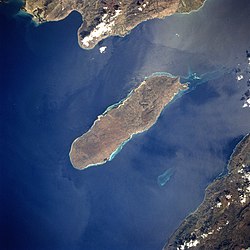
- Gonâve Island, 18°50′29″N 73°02′14″W / 18.84142°N 73.03713°W / 18.84142; -73.03713 (Gonâve Island)[2][3][4][5]
- Grosse Caye, 18°13′24″N 73°23′56″W / 18.22324°N 73.39893°W / 18.22324; -73.39893 (Grosse Caye)[2][6][7]
- Hispaniola, 19°N 71°W / 19°N 71°W / 19; -71 (Hispaniola)
- Île de Anacaona
- Île Bayau, 19°40′54″N 71°51′20″W / 19.68164°N 71.85545°W / 19.68164; -71.85545 (Île Bayau)
- Îlet Boyer, 18°04′00″N 73°48′01″W / 18.06667°N 73.80016°W / 18.06667; -73.80016 (Îlet Boyer)
- Île à Cabrits, 18°33′00″N 73°40′00″W / 18.55°N 73.66667°W / 18.55; -73.66667 (Île à Cabrits)
- Île Corny, 18°31′10″N 73°39′21″W / 18.51941°N 73.65576°W / 18.51941; -73.65576 (Île Corny)
- Île du Nord (Ti Teal)
- Île Petite Gonâve
- Île du Phare (Lighthouse Island)
- Île Picoulet, 18°32′00″N 73°33′00″W / 18.53333°N 73.55°W / 18.53333; -73.55 (Île Picoulet)
- Île Pleermantois, 18°07′08″N 73°40′01″W / 18.11879°N 73.667°W / 18.11879; -73.667 (Île Plermantois)
- Île du Sud
- Île-à-Vache (Cow Island), 18°04′20″N 73°38′20″W / 18.07211°N 73.63886°W / 18.07211; -73.63886 (Lilavach)[3][4][5]
- Ilet a Brouee, 18°07′42″N 73°35′26″W / 18.12845842153287°N 73.59061721738804°W / 18.12845842153287; -73.59061721738804 (Ilet a Brouee)
- Îlet Limbé, 19°48′54″N 72°22′35″W / 19.81493°N 72.37647°W / 19.81493; -72.37647 (Îlet Limbé)
- Îlet Moustique, 18°12′46″N 73°30′57″W / 18.21281°N 73.51591°W / 18.21281; -73.51591 (Îlet Moustique)
- Îlet Rémy, 18°33′00″N 73°41′00″W / 18.55°N 73.68333°W / 18.55; -73.68333 (Îlet Rémy)
- Îlet Saint-Louis, 18°15′06″N 73°33′07″W / 18.25172°N 73.55182°W / 18.25172; -73.55182 (Îlet Saint-Louis)
- Îlot du Fort, 18°33′18″N 72°21′04″W / 18.55505°N 72.35117°W / 18.55505; -72.35117 (Îlot du Fort)
- Isle Cacique, 18°41′42″N 72°22′45″W / 18.69500°N 72.37917°W / 18.69500; -72.37917 (Isle Cacique)
- Les Cayemites[2][3][4][5]
- Grand Cayemite, 18°36′53″N 73°45′09″W / 18.61464°N 73.75253°W / 18.61464; -73.75253 (Grand Cayemite)
- Petite Cayemite, 18°36′36″N 73°48′30″W / 18.61009°N 73.80845°W / 18.61009; -73.80845 (Petite Cayemite)
- Navassa Island (claimed by both Haiti and the United States), 18°24′11″N 75°00′43″W / 18.403°N 75.012°W / 18.403; -75.012 (Navassa Island)[3][4]
- Petite Caye, 18°05′02″N 73°48′41″W / 18.08396°N 73.81128°W / 18.08396; -73.81128 (Petite Caye)
- Tortuga Island (Turtle Island), 20°03′20″N 72°47′33″W / 20.05561°N 72.79249°W / 20.05561; -72.79249 (Tortuga Island)[2]
- La Trompeuse, 18°15′08″N 73°26′29″W / 18.25225°N 73.44141°W / 18.25225; -73.44141 (La Trompeuse)
See also
References
- ^ "Islands of Haiti". GeoNames. Retrieved September 27, 2021.
- ^ a b c d Anastil, Lancelot (2010). C'est La Vie. p. 33. ISBN 9781456811648. Retrieved 23 April 2015.
- ^ a b c d Bellegarde, Serge (October 1998). "Navassa Island: Haiti and the U.S. – A Matter of History and Geography". windowsonhaiti.com. Retrieved February 6, 2008.
- ^ a b c d "Haiti: Constitution, 1987 (English translation)".
- ^ a b c Augier, Dominique; Watson, Patrick, eds. (2015). Etudes Caribéennes n°15: Ressources marines: états des lieux, usages et gestion Vol. 5, 15. p. 187. ISBN 9782342034318. Retrieved 23 April 2015.
- ^ Ile Grosse Caye, Haiti / Sud / Aquin
- ^ "Ile Grosse Caye". GeoNames. Retrieved September 27, 2021.
- v
- t
- e
List of islands of the Americas
- United States and Canada
- Latin America and the Caribbean
- Latin America
- Hispanic
- North America
- Northern
- Caribbean
- Central America
- South America

- Antigua and Barbuda
- Argentina
- Bahamas
- Barbados
- Belize
- Bolivia
- Brazil
- Canada
- Chile
- Colombia
- Costa Rica
- Cuba
- Dominica
- Dominican Republic
- Ecuador
- El Salvador
- Grenada
- Guatemala
- Guyana
- Haiti
- Honduras
- Jamaica
- Mexico
- Nicaragua
- Panama
- Paraguay
- Peru
- Saint Kitts and Nevis
- Saint Lucia
- Saint Vincent and the Grenadines
- Suriname
- Trinidad and Tobago
- United States
- Uruguay
- Venezuela
- Anguilla
- Aruba
- Bermuda
- Bonaire
- British Virgin Islands
- Cayman Islands
- Curaçao
- Falkland Islands
- French Guiana
- Greenland
- Guadeloupe
- Martinique
- Montserrat
- Puerto Rico
- Saba
- Saint Barthélemy
- Saint Martin
- Saint Pierre and Miquelon
- Sint Eustatius
- Sint Maarten
- South Georgia and the South Sandwich Islands
- Turks and Caicos Islands
- U.S. Virgin Islands
| Authority control databases: National |
|
|---|


