M'Goun
Mountain in Morocco.

Ighil M'Goun
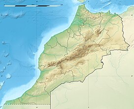
Location in Morocco
The M'Goun mountain, also rendered as Ighil Mgoun / Ighil M’Goun / Irhil M’Goun (in tifinagh ⵉⵖⵉⵍ ⵎⴳⵯⵏ), Ighil n’Oumsoud, Jebel Mgoun, Jebel Ighil M’Goun and Jebel Aït M’goun, at 4,071 metres (13,356 ft) is the third highest peak of the Atlas Mountains after Toubkal and Ouenkrim.
It is an ultra prominent peak located in the Drâa-Tafilalet region of Morocco.
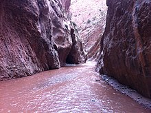
An area of 5,370 km2 in the region was designated as a UNESCO Global Geopark in 2015, having become a member of the Global Geopark Network the previous year. The Geopark showcases tectonic structures within the Atlas Mountains as well as aspects of the area's cultural history.[2]

See also
References
- ^ a b c "Africa Ultra-Prominences". Peaklist.org. Retrieved 28 August 2022.
- ^ "M'Goun UNESCO Global Geopark (Morocco)". UNESCO International Geoscience and Geoparks Programme. UNESCO. Retrieved 11 September 2023.
External links
![]() Media related to M'goun at Wikimedia Commons
Media related to M'goun at Wikimedia Commons
- v
- t
- e
 Mountains of Morocco
- Toubkal (4167 m)
- Ouanoukrim (4089 m)
- Ighil M'Goun (4071 m)
- Afella (4043 m)
- Akioud (4030 m)
- Jbel Tifnout (4001 m)
- Tazarhart (3995 m)
- Aksoual (3910 m)
- Ineghmar (3892 m)
- Bou Iguenwan (3882 m)
- Uwawgulzat (3763 m)
- Tichki (3753 m)
- Ayachi (3747 m)
- Azrou Tamadout (3664 m)
- Gourza (3280 m)
- Jbel Oukaïmeden (3200 m)
- Jebel Yagour (2700 m)
- Tassemit (2205 m)
- Bou Naceur (3340 m)
- Mouasker (3277 m)
- Bou Iblan (3081 m)
- Tanourdi (2250 m)
- Aklim (2531 m)
- Jbel Kissane (1485 m)
- Sirwa (3304 m)
- Amalou-n-Mansour (2712 m)
- Kouaouch (2592 m)
- Imgout (2530 m)
- Mount Amchad (1238 m)
- Mount Zagora (1030 m)
- Grouz (1888 m)
- Colline du Charf (93 m)
- Tidirhine (2456 m)
- Kelti (1912 m)
- Ras Foughal (1535 m)
- Gourougou (900 m)
- Jbel Musa (851 m)
- Jebel Zem-Zem (435 m)
- Zerhoun (1025 m)
- Jbel Lakhdar (893 m)
- Béni-Snassen
- Djebel Ouarkziz
- Djebel Bani
- Jbel Saghro
- Kebdana Range
Authority control databases | |
|---|---|
| International |
|
| National |
|
This Drâa-Tafilalet location article is a stub. You can help Wikipedia by expanding it. |
- v
- t
- e


