Montefiore, Tel Aviv
Neighborhood in Tel Aviv, Israel

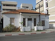
Montefiore (Hebrew: מונטיפיורי) is a neighborhood in the center of Tel Aviv, Israel.
History
The Montefiore neighbourhood was built on the site of Har Hatikva (Mount Hope, Jaffa) the first community outside Jaffa, established by messianic Christians. In 1855, on his fourth visit to Israel, Moses Montefiore purchased land for the group and appointed Clorinda Minor head of the orchard. In January 1858, the farm was ransacked by Arab villagers, who murdered the head of the family and raped the women.[1]
The Montefiore neighborhood is located on the eastern edge of central Tel Aviv, about 2 kilometers from the Mediterranean coast, at an altitude of about 20 meters. At its eastern border, the Ayalon Motorway (Highway 20) passes along the railway line (on which the Ha-Shalom railway station is located) and the Ayalon River.[2][3]
See also
References
32°4′8″N 34°47′22″E / 32.06889°N 34.78944°E / 32.06889; 34.78944
- v
- t
- e
- Afeka
- Azorei Hen
- Kokhav HaTzafon
- Migdalei Ne'eman
- Neve Avivim
- Ramat Aviv
- Ramat Aviv Gimel
- Ramat Aviv HaHadasha
- Tokhnit Lamed

- Ganei Tzahala
- Hadar Yosef
- HaMishtala
- Kiryat Atidim
- Ma'oz Aviv
- Ne'ot Afeka
- Neve Sharret
- Ramat HaHayal
- Ramot Tzahala
- Revivim
- Neve Dan
- Tel Baruch
- Tzahala
- Yisgav
- Achva
- Bavli
- Giv'at Amal Bet
- HaRakevet
- Kerem HaTeimanim
- Lev HaIr
- Manshiya
- Montefiore
- Nahalat Binyamin
- Neve Shalom
- Neve Tzedek
- Old North
- Sarona
- Shabazi
- Tzamarot Ayalon
- Yehuda HaMaccabi
- Abu Kabir
- Ajami
- Giv'at Aliyah
- Giv'at Herzl
- Giv'at HaTmarim
- Neve Ofer
- Old Jaffa
- Tzahalon
- Yafo C
- American–German Colony
- Florentin
- Kiryat Shalom
- Neve Sha'anan
- Shapira
- Bitzaron
- Ezra
- HaArgazim
- HaTikva
- Kfar Shalem
- Nahalat Yitzhak
- Neve Barbur
- Neve Tzahal
- Ramat HaTayasim
- Ramat Yisrael
- Tel Haim
- Yad Eliyahu
Authority control databases | |
|---|---|
| International |
|
| National |
|


