Nayoro
You can help expand this article with text translated from the corresponding article in Japanese. (June 2022) Click [show] for important translation instructions.
- Machine translation, like DeepL or Google Translate, is a useful starting point for translations, but translators must revise errors as necessary and confirm that the translation is accurate, rather than simply copy-pasting machine-translated text into the English Wikipedia.
- Consider adding a topic to this template: there are already 3,691 articles in the main category, and specifying
|topic=will aid in categorization. - Do not translate text that appears unreliable or low-quality. If possible, verify the text with references provided in the foreign-language article.
- You must provide copyright attribution in the edit summary accompanying your translation by providing an interlanguage link to the source of your translation. A model attribution edit summary is
Content in this edit is translated from the existing Japanese Wikipedia article at [[:ja:名寄市]]; see its history for attribution. - You may also add the template
{{Translated|ja|名寄市}}to the talk page. - For more guidance, see Wikipedia:Translation.
City in Hokkaido, Japan
Nayoro  Flag  Seal | |
|---|---|
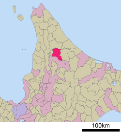 Location of Nayoro in Hokkaido (Kamikawa Subprefecture) | |
| Symbols | |
| Bird | Great spotted woodpecker |
| Flower | Ōbana enreisō (Trillium kamtschaticum) |
| Mascot | Nayoro-kun (なよろう) |
| Tree | Japanese white birch |
Nayoro (名寄市, Nayoro-shi, Ainu: Nay Oro meaning "in the middle of the valley") is a city in Kamikawa Subprefecture, Hokkaido, Japan.
As of September 2016[update], the city has an estimated population of 28,373 and a population density of 53 persons per km2 (140 persons per sq. mi.). The total area is 535.23 km2 (206.65 sq mi).
On March 27, 2006, the town of Fūren was merged into Nayoro.
History
- 1909: Kaminayoro village was founded.
- 1915: Kaminayoro village became Nayoro town.
- 1920: Chiebun village split off from Shimonayoro village.
- 1924: Shimokawa village was separated from Nayoro town.
- 1954: Nayoro town and Chiebun village was merged to form Nayoro town.
- 1956: Nayoro town became Nayoro city.
- 2006: Nayoro city and Fūren town was merged to form Nayoro city.
Education
Universities
- Nayoro City University
Junior colleges
High schools
- Hokkaido Nayoro High School
- Hokkaido Nayoro Industry High School
Transportation
Rail
The Nayoro Main Line and Shimmei Line used to run from Nayoro Station.
- Sōya Main Line : Fūren - Nayorokōkō - Nayoro - Nisshin - Chiebun - Chihoku
Above are stations located in Nayoro.
Road
Nayoro is linked with National Route 40 linking Wakkanai and southern Hokkaido as well as the Hokkaidō Expressway linking with the island capital of Sapporo. Nayoro is bypassed to the west with the Nayoro Bypass (Route 40) serving two interchanges.
Climate
Nayoro has a wet and snowy warm-summer humid continental climate (Köppen climate classification Dfb). The climate retains warm and sometimes hot summers with very cold winters by Japanese standards, coupled with heavy sea-effect snowfall.
| Climate data for Nayoro (1991−2020 normals, extremes 1976−present) | |||||||||||||
|---|---|---|---|---|---|---|---|---|---|---|---|---|---|
| Month | Jan | Feb | Mar | Apr | May | Jun | Jul | Aug | Sep | Oct | Nov | Dec | Year |
| Record high °C (°F) | 5.3 (41.5) | 10.1 (50.2) | 14.8 (58.6) | 26.4 (79.5) | 32.2 (90.0) | 35.4 (95.7) | 36.4 (97.5) | 35.6 (96.1) | 31.3 (88.3) | 26.0 (78.8) | 20.2 (68.4) | 10.3 (50.5) | 36.4 (97.5) |
| Mean daily maximum °C (°F) | −4.2 (24.4) | −2.7 (27.1) | 2.0 (35.6) | 9.3 (48.7) | 17.5 (63.5) | 22.3 (72.1) | 25.6 (78.1) | 25.7 (78.3) | 21.4 (70.5) | 14.2 (57.6) | 5.3 (41.5) | −1.8 (28.8) | 11.2 (52.2) |
| Daily mean °C (°F) | −8.6 (16.5) | −8.0 (17.6) | −3.0 (26.6) | 3.8 (38.8) | 10.8 (51.4) | 15.6 (60.1) | 19.5 (67.1) | 19.9 (67.8) | 15.2 (59.4) | 8.3 (46.9) | 1.5 (34.7) | −5.4 (22.3) | 5.8 (42.4) |
| Mean daily minimum °C (°F) | −14.7 (5.5) | −14.9 (5.2) | −9.1 (15.6) | −1.7 (28.9) | 4.1 (39.4) | 9.6 (49.3) | 14.4 (57.9) | 15.1 (59.2) | 9.9 (49.8) | 3.1 (37.6) | −2.3 (27.9) | −10.1 (13.8) | 0.3 (32.5) |
| Record low °C (°F) | −34.5 (−30.1) | −35.7 (−32.3) | −30.2 (−22.4) | −16.5 (2.3) | −5.9 (21.4) | −1.0 (30.2) | 3.4 (38.1) | 4.3 (39.7) | 0.3 (32.5) | −6.0 (21.2) | −18.1 (−0.6) | −29.4 (−20.9) | −35.7 (−32.3) |
| Average precipitation mm (inches) | 49.4 (1.94) | 38.7 (1.52) | 44.2 (1.74) | 45.5 (1.79) | 60.6 (2.39) | 65.2 (2.57) | 129.4 (5.09) | 136.1 (5.36) | 138.1 (5.44) | 115.6 (4.55) | 108.5 (4.27) | 83.1 (3.27) | 1,006.8 (39.64) |
| Average snowfall cm (inches) | 186 (73) | 147 (58) | 128 (50) | 33 (13) | 0 (0) | 0 (0) | 0 (0) | 0 (0) | 0 (0) | 3 (1.2) | 104 (41) | 225 (89) | 829 (326) |
| Average rainy days | 16.6 | 14.1 | 14.0 | 10.9 | 10.4 | 9.2 | 10.6 | 11.4 | 13.6 | 16.1 | 19.3 | 21.3 | 167.5 |
| Average snowy days | 20.5 | 18.2 | 16.0 | 4.6 | 0 | 0 | 0 | 0 | 0 | 0.4 | 10.2 | 22.2 | 92.1 |
| Mean monthly sunshine hours | 58.6 | 79.1 | 116.2 | 147.9 | 178.1 | 159.7 | 148.7 | 142.0 | 139.4 | 109.9 | 50.7 | 37.6 | 1,367.8 |
| Source 1: JMA[1] | |||||||||||||
| Source 2: JMA[2] | |||||||||||||


Culture
Mascot

Nayoro's mascot is Nayoro-kun (なよろう). He is a mochi alien who loves star watching and collecting toys. He carries a telescope all the time to study the stars. He is designed by Sakiko Yatani from Ebetsu and was named by Ayumi Hagiwara from Sapporo.[3][4]
Sister cities and partner cities
International
 Lindsay, Ontario, Canada[5]
 Dolinsk, Russia.[6]


Within Japan
References
- ^ 観測史上1~10位の値(年間を通じての値). JMA. Retrieved February 18, 2022.
- ^ 気象庁 / 平年値(年・月ごとの値). JMA. Retrieved February 18, 2022.
- ^ "名寄市観光キャラクター「なよろう」". Nayoro.
- ^ "なよろう (北海道)". Yuru-chara Grand Prix.
- ^ "Interaction with Lindsay". Archived from the original on 2015-05-19. Retrieved 2015-05-18.
- ^ "Interaction with Dolinsk". Archived from the original on 2015-05-19. Retrieved 2015-05-18.
- ^ "Interaction with Fujishima, Tsuruoka". Archived from the original on 2015-05-19. Retrieved 2015-05-18.
- ^ "Interaction with Suginami, Tokyo". Archived from the original on 2015-05-19. Retrieved 2015-05-18.
External links
Wikimedia Commons has media related to Nayoro, Hokkaido.
- Official Website (in Japanese)
| ||||||||||||
|---|---|---|---|---|---|---|---|---|---|---|---|---|
|  | |||||||||||
|
| ||||||||||||
| ||||||||||||
| ||||||||||||
| ||||||||||||
| ||||||||||||
| ||||||||||||
| ||||||||||||
| ||||||||||||
| ||||||||||||
| ||||||||||||
| ||||||||||||
| ||||||||||||

Authority control databases | |
|---|---|
| International |
|
| National |
|
| Geographic |
|


