Orosí Volcano

Mountain in Costa Rica
Orosí Volcano is located in Costa Rica
Orosí Volcano
Orosí Volcano
Costa Rica
Parent rangeCordillera de GuanacasteGeologyMountain typeStratovolcanoLast eruption~3500 years ago[1]

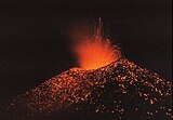
The Orosí Volcano, in Spanish the Volcán Orosí, is an inactive volcano in Costa Rica, situated in the Cordillera de Guanacaste near the border with Nicaragua. The area around the volcano is a popular tourist destination, especially for more ecologically minded tourists due to its biodiversity, including the Guanacaste National Park.

Volcán Orosí itself has a conical shape as viewed from the north or west, but its flanks are heavily eroded. The complex includes Orosí, Orosilito, Volcán Pedregal, and Cacao. The highest peak of the volcanic complex is 1,659-m-high Volcán Cacao, 5.5 km southeast of Orosí. Historical eruptions were reported from Orosí in 1844 and 1849, but even at the time of the first volcanological observations at the end of the 19th century, Orosí was overgrown with large trees, and the eruptions may actually have been from neighboring Rincón de la Vieja.[2]

At the base of the volcano is the Maritza Biological Station, which researches aquatic biology, founded in conjunction with Stroud Water Research Center, Avondale, Pennsylvania, USA.

References

  1. ^ a b c "Orosí". Global Volcanism Program. Smithsonian Institution. Retrieved 2020-05-30.
  2. ^ "Global Volcanism Program | Orosí". volcano.si.edu. Retrieved 2019-06-30.
  • v
  • t
  • e
Volcanoes of Costa Rica
Cordillera de Guanacaste
  • flagCosta Rica portal
Cordillera de TilaránCordillera Central
  • v
  • t
  • e
Mountains of Costa Rica
  • Agua Gata
  • Anunciación
  • Arenal
  • Azufrado
  • Barva
  • Cerro Barrera
  • Bijagua
  • Cerro Bola
  • Braum
  • Cerro Cacao
  • Cacho Negro
  • Caldera de Miravalles
  • Cañas Dulces
  • Cerro Cedral
  • Cerro Buenos Aires
  • Cerro de la Muerte
  • Cerro de Las Vueltas
  • Cerros de Escazú
  • Chachaguita
  • Chato
  • Chirripó
  • Chompipe
  • Coco Mountain
  • Cocorí Mountain
  • Concepción Mountain
  • Congo Mountain
  • Coronel Mountain
  • Coto Pelón
  • Cotón
  • Crestones (Costa Rica)
  • Dikar
  • Doussaints
  • Duan Mountains
  • Durika
  • Echandi
  • El Hacha
  • El Jaboncillo
  • Espiritu Santo Mountain
  • Fortuna Mountain
  • Gorgona Mountain
  • Iglesias
  • Irazú
  • Juan Murillo Mountain
  • Kámuk
  • Laguna Bosque Alegre
  • Laguna Poco Sol
  • Laguna Rio IV
  • Loma Barrantes
  • Loma Morera
  • Lomas
  • Los Chiles
  • Mano de Tigre
  • Miravalles
  • Monte de la Cruz
  • Montezuma Mountain
  • Morazán Mountain
  • Negro
  • Olla de Carne
  • Orosí
  • Palmira Mountain
  • Pasquí
  • Pata de Gallo
  • Pelado y Delicias
  • Pelón
  • Perdidos
  • Pico Alto
  • Pico Blanco
  • Piedra de Fuego
  • Platanar
  • Poás
  • Porvenir
  • Quemados
  • Quezada Mountain
  • Rabo de Mico
  • Rincón (Costa Rica)
  • Rincón de la Vieja
  • San Miguel
  • San Roque Mountain
  • San Vicente Mountain
  • Santa Maria Mountain
  • Siete
  • Sinsal
  • Tenorio
  • Tilarán
  • Tortuguero Mountain
  • Truncado
  • Turrialba
  • Urán
  • Valle Hermoso Mountain
  • Ventisqueros
  • Viejo
  • Von Francius
  • Von Seebach
  • Vuelta Kopper
  • Weyl Mountain
  • flagCosta Rica portal
  • v
  • t
  • e
Guatemala
El Salvador
  • Chinameca
  • Chingo
  • Conchagua
  • Izalco
  • Santa Ana
  • San Miguel
  • San Salvador
  • San Vicente
  • Usulután
Nicaragua
Costa Rica
Panama
Note: volcanoes are ordered from north-west to south-east.
Authority control databases: Geographic Edit this at Wikidata
  • Global Volcanism Program


Stub icon

This Costa Rican location article is a stub. You can help Wikipedia by expanding it.

  • v
  • t
  • e