Pimenteiras do Oeste
Municipality in North, Brazil

Flag

Coat of arms
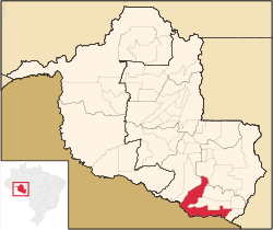
Location in Rondônia state
(2020 [1])
Pimenteiras do Oeste is a municipality located in the Brazilian state of Rondônia. Its population was 2,148 (2020) and its area is 6,015 km2.[2]
The municipality contains 52% of the 384,055 hectares (949,020 acres) Corumbiara State Park, created in 1990.[3]
References
- v
- t
- e

Capital: Porto Velho
| Ariquemes | |
|---|---|
| Jaru | |
| Porto Velho |

| Cacoal | |
|---|---|
| Ji-Paraná | |
| Vilhena |
|
 | This Rondônia, Brazil location article is a stub. You can help Wikipedia by expanding it. |
- v
- t
- e


