Pyu
Town in Bago Region, Myanmar
Phyu Phyuu | |
|---|---|
Town | |
 | |
| 18°28′55″N 96°26′13″E / 18.48194°N 96.43694°E / 18.48194; 96.43694 | |
| Country |  Myanmar Myanmar |
| Region |  Bago Region Bago Region |
| District | Taungoo |
| Township | Phyu |
| Population (2010)[1] | 44,642 |
| Time zone | UTC+6.30 (MST) |
| Area code | 54 |
| [2] | |
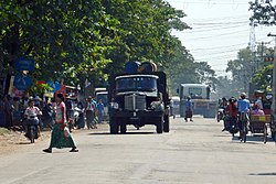
Pyu, also spelled Phyu or Phyuu,[3] is a town in Taungoo District, Bago Region in Myanmar. It is the administrative seat of Phyu Township.The old Yangon-Mandalay highway passes through Phyu Township. In addition, the Phyu-Oakpyat-Mong-(Kyauk Gyi)-Htantabin-Taungoo road was built and Phyu became more prosperous. The new Yangon-Mandalay Expressway (AH-1) is also about 3 miles west of Phyu. The Yangon-Mandalay railway also runs through Phyu Township. Phyu is surrounded by the Sittaung River to the east and Bago Yoma to the west. Phyu Stream passes through the center of the city, and Kwin Stream is the southern boundary of Kyauktadakha Township. Phyu is located 156 feet above sea level.
References
External links
- "Phyu Map — Satellite Images of Phyu" Maplandia
- v
- t
- e
Bago Region
Capital: Bago
| Bago District | |
|---|---|
| Nyaunglebin District | |
| Taungoo District |


| Pyay District | |
|---|---|
| Tharrawaddy District | |
| Nattalin District |
- Bago
- Daik-U
- Gyobingauk
- Letpadan
- Nyaunglebin
- Paungde
- Pyay
- Pyu
- Pyuntaza
- Shwedaung
- Shwegyin
- Taungoo
- Tharrawaddy
- Yedashe
Authority control databases | |
|---|---|
| International |
|
| National |
|
  | This Bago Region location article is a stub. You can help Wikipedia by expanding it. |
- v
- t
- e


