Saharenana River
River in Madagascar
| Saharenana River | |
|---|---|
 Ambohitra Massif river system | |
| Location | |
| Country | Madagascar |
| Region | Diana |
| Physical characteristics | |
| Source | |
| • location | Ambohitra Massif, Diana |
| • elevation | 1,445 m (4,741 ft) |
| Mouth | Indian Ocean |
• location | Diana |
• coordinates | 12°39′40″S 49°33′20″E / 12.66111°S 49.55556°E / -12.66111; 49.55556 |
• elevation | 0 m (0 ft) |
| Length | 52 km (32 mi) |
| Basin size | 140 km2 (54 sq mi) |
| Discharge | |
| • location | bridge of the RN6 |
| • average | 1.48 m3/s (52 cu ft/s) |
| • minimum | 0.86 m3/s (30 cu ft/s) |
| • maximum | 8.1 m3/s (290 cu ft/s) |
| Basin features | |
| Tributaries | |
| • right | Andranotsimisiamalona River |
| |
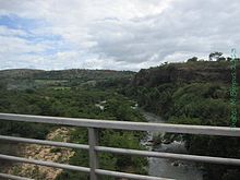
The Saharenana River is located in northern Madagascar and crosses the Route Nationale 6 near Antananandrenitelo. Its sources are situated near Joffreville in the Ambohitra Massif and flows into the Indian Ocean.
References
- (in French) Monographie de la Région Diana (on page 13)
- v
- t
- e
Rivers of Madagascar
- Ambalona River
- Ambato
- Anjobony
- Andranotsimisiamalona
- Ankavanana
- Antainambalana
- Bemarivo
- Bemarivo (Sofia)
- Besokatra
- Betsiboka
- Bombetoka
- Canal des Pangalanes
- Fanambana
- Faraony
- Fiherenana
- Iazafo
- Ifasy
- Ihosy
- Ikopa
- Irodo
- Ivondro
- Linta
- Lokoho
- Loky
- Mahajamba
- Mahajilo
- Maharivo
- Mahavavy Nord
- Mahavavy Sud
- Manambaho
- Manambolo
- Manamptrana
- Mananara (Nord)
- Mananara (South)
- Mananantanana
- Mananjary
- Mananjeba
- Manambolo
- Manambovo
- Mandrare
- Mangoky
- Mangoro
- Mania
- Maningory
- Maningoza
- Marimbona
- Matitanana
- Matsiatra
- Menarandra
- Morondava
- Namorona
- Nosivolo
- Onibe
- Onilahy
- Onive
- Ramena
- Ranobe
- Rantabe
- Rianila
- Sahamaitso
- Saharenana
- Sahatandra
- Sahatavy
- Sakaleona
- Sakanila
- Sakay
- Sakeny
- Sambao
- Sambirano
- Sandrananta
- Sandrangato
- Simianona
- Sisaony
- Sofia
- Tsiribihina
- Vohipeno
- Vohitra
- Zomandao
This article related to a river in Madagascar is a stub. You can help Wikipedia by expanding it. |
- v
- t
- e


