Survey, Kansas
Ghost town in Kansas, United States
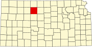
39°22′50″N 99°08′21″W / 39.38056°N 99.13917°W / 39.38056; -99.13917 [1]Survey is a ghost town in Medicine Township, Rooks County, Kansas, United States.
History
Survey was issued a post office in 1880. The post office was discontinued in 1890. There is nothing left of Survey. There is a Survey Cemetery still in existence.[2]
References
- v
- t
- e
Municipalities and communities of Rooks County, Kansas, United States
County seat: Stockton
communities
†This community is designated a Census-Designated Place (CDP) by the United States Census Bureau.
- Kansas portal
- United States portal
 | This article about a location in Rooks County, Kansas is a stub. You can help Wikipedia by expanding it. |
- v
- t
- e


