Walkersville, West Virginia
Unincorporated community in West Virginia, United States
38°52′10″N 80°27′24″W / 38.86944°N 80.45667°W / 38.86944; -80.4566726447
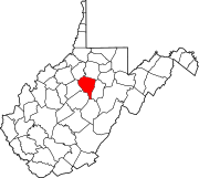
Walkersville is an unincorporated community in Lewis County, West Virginia, United States. Walkersville is 11.5 miles (18.5 km) south of Weston. Walkersville has a post office with ZIP code 26447.[2]
There are several accounts regarding the origin of the name Walkersville.[3]
References
- ^ "US Board on Geographic Names". United States Geological Survey. October 25, 2007. Retrieved January 31, 2008.
- ^ ZIP Code Lookup
- ^ Kenny, Hamill (1945). West Virginia Place Names: Their Origin and Meaning, Including the Nomenclature of the Streams and Mountains. Piedmont, WV: The Place Name Press. p. 654.
- v
- t
- e
Municipalities and communities of Lewis County, West Virginia, United States
County seat: Weston
communities
- Aberdeen
- Alkires Mills
- Alum Bridge
- Arnold
- Aspinall
- Bablin
- Bealls Mills
- Ben Dale
- Bennett
- Berlin
- Brownsville
- Butchersville
- Camden
- Churchville
- Copley
- Cox Town
- Crawford
- Duffy
- Emmart
- Fink
- Freemansburg
- Gaston
- Georgetown
- Gillooly
- Homewood
- Horner
- Hurst
- Ingo
- Ireland
- Jacksonville
- Kitsonville
- Lightburn
- Little Wildcat
- Los Anglin
- McGuire Park
- Orlando‡
- Pickle Street
- Quiet Dale
- Roanoke
- Turnertown
- Vadis
- Valley Chapel
- Vandalia
- Walkersville
- Westfield
- Wildcat
- Wymer
‡This populated place also has portions in an adjacent county or counties
- West Virginia portal
- United States portal
Authority control databases | |
|---|---|
| International |
|
| National |
|
 | This article about a location in Lewis County, West Virginia is a stub. You can help Wikipedia by expanding it. |
- v
- t
- e


