West Rand District Municipality
District municipality in Gauteng, South Africa

Seal
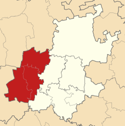
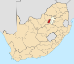
Location in Gauteng
(2011)[2]
The West Rand District Municipality (Tswana: Mmasepala wa Sedika wa West Rand; Afrikaans: Wesrand-distriksmunisipaliteit; Xhosa: uMasipala weSithili sase West Rand; Sotho: Masepala wa Setereke wa West Rand)[1] is one of the districts of the Gauteng province of South Africa, that covers the West Rand area, with the exception of Roodepoort. The seat of the district municipality is Randfontein.[3][4] As of 2011, the most spoken language among its population of 820,995 is Tswana. The district code is CBDC8.
Geography
Neighbours
West Rand is surrounded by:
- Bojanala Platinum (DC37) to the north
- Tshwane (Pretoria) to the north-east
- Johannesburg to the east
- Sedibeng (DC42) to the south-east
- Dr Kenneth Kaunda (DC40) to the south-west
Local municipalities
The district contains the following local municipalities:
| Name | Code | Seat | Area (km²)[5] | Population (2016)[6] | Pop. density (per km²) |
|---|---|---|---|---|---|
| Merafong City | GT484 | Carletonville | 1,631 | 188,843 | 115.8 |
| Mogale City | GT481 | Krugersdorp | 1,342 | 383,864 | 286.0 |
| Rand West City | GT485 | Randfontein | 1,115 | 265,887 | 238.5 |
Demographics
The following statistics are from the 2011 census.
| Language | Population | % |
|---|---|---|
| Tswana | 215 507 | 24.96% |
| Afrikaans | 126 338 | 16.98% |
| Xhosa | 123 501 | 16.60% |
| Sotho | 86 236 | 11.59% |
| Zulu | 63 541 | 8.54% |
| Tsonga | 38 410 | 5.16% |
| English | 35 811 | 4.81% |
| Northern Sotho | 22 618 | 3.04% |
| Other | 10 587 | 1.42% |
| Swati | 9 918 | 1.33% |
| Venda | 8 927 | 1.20% |
| Ndebele | 2 759 | 0.37% |
Gender
| Gender | Population | % |
|---|---|---|
| Male | 400 157 | 53.77% |
| Female | 344 011 | 46.23% |
Ethnic group
| Ethnic group | Population | % |
|---|---|---|
| Black African | 587 665 | 78.84% |
| White | 132 849 | 17.85% |
| Coloured | 17 531 | 2.36% |
| Indian/Asian | 7 123 | 0.96% |
Age
| Age | Population | % |
|---|---|---|
| 000 - 004 | 63 062 | 8.47% |
| 005 - 009 | 55 983 | 7.52% |
| 010 - 014 | 55 746 | 7.49% |
| 015 - 019 | 58 721 | 7.89% |
| 020 - 024 | 72 868 | 9.79% |
| 025 - 029 | 82 601 | 11.10% |
| 030 - 034 | 77 616 | 10.43% |
| 035 - 039 | 76 425 | 10.27% |
| 040 - 044 | 65 412 | 8.79% |
| 045 - 049 | 46 479 | 6.25% |
| 050 - 054 | 31 153 | 4.19% |
| 055 - 059 | 19 826 | 2.66% |
| 060 - 064 | 14 459 | 1.94% |
| 065 - 069 | 9 058 | 1.22% |
| 070 - 074 | 6 526 | 0.88% |
| 075 - 079 | 4 177 | 0.56% |
| 080 - 084 | 2 561 | 0.34% |
| 085 - 089 | 897 | 0.12% |
| 090 - 094 | 395 | 0.05% |
| 095 - 099 | 130 | 0.02% |
| 100 plus | 73 | 0.01% |
Politics
Election results
Election results for the West Rand District Municipality in the 2021 South African municipal elections.
| Party | Votes | % |
|---|---|---|
| African National Congress | 79 559 | 43.82% |
| Democratic Alliance | 48 337 | 26.62% |
| Economic Freedom Fighters | 28 508 | 15.70% |
| Freedom Front Plus | 11 749 | 6.47% |
| African Independent Congress | 2 779 | 1.53% |
| Patriotic Alliance | 1 978 | 1.09% |
| African Christian Democratic Party | 1 693 | 0.93% |
| African Transformation Movement | 1 178 | 0.65% |
| Pan Africanist Congress of Azania | 1 134 | 0.62% |
| United Democratic Movement | 1 017 | 0.56% |
| Congress Of The People | 950 | 0.52% |
| Randfontein Peoples Party | 854 | 0.47% |
| Forum 4 Service Delivery | 653 | 0.36% |
| National Freedom Party | 415 | 0.23% |
| Activists Movement of South Africa | 339 | 0.19% |
| Justice And Employment Party | 318 | 0.18% |
| African Covenant | 114 | 0.06% |
| Total | 181 575 | 100.00% |
References
- ^ a b "West Rand District Municipality | Government Communication and Information System (GCIS)". www.gcis.gov.za. Government Communication and Information System. Retrieved 20 June 2017.
- ^ a b c "Statistics by place". Statistics South Africa. Retrieved 27 September 2015.
- ^ "West Rand District Municipality". www.localgovernment.co.za. Yes Media. Retrieved 20 June 2017.
- ^ "West Rand District Municipality Contact". www.wrdm.gov.za. West Rand District Municipality. Retrieved 20 June 2017.
- ^ "2016 Boundaries". Municipal Demarcation Board (Shapefile). 2016.
- ^ "Community Survey 2016". Statistics South Africa (Data file). 2016.
External links
- West Rand DM Official Website
- v
- t
- e
Municipalities and communities of West Rand District Municipality, Gauteng
District seat: Randfontein
| |||||
|---|---|---|---|---|---|
| Metropolitan |  | ||||
| District and local |
| ||||


