West Virginia Route 161
State highway in West Virginia, United States
Major junctions WV 16 in Bishop
 WV 103 near Black Wolf
 US 52 in Elkhorn
←  WV 152 WV 152 | →  WV 180 WV 180 |
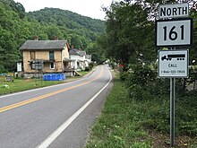
West Virginia Route 161 is a north–south state highway located entirely within McDowell County, West Virginia. The southern terminus of the route is at West Virginia Route 16 in Bishop less than 900 feet (270 m) from the Virginia state line. The northern terminus is at U.S. Route 52 in Elkhorn.
At Bishop, WV 161 enters Virginia for approximately 500 feet (150 m). The state line follows Jacobs Fork and Horsepen Creek, which form a tight bend.[2] There are no signs or visual indications of the state line. West Virginia maintains the road in Virginia.
Major intersections
The entire route is in McDowell County.
| Location | mi | km | Destinations | Notes | |
|---|---|---|---|---|---|
| Bishop | WV 16 – Tazewell, VA, War | ||||
| |  SR 644 (Abbs Valley Road) SR 644 (Abbs Valley Road) | ||||
| |  WV 103 west WV 103 west | ||||
| |  CR 84 (Anawalt Ridge Road) CR 84 (Anawalt Ridge Road) | Former WV 102 east | |||
| Elkhorn | US 52 | ||||
| 1.000 mi = 1.609 km; 1.000 km = 0.621 mi | |||||
References
- ^ Distance calculated using Microsoft MapPoint mapping software.
- ^ Google (September 25, 2015). "WV 161 entering Virginia" (Map). Google Maps. Google. Retrieved September 25, 2015.
Wikimedia Commons has media related to West Virginia Route 161.
- v
- t
- e


