Zemplínska šírava
Reservoir in Michalovce district
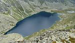
48°47′0″N 22°02′12″E / 48.78333°N 22.03667°E / 48.78333; 22.03667Zemplínska šírava (sometimes called the "Slovak sea" (Slovak: Slovenské more, Hungarian: Széles-tó). is a dam and lake in eastern Slovakia, near the town of Michalovce, wholly belonging to the Michalovce District. The name recalls the historical Zemplín region. The dam was built in 1961–1965, covers an area of 33 km2 (13 sq mi), has an average depth of 9.5 m (31 ft), with a maximum depth of 14 m (46 ft). Water from the dam flows into the Laborec river, which in turn flows into the Bodrog river. The area is primarily used for recreation. It also supplies cooling water for the Vojany Power Station.
Panorama

External links
Wikimedia Commons has media related to Zemplínska Šírava Reservoir.
- Zemplinska sirava (in Slovak)
- v
- t
- e
Hydrography of Slovakia
| Black Sea basin |
| ||||
|---|---|---|---|---|---|
| Baltic Sea basin |
|
| Tarns in Tatra Mountains | |
|---|---|
| Other natural lakes |
|
| Váh basin |
|
|---|---|
| Other |
|
Authority control databases | |
|---|---|
| International |
|
| National |
|
 | This article about a Slovak building or structure is a stub. You can help Wikipedia by expanding it. |
- v
- t
- e


