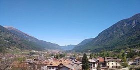
Dimaro Folgarida

Cet article est une ébauche concernant le Trentin-Haut-Adige.
Vous pouvez partager vos connaissances en l’améliorant (comment ?) selon les recommandations des projets correspondants.
| Dimaro Folgarida | |||
 Armoiries | |||
 | |||
| Administration | |||
|---|---|---|---|
| Pays |  Italie Italie | ||
| Code postal | 38025 | ||
| Préfixe tel. | 0463 | ||
| Démographie | |||
| Population | 2 089 hab. ([1]) | ||
| Densité | 57 hab./km2 | ||
| Géographie | |||
| Coordonnées | 46° 19′ 33″ nord, 10° 52′ 28″ est | ||
| Superficie | 3 653 ha = 36,53 km2 | ||
| Localisation | |||
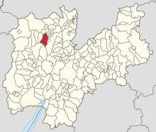 Localisation dans la région. | |||
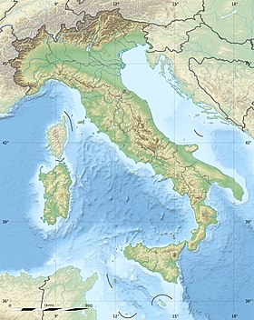
| Géolocalisation sur la carte : Italie
Géolocalisation sur la carte : Italie
| |||
| Liens | |||
| Site web | Site officiel | ||
modifier  | |||


Dimaro Folgarida est une commune italienne située dans la province autonome de Trente dans la région du Trentin-Haut-Adige dans le nord-est de l'Italie. Créée le , elle est issue de la fusion de Dimaro et de Monclassico.
Les communes limitrophes sont Cles, Commezzadura, Pinzolo, Ville d'Anaunia, Malè, Croviana et Tre Ville.

Les limites communales de Dimaro Folgarida et celles de ses communes adjacentes.
Références
- ↑ « https://demo.istat.it/?l=it »

 Portail du Trentin-Haut-Adige


