Shadwell
Koordinat: 53°51′17″N 1°29′02″W / 53.8547°N 1.4839°W / 53.8547; -1.4839
| Shadwell | |
 Jalan Utama: Red Lion dan kantor pos | |
  Shadwell Letak Shadwell di West Yorkshire | |
| Population | 1,864 |
|---|---|
| Paroki sipil | Shadwell |
| Distrik metropolitan | Kota Leeds |
| County metropolitan | West Yorkshire |
| Region | Yorkshire and the Humber |
| Negara konstituen | Inggris |
| Negara berdaulat | Britania Raya |
| Kota pos | LEEDS |
| Distrik kode pos | LS17 |
| Kode telepon | 0113 |
| Polisi | West Yorkshire |
| Pemadam kebakaran | West Yorkshire |
| Ambulans | Yorkshire |
| Parlemen UE | Yorkshire and the Humber |
| Parlemen Britania Raya | Leeds Timur Laut |
| Daftar tempat: Britania Raya • Inggris • Yorkshire | |
Shadwell adalah sebuah desa kecil tetapi makmur, wilayah suburban dan paroki di timur laut Leeds, West Yorkshire, Inggris. Desa ini berjarak 6 mil (9.7 km) ke arah timur laut dari pusat kota Leeds. Shadwell juga dekat dengan Wetherby; koran lokal adalah Wetherby News. Wilayah ini memiliki populasi 1.864.[1]
Shadwell berbatasan dengan Alwoodley, Roundhay, Whinmoor dan Moortown dari tempat jalan utama menuju desa, Shadwell Lane dimulai. Desa ini berada di kode pos LS17 dan dilayani oleh Dewan Paroki Shadwell. Shadwell semakin sering disebut hanya sebagai suatu kawasan atau daerah suburban Leeds tetapi tetap mempertahankan tradisi sebagai desa.
Galeri Foto
-
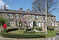
 Balai Desa Shadwell
 -
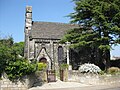 Gereja St Paul
 -
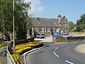
 Red Lion
 -
 Perpustakaan Shadwell
 -
 Rumah dan Bundaran Millenium
 -
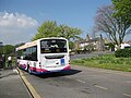 Ujung dari rute Bis 45 Leeds-Shadwell
 -
 Tanda dari Bukit Slaid ke Shadwell


Referensi
- ^ Office for National Statistics: Census 2001: Parish Headcounts: Leeds Diarsipkan 2015-03-19 di Wayback Machine. Diakses 2009-09-09
Pranala luar
- The ancient parish of Thorner: historical and genealogical information at GENUKI (Shadwell was in this parish).
- l
- b
- s


