Montenoy
Gemeente in Frankrijk  | |||
|---|---|---|---|
 | |||
  | |||
| Situering | |||
| Regio | Grand Est | ||
| Departement | Meurthe-et-Moselle (54) | ||
| Arrondissement | Nancy | ||
| Kanton | Entre Seille et Meurthe | ||
| Coördinaten | 48° 48′ NB, 6° 14′ OL | ||
| Algemeen | |||
| Oppervlakte | 3,98 km² | ||
| Inwoners (1 januari 2021) | 403[1] (101 inw./km²) | ||
| Hoogte | 252 - 417 m | ||
| Overig | |||
| Postcode | 54760 | ||
| INSEE-code | 54376 | ||
| |||

Montenoy is een gemeente in het Franse departement Meurthe-et-Moselle (regio Grand Est) en telt 406 inwoners (2004). De plaats maakt deel uit van het arrondissement Nancy.
Geografie
De oppervlakte van Montenoy bedraagt 4,0 km², de bevolkingsdichtheid is 101,5 inwoners per km².
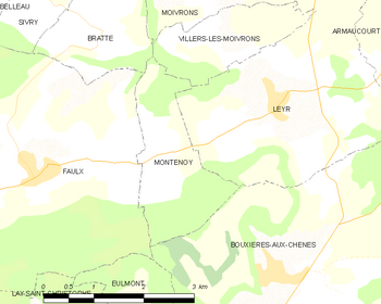
De onderstaande kaart toont de ligging van Montenoy met de belangrijkste infrastructuur en aangrenzende gemeenten.
 |
Demografie
De figuur toont het verloop van het inwonertal (bron: INSEE-tellingen).

Externe links
- (fr) Statistische informatie op de website van INSEE
Gemeenten in het kanton Nomeny
Abaucourt · Armaucourt · Arraye-et-Han · Belleau · Bey-sur-Seille · Bratte · Chenicourt · Clémery · Éply · Faulx · Jeandelaincourt · Lanfroicourt · Létricourt · Leyr · Mailly-sur-Seille · Malleloy · Moivrons · Montenoy · Nomeny · Phlin · Raucourt · Rouves · Sivry · Thézey-Saint-Martin · Villers-lès-Moivrons
Mediabestanden
Zie de categorie Montenoy van Wikimedia Commons voor mediabestanden over dit onderwerp.
- ↑ Populations légales 2021.


