Chartres-de-Bretagne
You can help expand this article with text translated from the corresponding article in French. (November 2015) Click [show] for important translation instructions.
- View a machine-translated version of the French article.
- Machine translation, like DeepL or Google Translate, is a useful starting point for translations, but translators must revise errors as necessary and confirm that the translation is accurate, rather than simply copy-pasting machine-translated text into the English Wikipedia.
- Do not translate text that appears unreliable or low-quality. If possible, verify the text with references provided in the foreign-language article.
- You must provide copyright attribution in the edit summary accompanying your translation by providing an interlanguage link to the source of your translation. A model attribution edit summary is
Content in this edit is translated from the existing French Wikipedia article at [[:fr:Chartres-de-Bretagne]]; see its history for attribution. - You may also add the template
{{Translated|fr|Chartres-de-Bretagne}}to the talk page. - For more guidance, see Wikipedia:Translation.
Commune in Brittany, France
Chartres-de-Bretagne Chartr (Gallo) Karnod (Breton) | ||
|---|---|---|
Commune | ||
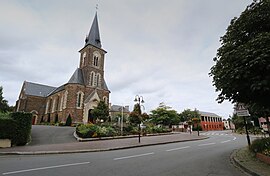 Notre Dame church | ||
 Coat of arms | ||
Location of Chartres-de-Bretagne  | ||
(2020–2026) Philippe Bonnin[1] | | |
| Area 1 | 9.95 km2 (3.84 sq mi) | |
| Population (2021)[2] | 8,237 | |
| • Density | 830/km2 (2,100/sq mi) | |
| Time zone | UTC+01:00 (CET) | |
| • Summer (DST) | UTC+02:00 (CEST) | |
| INSEE/Postal code | 35066 /35131 | |
| Elevation | 16–50 m (52–164 ft) | |
| 1 French Land Register data, which excludes lakes, ponds, glaciers > 1 km2 (0.386 sq mi or 247 acres) and river estuaries. | ||
Chartres-de-Bretagne (French pronunciation: [ʃaʁtʁ də bʁətaɲ]; Breton: Karnod, Gallo: Chartr) is a commune in the Ille-et-Vilaine department of Brittany in northwestern France.
Inhabitants of Chartres-de-Bretagne are called Chartrains in French.
Population
|
| ||||||||||||||||||||||||||||||||||||||||||||||||||||||||||||||||||||||||||||||||||||||||||||||||||||||||||||||||||
| Source: EHESS[3] and INSEE (1968-2017)[4] | |||||||||||||||||||||||||||||||||||||||||||||||||||||||||||||||||||||||||||||||||||||||||||||||||||||||||||||||||||
See also
- Communes of the Ille-et-Vilaine department
- Emmanuel Guérin Sculptor Chartres-de-Bretagne war memorial
References
- ^ "Répertoire national des élus: les maires". data.gouv.fr, Plateforme ouverte des données publiques françaises (in French). 2 December 2020.
- ^ "Populations légales 2021". The National Institute of Statistics and Economic Studies. 28 December 2023.
- ^ Des villages de Cassini aux communes d'aujourd'hui: Commune data sheet Chartres-de-Bretagne, EHESS (in French).
- ^ Population en historique depuis 1968, INSEE
External links
Wikimedia Commons has media related to Chartres-de-Bretagne.
- Official website (in French)
- Base Mérimée: Search for heritage in the commune, Ministère français de la Culture. (in French)
- Mayors of Ille-et-Vilaine Association Archived 14 January 2012 at the Wayback Machine (in French)
- v
- t
- e

- Acigné
- Amanlis
- Andouillé-Neuville
- Arbrissel
- Argentré-du-Plessis
- Aubigné
- Availles-sur-Seiche
- Baguer-Morvan
- Baguer-Pican
- Bain-de-Bretagne
- Bains-sur-Oust
- Bais
- Balazé
- Baulon
- La Baussaine
- La Bazouge-du-Désert
- Bazouges-la-Pérouse
- Beaucé
- Bécherel
- Bédée
- Betton
- Billé
- Bléruais
- Boisgervilly
- Boistrudan
- Bonnemain
- La Bosse-de-Bretagne
- La Bouëxière
- Bourgbarré
- Bourg-des-Comptes
- La Boussac
- Bovel
- Bréal-sous-Montfort
- Bréal-sous-Vitré
- Brécé
- Breteil
- Brie
- Brielles
- Broualan
- Bruc-sur-Aff
- Les Brulais
- Bruz
- Cancale
- Cardroc
- Cesson-Sévigné
- Champeaux
- Chanteloup
- Chantepie
- La Chapelle-aux-Filtzméens
- La Chapelle-Bouëxic
- La Chapelle-Chaussée
- La Chapelle-de-Brain
- La Chapelle-des-Fougeretz
- La Chapelle-du-Lou-du-Lac
- La Chapelle-Erbrée
- La Chapelle-Fleurigné
- La Chapelle-Saint-Aubert
- La Chapelle-Thouarault
- Chartres-de-Bretagne
- Chasné-sur-Illet
- Châteaubourg
- Châteaugiron
- Châteauneuf-d'Ille-et-Vilaine
- Le Châtellier
- Châtillon-en-Vendelais
- Chauvigné
- Chavagne
- Chelun
- Cherrueix
- Chevaigné
- Cintré
- Clayes
- Coësmes
- Comblessac
- Combourg
- Combourtillé
- Cornillé
- Corps-Nuds
- La Couyère
- Crevin
- Le Crouais
- Cuguen
- Dinard
- Dingé
- Dol-de-Bretagne
- Domagné
- Domalain
- La Dominelais
- Domloup
- Dourdain
- Drouges
- Eancé
- Epiniac
- Erbrée
- Ercé-en-Lamée
- Ercé-près-Liffré
- Essé
- Étrelles
- Feins
- Le Ferré
- Forges-la-Forêt
- Fougèressubpr
- La Fresnais
- Gaël
- Gahard
- Gennes-sur-Seiche
- Gévezé
- Gosné
- La Gouesnière
- Goven
- Grand-Fougeray
- La Guerche-de-Bretagne
- Guichen
- Guignen
- Guipel
- Guipry-Messac
- Hédé-Bazouges
- L'Hermitage
- Hirel
- Iffendic
- Les Iffs
- Irodouër
- Janzé
- Javené
- Laignelet
- Laillé
- Lalleu
- Landavran
- Landéan
- Landujan
- Langan
- Langon
- Langouet
- Lanrigan
- Lassy
- Lécousse
- Lieuron
- Liffré
- Lillemer
- Livré-sur-Changeon
- Lohéac
- Longaulnay
- Le Loroux
- Lourmais
- Loutehel
- Louvigné-de-Bais
- Louvigné-du-Désert
- Luitré-Dompierre
- Maen Roch
- Marcillé-Raoul
- Marcillé-Robert
- Marpiré
- Martigné-Ferchaud
- Maxent
- Mecé
- Médréac
- Meillac
- Melesse
- Mellé
- Mernel
- Mesnil-Roc'h
- La Mézière
- Mézières-sur-Couesnon
- Miniac-Morvan
- Miniac-sous-Bécherel
- Le Minihic-sur-Rance
- Mondevert
- Montauban-de-Bretagne
- Montautour
- Mont-Dol
- Monterfil
- Montfort-sur-Meu
- Montgermont
- Monthault
- Montreuil-des-Landes
- Montreuil-le-Gast
- Montreuil-sous-Pérouse
- Montreuil-sur-Ille
- Mordelles
- Mouazé
- Moulins
- Moussé
- Moutiers
- Muel
- La Noë-Blanche
- La Nouaye
- Nouvoitou
- Noyal-Châtillon-sur-Seiche
- Noyal-sous-Bazouges
- Noyal-sur-Vilaine
- Orgères
- Pacé
- Paimpont
- Pancé
- Parcé
- Parigné
- Parthenay-de-Bretagne
- Le Pertre
- Le Petit-Fougeray
- Pipriac
- Piré-Chancé
- Pléchâtel
- Pleine-Fougères
- Plélan-le-Grand
- Plerguer
- Plesder
- Pleugueneuc
- Pleumeleuc
- Pleurtuit
- Pocé-les-Bois
- Poilley
- Poligné
- Pont-Péan
- Les Portes du Coglais
- Princé
- Québriac
- Quédillac
- Rannée
- Redonsubpr
- Renac
- Rennespref
- Retiers
- Le Rheu
- La Richardais
- Rimou
- Rives-du-Couesnon
- Romagné
- Romazy
- Romillé
- Roz-Landrieux
- Roz-sur-Couesnon
- Sains
- Saint-Armel
- Saint-Aubin-d'Aubigné
- Saint-Aubin-des-Landes
- Saint-Aubin-du-Cormier
- Saint-Benoît-des-Ondes
- Saint-Briac-sur-Mer
- Saint-Brieuc-des-Iffs
- Saint-Broladre
- Saint-Christophe-des-Bois
- Saint-Christophe-de-Valains
- Saint-Coulomb
- Saint-Didier
- Saint-Domineuc
- Sainte-Anne-sur-Vilaine
- Sainte-Colombe
- Sainte-Marie
- Saint-Erblon
- Saint-Ganton
- Saint-Georges-de-Gréhaigne
- Saint-Georges-de-Reintembault
- Saint-Germain-du-Pinel
- Saint-Germain-en-Coglès
- Saint-Germain-sur-Ille
- Saint-Gilles
- Saint-Gondran
- Saint-Gonlay
- Saint-Grégoire
- Saint-Guinoux
- Saint-Hilaire-des-Landes
- Saint-Jacques-de-la-Lande
- Saint-Jean-sur-Vilaine
- Saint-Jouan-des-Guérets
- Saint-Just
- Saint-Léger-des-Prés
- Saint-Lunaire
- Saint-Malosubpr
- Saint-Malo-de-Phily
- Saint-Malon-sur-Mel
- Saint-Marcan
- Saint-Marc-le-Blanc
- Saint-Maugan
- Saint-Médard-sur-Ille
- Saint-Méen-le-Grand
- Saint-Méloir-des-Ondes
- Saint-M'Hervé
- Saint-Onen-la-Chapelle
- Saint-Ouen-des-Alleux
- Saint-Péran
- Saint-Père-Marc-en-Poulet
- Saint-Pern
- Saint-Rémy-du-Plain
- Saint-Sauveur-des-Landes
- Saint-Séglin
- Saint-Senoux
- Saint-Suliac
- Saint-Sulpice-des-Landes
- Saint-Sulpice-la-Forêt
- Saint-Symphorien
- Saint-Thual
- Saint-Thurial
- Saint-Uniac
- Saulnières
- Le Sel-de-Bretagne
- La Selle-en-Luitré
- La Selle-Guerchaise
- Sens-de-Bretagne
- Servon-sur-Vilaine
- Sixt-sur-Aff
- Sougeal
- Taillis
- Talensac
- Teillay
- Le Theil-de-Bretagne
- Thorigné-Fouillard
- Thourie
- Le Tiercent
- Tinténiac
- Torcé
- Trans-la-Forêt
- Treffendel
- Trémeheuc
- Tresbœuf
- Trévérien
- Trimer
- Le Tronchet
- Val-Couesnon
- Val d'Anast
- Val-d'Izé
- Vergéal
- Le Verger
- Vern-sur-Seiche
- Vezin-le-Coquet
- Vieux-Viel
- Vieux-Vy-sur-Couesnon
- Vignoc
- Villamée
- La Ville-ès-Nonais
- Visseiche
- Vitré
- Le Vivier-sur-Mer
- pref: prefecture
- subpr: subprefecture
| Authority control databases: National |
|
|---|
 | This Ille-et-Vilaine geographical article is a stub. You can help Wikipedia by expanding it. |
- v
- t
- e


