Sains, Ille-et-Vilaine
You can help expand this article with text translated from the corresponding article in French. (June 2020) Click [show] for important translation instructions.
- View a machine-translated version of the French article.
- Machine translation, like DeepL or Google Translate, is a useful starting point for translations, but translators must revise errors as necessary and confirm that the translation is accurate, rather than simply copy-pasting machine-translated text into the English Wikipedia.
- Do not translate text that appears unreliable or low-quality. If possible, verify the text with references provided in the foreign-language article.
- You must provide copyright attribution in the edit summary accompanying your translation by providing an interlanguage link to the source of your translation. A model attribution edit summary is
Content in this edit is translated from the existing French Wikipedia article at [[:fr:Sains (Ille-et-Vilaine)]]; see its history for attribution. - You may also add the template
{{Translated|fr|Sains (Ille-et-Vilaine)}}to the talk page. - For more guidance, see Wikipedia:Translation.
Commune in Brittany, France
Sains Saent (Gallo) Sent (Breton) | ||
|---|---|---|
Commune | ||
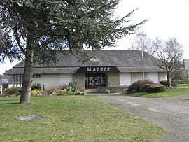 The town hall of Sains | ||
Location of Sains  | ||
(2020–2026) Nicolas Bathellier[1] | | |
| Area 1 | 10.25 km2 (3.96 sq mi) | |
| Population (2021)[2] | 458 | |
| • Density | 45/km2 (120/sq mi) | |
| Time zone | UTC+01:00 (CET) | |
| • Summer (DST) | UTC+02:00 (CEST) | |
| INSEE/Postal code | 35248 /35610 | |
| Elevation | 19–96 m (62–315 ft) | |
| 1 French Land Register data, which excludes lakes, ponds, glaciers > 1 km2 (0.386 sq mi or 247 acres) and river estuaries. | ||
Sains (Gallo: Saent, Breton: Sent) is a commune in the Ille-et-Vilaine department in Brittany in northwestern France.
History
Treaties between France and England placed Brittany under English rule. In 1402 the French and English were getting along a little better, after many decades of disputes in 1518 a treaty was signed giving England ownership of Brittany, hostages were handed over by the French as a guarantee that the treaty would be honoured.
The Lords of Sains in Brittany were party to many of the meetings and discussions, and involved in agreeing terms. Whilst the agreements were made Brittany was still disputed for many years later and eventually fell back into French hands.
1402 September 19 - Letters of the King of France, appointing Lancelot de Longvilliers, sire d'Engoudsent, his Chamberlain and Jehan de Sains, Chancellor of Amiens, his secretary, to treat with the envoys of Henry IV: Corbeil (addressed to Henry IV's envoys)
1521 February 4 - Powers by Francis, King of France, to John de Sains, Lord of Marigny, to arrange for the exchange of four out of the eight hostages surrendered to Henry VIII. in accordance with the treaty of 8 October 1518, four having been already released. Romorantin.
Population
| Year | Pop. | ±% |
|---|---|---|
| 1962 | 543 | — |
| 1968 | 569 | +4.8% |
| 1975 | 628 | +10.4% |
| 1982 | 667 | +6.2% |
| 1990 | 569 | −14.7% |
| 1999 | 504 | −11.4% |
| 2009 | 483 | −4.2% |
Inhabitants of Sains are called sainsois in French.
Geography

- The Église Saint-Pierre is in the Gothic revival style; it was mainly built between 1861 and 1868 by Jean-Gabriel Frangeul to the designs of Eugène Hawke [Wikidata]. The tower and spire are the work of Alfred-Louis Frangeul (his son), 1893-1894.[3][4]
- The Étang du Bourg, a mesotrophic pond[5]
See also
References
- ^ "Répertoire national des élus: les maires". data.gouv.fr, Plateforme ouverte des données publiques françaises (in French). 9 August 2021.
- ^ "Populations légales 2021". The National Institute of Statistics and Economic Studies. 28 December 2023.
- ^ Véronique Orain (ed.), Ille-et-Vilaine. Églises et chapelles. Rennes: Service de l'Inventaire, Indicateurs du Patrimoine, 1996; p. 236
- ^ Mérimée
- ^ Louis Diard, La flore d'Ille-et-Vilaine, Atlas floristique de Bretagne. Rennes: Siloë, 2005; p. 64.
External links
![]() Media related to Sains (Ille-et-Vilaine) at Wikimedia Commons
Media related to Sains (Ille-et-Vilaine) at Wikimedia Commons
- Mayors of Ille-et-Vilaine Association (in French)
- v
- t
- e

- Acigné
- Amanlis
- Andouillé-Neuville
- Arbrissel
- Argentré-du-Plessis
- Aubigné
- Availles-sur-Seiche
- Baguer-Morvan
- Baguer-Pican
- Bain-de-Bretagne
- Bains-sur-Oust
- Bais
- Balazé
- Baulon
- La Baussaine
- La Bazouge-du-Désert
- Bazouges-la-Pérouse
- Beaucé
- Bécherel
- Bédée
- Betton
- Billé
- Bléruais
- Boisgervilly
- Boistrudan
- Bonnemain
- La Bosse-de-Bretagne
- La Bouëxière
- Bourgbarré
- Bourg-des-Comptes
- La Boussac
- Bovel
- Bréal-sous-Montfort
- Bréal-sous-Vitré
- Brécé
- Breteil
- Brie
- Brielles
- Broualan
- Bruc-sur-Aff
- Les Brulais
- Bruz
- Cancale
- Cardroc
- Cesson-Sévigné
- Champeaux
- Chanteloup
- Chantepie
- La Chapelle-aux-Filtzméens
- La Chapelle-Bouëxic
- La Chapelle-Chaussée
- La Chapelle-de-Brain
- La Chapelle-des-Fougeretz
- La Chapelle-du-Lou-du-Lac
- La Chapelle-Erbrée
- La Chapelle-Fleurigné
- La Chapelle-Saint-Aubert
- La Chapelle-Thouarault
- Chartres-de-Bretagne
- Chasné-sur-Illet
- Châteaubourg
- Châteaugiron
- Châteauneuf-d'Ille-et-Vilaine
- Le Châtellier
- Châtillon-en-Vendelais
- Chauvigné
- Chavagne
- Chelun
- Cherrueix
- Chevaigné
- Cintré
- Clayes
- Coësmes
- Comblessac
- Combourg
- Combourtillé
- Cornillé
- Corps-Nuds
- La Couyère
- Crevin
- Le Crouais
- Cuguen
- Dinard
- Dingé
- Dol-de-Bretagne
- Domagné
- Domalain
- La Dominelais
- Domloup
- Dourdain
- Drouges
- Eancé
- Epiniac
- Erbrée
- Ercé-en-Lamée
- Ercé-près-Liffré
- Essé
- Étrelles
- Feins
- Le Ferré
- Forges-la-Forêt
- Fougèressubpr
- La Fresnais
- Gaël
- Gahard
- Gennes-sur-Seiche
- Gévezé
- Gosné
- La Gouesnière
- Goven
- Grand-Fougeray
- La Guerche-de-Bretagne
- Guichen
- Guignen
- Guipel
- Guipry-Messac
- Hédé-Bazouges
- L'Hermitage
- Hirel
- Iffendic
- Les Iffs
- Irodouër
- Janzé
- Javené
- Laignelet
- Laillé
- Lalleu
- Landavran
- Landéan
- Landujan
- Langan
- Langon
- Langouet
- Lanrigan
- Lassy
- Lécousse
- Lieuron
- Liffré
- Lillemer
- Livré-sur-Changeon
- Lohéac
- Longaulnay
- Le Loroux
- Lourmais
- Loutehel
- Louvigné-de-Bais
- Louvigné-du-Désert
- Luitré-Dompierre
- Maen Roch
- Marcillé-Raoul
- Marcillé-Robert
- Marpiré
- Martigné-Ferchaud
- Maxent
- Mecé
- Médréac
- Meillac
- Melesse
- Mellé
- Mernel
- Mesnil-Roc'h
- La Mézière
- Mézières-sur-Couesnon
- Miniac-Morvan
- Miniac-sous-Bécherel
- Le Minihic-sur-Rance
- Mondevert
- Montauban-de-Bretagne
- Montautour
- Mont-Dol
- Monterfil
- Montfort-sur-Meu
- Montgermont
- Monthault
- Montreuil-des-Landes
- Montreuil-le-Gast
- Montreuil-sous-Pérouse
- Montreuil-sur-Ille
- Mordelles
- Mouazé
- Moulins
- Moussé
- Moutiers
- Muel
- La Noë-Blanche
- La Nouaye
- Nouvoitou
- Noyal-Châtillon-sur-Seiche
- Noyal-sous-Bazouges
- Noyal-sur-Vilaine
- Orgères
- Pacé
- Paimpont
- Pancé
- Parcé
- Parigné
- Parthenay-de-Bretagne
- Le Pertre
- Le Petit-Fougeray
- Pipriac
- Piré-Chancé
- Pléchâtel
- Pleine-Fougères
- Plélan-le-Grand
- Plerguer
- Plesder
- Pleugueneuc
- Pleumeleuc
- Pleurtuit
- Pocé-les-Bois
- Poilley
- Poligné
- Pont-Péan
- Les Portes du Coglais
- Princé
- Québriac
- Quédillac
- Rannée
- Redonsubpr
- Renac
- Rennespref
- Retiers
- Le Rheu
- La Richardais
- Rimou
- Rives-du-Couesnon
- Romagné
- Romazy
- Romillé
- Roz-Landrieux
- Roz-sur-Couesnon
- Sains
- Saint-Armel
- Saint-Aubin-d'Aubigné
- Saint-Aubin-des-Landes
- Saint-Aubin-du-Cormier
- Saint-Benoît-des-Ondes
- Saint-Briac-sur-Mer
- Saint-Brieuc-des-Iffs
- Saint-Broladre
- Saint-Christophe-des-Bois
- Saint-Christophe-de-Valains
- Saint-Coulomb
- Saint-Didier
- Saint-Domineuc
- Sainte-Anne-sur-Vilaine
- Sainte-Colombe
- Sainte-Marie
- Saint-Erblon
- Saint-Ganton
- Saint-Georges-de-Gréhaigne
- Saint-Georges-de-Reintembault
- Saint-Germain-du-Pinel
- Saint-Germain-en-Coglès
- Saint-Germain-sur-Ille
- Saint-Gilles
- Saint-Gondran
- Saint-Gonlay
- Saint-Grégoire
- Saint-Guinoux
- Saint-Hilaire-des-Landes
- Saint-Jacques-de-la-Lande
- Saint-Jean-sur-Vilaine
- Saint-Jouan-des-Guérets
- Saint-Just
- Saint-Léger-des-Prés
- Saint-Lunaire
- Saint-Malosubpr
- Saint-Malo-de-Phily
- Saint-Malon-sur-Mel
- Saint-Marcan
- Saint-Marc-le-Blanc
- Saint-Maugan
- Saint-Médard-sur-Ille
- Saint-Méen-le-Grand
- Saint-Méloir-des-Ondes
- Saint-M'Hervé
- Saint-Onen-la-Chapelle
- Saint-Ouen-des-Alleux
- Saint-Péran
- Saint-Père-Marc-en-Poulet
- Saint-Pern
- Saint-Rémy-du-Plain
- Saint-Sauveur-des-Landes
- Saint-Séglin
- Saint-Senoux
- Saint-Suliac
- Saint-Sulpice-des-Landes
- Saint-Sulpice-la-Forêt
- Saint-Symphorien
- Saint-Thual
- Saint-Thurial
- Saint-Uniac
- Saulnières
- Le Sel-de-Bretagne
- La Selle-en-Luitré
- La Selle-Guerchaise
- Sens-de-Bretagne
- Servon-sur-Vilaine
- Sixt-sur-Aff
- Sougeal
- Taillis
- Talensac
- Teillay
- Le Theil-de-Bretagne
- Thorigné-Fouillard
- Thourie
- Le Tiercent
- Tinténiac
- Torcé
- Trans-la-Forêt
- Treffendel
- Trémeheuc
- Tresbœuf
- Trévérien
- Trimer
- Le Tronchet
- Val-Couesnon
- Val d'Anast
- Val-d'Izé
- Vergéal
- Le Verger
- Vern-sur-Seiche
- Vezin-le-Coquet
- Vieux-Viel
- Vieux-Vy-sur-Couesnon
- Vignoc
- Villamée
- La Ville-ès-Nonais
- Visseiche
- Vitré
- Le Vivier-sur-Mer
- pref: prefecture
- subpr: subprefecture
| Authority control databases: National |
|
|---|
 | This Ille-et-Vilaine geographical article is a stub. You can help Wikipedia by expanding it. |
- v
- t
- e


