Mount Wycheproof

Shortest mountain in the world, in Wycheproof, Victoria, Australia
Mount Wycheproof is located in Victoria
Mount Wycheproof
Mount Wycheproof
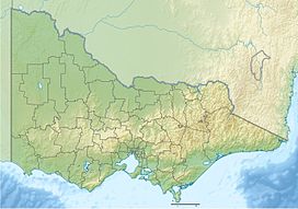
Location in Victoria
LocationWycheproof, Victoria, AustraliaParent rangeTerrick Terrick Range

Mount Wycheproof is a location in the small town of Wycheproof, Victoria, Australia, which stands at 42 metres (138 ft) above the surrounding terrain and 147 metres (482 ft) above sea level. The township of Wycheproof is located on the hillside, and a unique geological substance known as Wycheproofite is exclusive to the local area.

History

The township of Wycheproof is located on the mountain’s south western slopes.[2] The settlement was started as early as 1846, but the township was not surveyed until 1875. The name 'Wycheproof' originates from the local Aboriginal language, 'wichi-poorp', meaning 'grass on a hill'.[3] The mountain plays a role in the local community, with annual races to the summit.[3] There are many walking tracks in the area, and local wildlife such as emus and kangaroos can be seen.[3]

Geology

Mount Wycheproof is a granite outcrop. Located in a flat grassland area, the rounded terrain of Mount Wycheproof is consistent with that of the surrounding area.[2][4] Sharing several similarities to nearby Pyramid Hill, Mount Wycheproof is part of the low-lying Terrick Terrick range.[2] The mountain rises to a height of 147 metres (482 ft)[1] above sea level or only 42 metres (138 ft) above the surrounding plains,[5] The hill is characterised by a rocky, conical peak, common in the western areas of Victoria.[2] Phosphate materials are relatively rare in Victoria,[6] yet the Wycheproof area is known to have its own unique mineral, known as wycheproofite.[7] Wycheproofite can be characterised by its pinkish colour and its transparency.[7]

References

  1. ^ a b St Arnaud (Map) (1st ed.). 1:250,000. Series 1501. The Royal Australian Survey Corps. 1987. § YF0105.
  2. ^ a b c d "4.4 Hills and Low Hills". State of Victoria. 24 September 2008. Retrieved 20 November 2008.
  3. ^ a b c "Wycheproof - Victoria - Australia". Sydney Morning Herald. 8 February 2004. Retrieved 20 November 2008.
  4. ^ "Our Environment". Friends of Mount Wycheproof. Archived from the original on 18 July 2008. Retrieved 20 November 2008.
  5. ^ "7:30 Report - 01/11/2004". Australian Broadcasting Corporation. 1 November 2004. Retrieved 20 November 2008.
  6. ^ "Mineralogy and Petrology". Museum Victoria. 20 August 1996. Archived from the original on 16 August 2008. Retrieved 20 November 2008.
  7. ^ a b "mineral general info". Queensland University of Technology. Archived from the original on 8 July 2009. Retrieved 20 November 2008.
  • v
  • t
  • e
Grampians
  • William (1,167 m or 3,829 ft)
  • Difficult
  • Wilson
  • Zero (364 m or 1,194 ft)
Victorian Alps
Bogong High Plains
  • Nelse West (1,893 m or 6,211 ft)
  • Nelse North (1,885 m or 6,184 ft)
  • Fainter South (1,883 m or 6,178 ft)
  • Hotham (1,862 m or 6,109 ft)
  • McKay (1,849 m or 6,066 ft)
  • Cope (1,837 m or 6,027 ft)
  • Spion Kopje (1,837 m or 6,027 ft)
  • Jim (1,818 m or 5,965 ft)
Cathedral Range
  • Lake (1,482 m or 4,862 ft)
  • The Green Hill (1,241 m or 4,072 ft)
  • Sugarloaf (904 m or 2,966 ft)
  • The Cathedral (801 m or 2,628 ft)
  • South Jawbone Peak (761 m or 2,497 ft)
Cobberas Range
  • Cobberas No. 1 (1,810 m or 5,938 ft)
  • Cobberas No. 2
  • Moscow Peak
  • Middle Peak
  • Cleft Peak
Cobbler Plateau
  • Speculation (1,648 m or 5,407 ft)
  • Cobbler (1,628 m or 5,341 ft)
  • Koonika (1,545 m or 5,069 ft)
  • Despair (1,460 m or 4,790 ft)
Other
  • Bogong (1,986 m or 6,516 ft)
  • Feathertop (1,922 m or 6,306 ft)
  • Loch (1,865 m or 6,119 ft)
  • Buller (1,805 m or 5,922 ft)
  • Wills (1,755 m or 5,758 ft)
  • Gibbo (1,750 m or 5,741 ft)
  • Stirling (1,749 m or 5,738 ft)
  • Howitt (1,742 m or 5,715 ft)
  • The Horn (1,723 m or 5,653 ft)
  • Buffalo (1,723 m or 5,653 ft)
  • Wellington (1,634 m or 5,361 ft)
  • Buggery (Alpine) (1,598 m or 5,243 ft)
  • Baw Baw (1,567 m or 5,141 ft)
  • Saint Phillack (1,567 m or 5,141 ft)
  • Torbreck (1,516 m or 4,974 ft)
  • St Gwinear (1,509 m or 4,951 ft)
  • Mueller (1,460 m or 4,790 ft)
  • Selma (1,456 m or 4,777 ft)
  • Useful (1,435 m or 4,708 ft)
  • Tambo (1,430 m or 4,692 ft)
  • Selwyn (1,411 m or 4,629 ft)
  • Terrible (1,325 m or 4,347 ft)
  • Donna Buang (1,250 m or 4,101 ft)
  • Buggery (Wangaratta) (1,153 m or 3,783 ft)
  • Bulla Bulla (906 m or 2,972 ft)
  • Dom Dom (740 m or 2,428 ft)
  • Brumby Point
  • Pine
Other
mountain ranges
Central Highlands
Dandenong Ranges
  • Dandenong (633 m or 2,077 ft)
Pyrenees Ranges
  • Avoca (747 m or 2,451 ft)
  • Warrenmang (537 m or 1,762 ft)
Strzelecki Ranges
  • Tassie (740 m or 2,428 ft)
Other
  • Matlock (1,377 m or 4,518 ft)
  • Ritchie (1,259 m or 4,131 ft)
  • Toorongo (1,247 m or 4,091 ft)
  • Horsfall (1,130 m or 3,707 ft)
  • Kaye (998 m or 3,274 ft)
  • Elizabeth (941 m or 3,087 ft)
  • Ghiran (924 m or 3,031 ft)
  • Disappointment (794 m or 2,605 ft)
  • Riddell (781 m or 2,562 ft)
  • Beenak (745 m or 2,444 ft)
  • Alexander (744 m or 2,441 ft)
  • Buninyong (719 m or 2,359 ft)
  • Hanging Rock / Diogenes (718 m or 2,356 ft)
  • Warrenheip (714 m or 2,343 ft)
  • Franklin (648 m or 2,126 ft)
  • Beckworth (634 m or 2,080 ft)
  • Corhanwarrabul (628 m or 2,060 ft)
  • Tarrengower (556 m or 1,824 ft)
  • Warrenmang (526 m or 1,726 ft)
  • Teneriffe (444 m or 1,457 ft)
  • Napier (440 m or 1,444 ft)
  • Briggs Bluff (420 m or 1,378 ft)
  • Arapiles (369 m or 1,211 ft)
  • You Yangs (352 m or 1,155 ft)
  • Leura (313 m or 1,027 ft)
  • Noorat (310 m or 1,017 ft)
  • Elephant (240 m or 787 ft)
  • Warrnambool (216 m or 709 ft)
  • Budj Bim (178 m or 584 ft)
  • Wycheproof (148 m or 486 ft)
  • Cooper (137 m or 449 ft)
  • Fraser
  • Hopeless
  • Typo
  • Jack Hills