Stratford, Victoria
Town in Victoria, Australia
37°58′S 147°05′E / 37.967°S 147.083°E / -37.967; 147.083- 232 km (144 mi) E of Melbourne
- 18 km (11 mi) N of Sale
- 12 km (7 mi) E of Maffra
- 48 km (30 mi) W of Bairnsdale
| Mean max temp | Mean min temp | Annual rainfall |
| 21.1 °C 70 °F | 7.4 °C 45 °F | 637.4 mm 25.1 in |
Stratford is a town on the Avon River in Victoria, Australia, 232 kilometres (144 mi) east of Melbourne on the Princes Highway in Shire of Wellington. At the 2016 census, Stratford had a population of 2617. The town services the local regional community and travellers on the Princes Highway. Stratford's principal industries are dairying, sheep, cattle and horse breeding and vegetable crops. The town has numerous coffee shops and cafes, a cellar door for a local winery, Design Gallery, model railway shop, a pub, parks and playgrounds for car travelers to break their journey.
Town name

The origin of the town's name is unclear. Many believe it derives from Stratford-upon-Avon in England, William Shakespeare's birthplace, a view which is lent credence by the fact that it is located by the river Avon, although the name of the river Avon comes from a Scottish river.[2] Locals have embraced the connection with Shakespeare and a Shakespeare on the River Festival has been a successful annual event since 1989, incorporating works of Shakespeare and modern Australian plays. In 1998 the town formally became a member of the Stratford Sister Cities program to promote friendship and cultural exchange between participating countries.
Geography
The River Avon has a local reputation as a source for river polished gemstones, particularly agate, and for rapidly rising during increased rainfall upstream.
Three kilometres south-east of Stratford is a 56-hectare (140-acre) park called Knob Reserve (formerly known as the "Forest of Arden"), part of the Gunai/Kurnai Bataluk Cultural Trail, which winds its way through East Gippsland, highlighting the places of cultural significance to the first inhabitants. There are picnic facilities and an annual country music festival is held at Knob Reserve.
Stratford has a railway station on the Bairnsdale railway line, which was reopened for passenger use in 2004. The Howitt Bicycle Trail passes through Stratford.
Sports
The town has an Australian rules football team, nicknamed the Swans; who have been competing in the East Gippsland Football League since 2012. They had previously competed in the North Gippsland Football League from 2004 to 2011. The town has a cricket team competing in the Sale-Maffra Cricket Association.[3] They have won 4 A-Grade premierships since reforming in 1978.
History

The land around the Avon River was occupied by the Brayakuloong people of the Gunai/Kurnai indigenous nation for thousands of years prior to European settlement.
Angus McMillan named the Avon River after the river of the same name in his native Scotland. In 1840 he established a pastoral run at Bushy Park, north-west of the township. William Odell Raymond established a run in the area in 1842, and built his house, Strathfieldsaye, during 1848–54. European settlement did not take place without resistance, and in return, massacres were inflicted by Angus McMillan and others on Gunai people, especially between the years of 1840 and 1850.
The township was established in the late 1850s and the Post Office opened on 1 May 1858.[4]
With the 1860s gold rush to the Omeo and Dargo goldfields, the town of Stratford prospered. Historic buildings include the RSL Hall (1866), the Church of Holy Trinity (1868), the Methodist Church (1873), and the Post Office (1884).
In 1863 Reverend Friedrich Hagenauer established Ramahyuck Mission on the banks of the Avon River near Lake Wellington to house the Ganai survivors from west and central Gippsland. The name combines "Ramah", the home of Samuel in the First Book of Kings, with "yuck", an Aboriginal term reputedly meaning "our place". The mission sought to discourage all tribal ritual and culture, and replace it with Christian values and European customs. The Mission closed in 1908 and the few remaining residents were moved to Lake Tyers Mission.
Reverend Hagenauer's son Dr Henry Hagenauer was a top local Australian rules footballer who played one match for Victorian Football League (VFL) club Melbourne in 1898.[5]
Gallery
-
 Avon River Bakehouse restaurant
 -
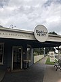 Badger and Hare cafe
 -
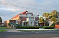
 CWA rooms
 -
 Council library
 -
 Hobbies Plus model train store
 -
 Knob Reserve
 -
 Mary Treasure Reserve
 -
 Mechanics Institute
 -
 Memorial Park
 -
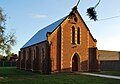 Methodist Church
 -
 Post office
 -
 Post office in 1917
 -
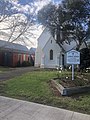 St. Patrick's Catholic Church
 -
 St. Patrick's Primary School
 -
 Stratford Motel
 -
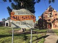 Stratford Museum
 -
 Swan Park
 -
 Ticklish Turtle cafe
 -
 War memorial


References
- ^ Australian Bureau of Statistics (28 June 2022). "Stratford (Vic.) (Suburbs and Localities)". 2021 Census QuickStats. Retrieved 11 June 2023.

- ^ "Stratford". Victorian Places. Retrieved 14 December 2020.
- ^ Sale-Maffra Cricket Association
- ^ Phoenix Auctions History, Post Office List, retrieved 20 March 2021
- ^ Hay, p. 107.
Sources
- Hay, R. (2020) Aboriginal People and Australian Football in the Nineteenth Century, SESA Publications: Melbourne. ISBN 9780994601957.
External links
 Media related to Stratford, Victoria at Wikimedia Commons
 Stratford (Victoria) travel guide from Wikivoyage
- v
- t
- e
Localities in the Shire of Wellington

- Alberton
- Boisdale
- Briagolong
- Bundalaguah
- Cobains
- Coongulla
- Cowwarr^
- Denison
- Devon North
- East Sale
- Fulham
- Glengarry^
- Glenmaggie
- Golden Beach
- Gormandale
- Heyfield
- Loch Sport
- Longford
- Maffra
- Nambrok
- Newry
- Port Albert
- Rosedale
- Seaspray
- Stratford
- Tinamba
- Toongabbie^
- Woodside
- Wurruk
- Yarram
- Airly
- Alberton West
- Arbuckle
- Balook^
- Billabong
- Binginwarri^
- Blackwarry
- Budgee Budgee
- Buragwonduc
- Bushy Park
- Callignee North
- Callignee South
- Calrossie
- Carrajung
- Carrajung Lower
- Carrajung South
- Clydebank
- Cowa
- Crookayan
- Crooked River
- Dargo^
- Darriman
- Dawson
- Dutson
- Dutson Downs
- Fernbank^
- Flamingo Beach
- Flynn^
- Flynns Creek^
- Gelliondale
- Giffard
- Giffard West
- Gillum
- Glenfalloch
- Glomar Beach
- Grand Ridge^
- Hawkhurst
- Hedley^
- Hiamdale
- Hiawatha
- Hollands Landing
- Howitt Plains
- Hunterston
- Jack River
- Kilmany
- Koorool
- Lake Wellington
- Langsborough
- Licola
- Licola North
- Llowalong
- Macks Creek
- Madalya
- Maffra West Upper
- Manns Beach
- McLoughlins Beach
- Meerlieu
- Miowera
- Monomak
- Montgomery
- Moornapa
- Moroka
- Munro
- Myrtlebank
- Nap Nap Marra
- Ocean Grange^
- Paradise Beach
- Pearsondale
- Perry Bridge
- Reynard^
- Riverslea
- Robertsons Beach
- Sargood
- Seacombe
- Seaton
- Snake Island
- Staceys Bridge
- Stockdale
- Stradbroke
- Tamboritha
- Tarra Valley
- Tarraville
- The Heart
- The Honeysuckles
- Tinamba West
- Toolome
- Valencia Creek
- Walhalla^
- Walhalla East
- Willung
- Willung South
- Winnindoo
- Won Wron
- Wongungarra^
- Wonyip
- Woodside Beach
- Woodside North
- Woolenook
- Worrowing
- Wrathung
- Wrixon
- Yangoura
^ - Territory divided with another LGA


